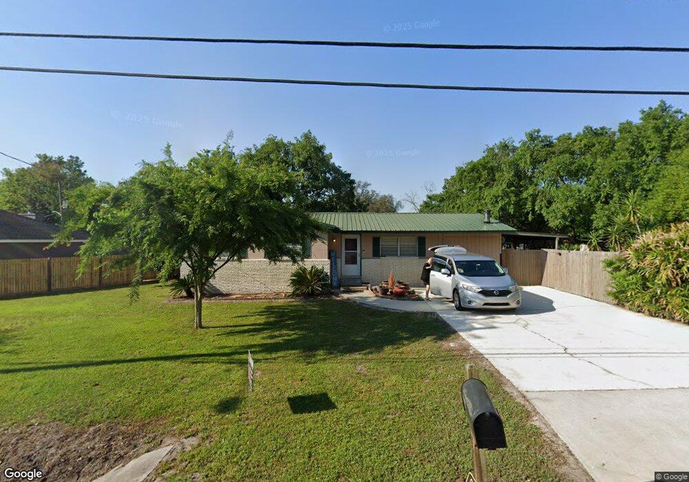
6942 Sallie Ave Jacksonville, FL 32210
Hyde Park NeighborhoodEstimated Value: $218,000 - $269,000
3
Beds
2
Baths
1,228
Sq Ft
$200/Sq Ft
Est. Value
About This Home
This home is located at 6942 Sallie Ave, Jacksonville, FL 32210 and is currently estimated at $245,452, approximately $199 per square foot. 6942 Sallie Ave is a home located in Duval County with nearby schools including Andros Karperos, Hyde Park Elementary School, and Lake Shore Middle School.
Ownership History
Date
Name
Owned For
Owner Type
Purchase Details
Closed on
Dec 14, 2014
Sold by
Smith Estes Carl and Smith Cynthia A
Bought by
Smith Jeremy Carl
Current Estimated Value
Purchase Details
Closed on
Jul 10, 2001
Sold by
Smith Estes Carl and Smith Cynthia A
Bought by
Smith Estes Carl and Smith Cynthia A
Home Financials for this Owner
Home Financials are based on the most recent Mortgage that was taken out on this home.
Original Mortgage
$46,000
Interest Rate
7.08%
Create a Home Valuation Report for This Property
The Home Valuation Report is an in-depth analysis detailing your home's value as well as a comparison with similar homes in the area
Home Values in the Area
Average Home Value in this Area
Purchase History
| Date | Buyer | Sale Price | Title Company |
|---|---|---|---|
| Smith Jeremy Carl | -- | Attorney | |
| Smith Estes Carl | $15,000 | Preferred Realty Title Agenc | |
| Smith Estes Carl | -- | Preferred Realty Title Agenc |
Source: Public Records
Mortgage History
| Date | Status | Borrower | Loan Amount |
|---|---|---|---|
| Previous Owner | Smith Estes Carl | $46,000 |
Source: Public Records
Tax History Compared to Growth
Tax History
| Year | Tax Paid | Tax Assessment Tax Assessment Total Assessment is a certain percentage of the fair market value that is determined by local assessors to be the total taxable value of land and additions on the property. | Land | Improvement |
|---|---|---|---|---|
| 2025 | $1,456 | $112,276 | -- | -- |
| 2024 | $1,407 | $109,112 | -- | -- |
| 2023 | $1,407 | $105,934 | $0 | $0 |
| 2022 | $1,279 | $102,849 | $0 | $0 |
| 2021 | $1,259 | $99,854 | $0 | $0 |
| 2020 | $1,243 | $98,476 | $0 | $0 |
| 2019 | $1,192 | $96,262 | $0 | $0 |
| 2018 | $1,171 | $94,468 | $0 | $0 |
| 2017 | $1,149 | $92,525 | $0 | $0 |
| 2016 | $1,136 | $90,622 | $0 | $0 |
| 2015 | $1,135 | $89,466 | $0 | $0 |
| 2014 | $1,135 | $88,756 | $0 | $0 |
Source: Public Records
Map
Nearby Homes
- 1465 Winnebago Ave
- 6914 Alachua Ave
- 1454 Winnebago Ave
- 1438 Ron Rd
- 1465 Manotak Point Dr Unit 104
- 1627 Westminister Ave
- 7132 Hanson Dr N
- 6938 Hanson Dr N
- 1341 Ottawa Ave
- 1728 Londonderry Rd
- 6717 Bakersfield Dr
- 6711 Bakersfield Dr
- 6803 Golfview St
- 1704 Memory Ln
- 1832 Navaho Ave
- 7446 Skye Dr S
- 6755 Calvados Ave
- 7753 Spring Branch Dr N
- 1662 Spring Branch Dr E
- 7687 Spring Branch Ct
- 6986 Sallie Ave
- 6941 Sallie Ave
- 1417 Winnebago Ave
- 1482 Winnebago Ave
- 6927 Sallie Ave
- 1429 Ottawa Ave
- 6914 Sallie Ave
- 1486 Winnebago Ave
- 1470 Ottawa Ave
- 1420 Old Middleburg Rd N
- 1430 Ottawa Ave
- 6908 Sallie Ave
- 1421 Ottawa Ave
- 6905 Sallie Ave
- 1428 Old Middleburg Rd N
- 1410 Navaho Ave
- 1404 Ottawa Ave
- 1418 Navaho Ave
- 1409 Ottawa Ave
- 7055 Bakersfield Dr