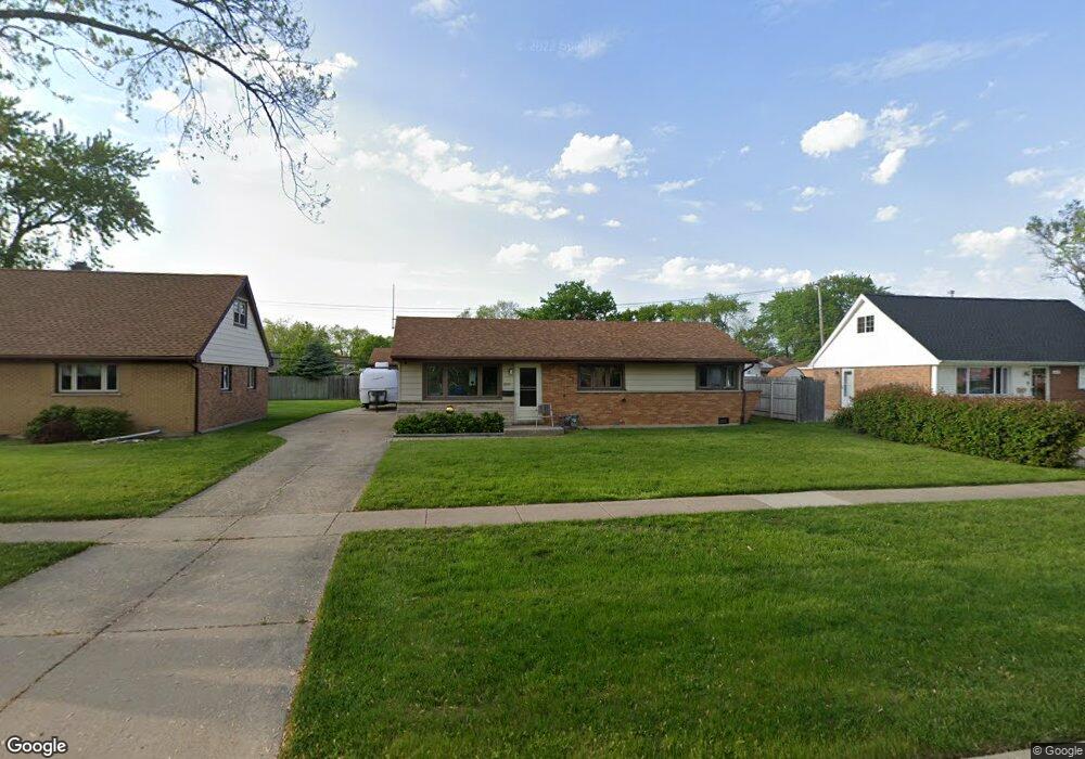
6944 W 91st St Bridgeview, IL 60455
Little Palestine NeighborhoodEstimated Value: $260,000 - $319,000
3
Beds
1
Bath
1,050
Sq Ft
$266/Sq Ft
Est. Value
About This Home
This home is located at 6944 W 91st St, Bridgeview, IL 60455 and is currently estimated at $279,010, approximately $265 per square foot. 6944 W 91st St is a home located in Cook County with nearby schools including George W Lieb Elementary School, Simmons Middle School, and Oak Lawn Community High School.
Ownership History
Date
Name
Owned For
Owner Type
Purchase Details
Closed on
Jul 17, 1998
Sold by
Declarat Harrignton Patricia C
Bought by
Howes Jeffrey W
Current Estimated Value
Home Financials for this Owner
Home Financials are based on the most recent Mortgage that was taken out on this home.
Original Mortgage
$72,000
Outstanding Balance
$14,773
Interest Rate
7.03%
Estimated Equity
$264,237
Create a Home Valuation Report for This Property
The Home Valuation Report is an in-depth analysis detailing your home's value as well as a comparison with similar homes in the area
Home Values in the Area
Average Home Value in this Area
Purchase History
| Date | Buyer | Sale Price | Title Company |
|---|---|---|---|
| Howes Jeffrey W | $117,000 | -- |
Source: Public Records
Mortgage History
| Date | Status | Borrower | Loan Amount |
|---|---|---|---|
| Open | Howes Jeffrey W | $72,000 |
Source: Public Records
Tax History Compared to Growth
Tax History
| Year | Tax Paid | Tax Assessment Tax Assessment Total Assessment is a certain percentage of the fair market value that is determined by local assessors to be the total taxable value of land and additions on the property. | Land | Improvement |
|---|---|---|---|---|
| 2024 | $1,495 | $20,000 | $4,111 | $15,889 |
| 2023 | $1,823 | $20,000 | $4,111 | $15,889 |
| 2022 | $1,823 | $16,186 | $3,575 | $12,611 |
| 2021 | $1,726 | $16,185 | $3,575 | $12,610 |
| 2020 | $1,575 | $16,185 | $3,575 | $12,610 |
| 2019 | $1,748 | $15,466 | $3,217 | $12,249 |
| 2018 | $1,672 | $15,466 | $3,217 | $12,249 |
| 2017 | $4,376 | $15,466 | $3,217 | $12,249 |
| 2016 | $3,339 | $11,186 | $2,681 | $8,505 |
| 2015 | $4,001 | $13,538 | $2,681 | $10,857 |
| 2014 | $3,910 | $13,538 | $2,681 | $10,857 |
| 2013 | $4,184 | $15,673 | $2,681 | $12,992 |
Source: Public Records
Map
Nearby Homes
- 6906 W 91st St
- 9128 Homestead Ln
- 9128 Pembroke Ln
- 9201 Willow Ln
- 8937 Fairlane Dr
- 6821 Saratoga Dr
- 8912 Windsor Ln
- 9236 Stanford Dr
- 8907 Saratoga Dr
- 6705 W 91st Place
- 8741 Cranbrook Ln
- 9348 Sayre Ave
- 7100 W 95th St Unit 312
- 8632 New England Ave
- 6541 Crescent Ct
- 8601 Newland Ave
- 9108 Crescent Ct
- 6632 W 95th St Unit 2C
- 6634 W 95th St Unit 1D
- 6455 W 88th Place
- 6947 Olympic Dr
- 6941 Olympic Dr
- 6932 W 91st St
- 6952 W 91st St
- 6953 Olympic Dr
- 6933 Olympic Dr
- 9101 Homestead Ln
- 6926 W 91st St
- 6955 Olympic Dr
- 6927 Olympic Dr
- 9100 Homestead Ln
- 9100 Orchard Ln
- 9107 Homestead Ln
- 6918 W 91st St
- 6954 Olympic Dr
- 6919 Olympic Dr
- 9106 Homestead Ln
- 6948 Olympic Dr
- 9106 Orchard Ln
- 9055 Fairlane Dr