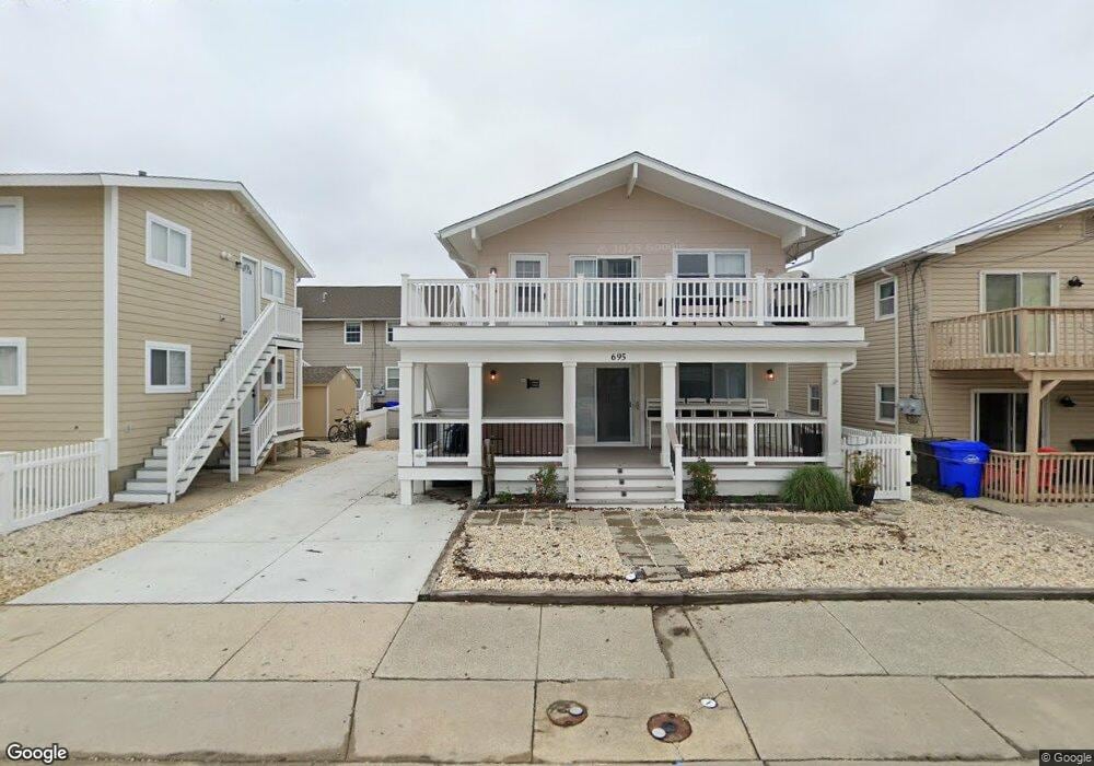
695 21st St Unit A Avalon, NJ 08202
Estimated Value: $816,115 - $1,074,000
--
Bed
--
Bath
1,050
Sq Ft
$945/Sq Ft
Est. Value
About This Home
This home is located at 695 21st St Unit A, Avalon, NJ 08202 and is currently estimated at $992,029, approximately $944 per square foot. 695 21st St Unit A is a home located in Cape May County with nearby schools including Avalon Elementary School.
Ownership History
Date
Name
Owned For
Owner Type
Purchase Details
Closed on
Aug 17, 2021
Sold by
John Rogers
Bought by
John Douglas Rogers Revocable Trust
Current Estimated Value
Purchase Details
Closed on
Nov 22, 2019
Sold by
Connoro Nancy M
Bought by
Rogers John
Purchase Details
Closed on
Sep 30, 2015
Sold by
Diottavio Dana M and Fontuna Maria T
Bought by
Connor Nancy M
Home Financials for this Owner
Home Financials are based on the most recent Mortgage that was taken out on this home.
Original Mortgage
$280,800
Interest Rate
3.88%
Mortgage Type
New Conventional
Purchase Details
Closed on
Mar 11, 2005
Sold by
Dupnock John T
Bought by
Diottavio Dana M and Fortuna Maria T
Home Financials for this Owner
Home Financials are based on the most recent Mortgage that was taken out on this home.
Original Mortgage
$383,200
Interest Rate
5.71%
Mortgage Type
Purchase Money Mortgage
Create a Home Valuation Report for This Property
The Home Valuation Report is an in-depth analysis detailing your home's value as well as a comparison with similar homes in the area
Home Values in the Area
Average Home Value in this Area
Purchase History
| Date | Buyer | Sale Price | Title Company |
|---|---|---|---|
| John Douglas Rogers Revocable Trust | -- | Mansoor Law Firm Pllc | |
| Rogers John | $486,274 | None Available | |
| Connor Nancy M | $351,000 | Seaboard Title Agency | |
| Diottavio Dana M | $479,000 | -- |
Source: Public Records
Mortgage History
| Date | Status | Borrower | Loan Amount |
|---|---|---|---|
| Previous Owner | Connor Nancy M | $280,800 | |
| Previous Owner | Diottavio Dana M | $383,200 |
Source: Public Records
Tax History Compared to Growth
Tax History
| Year | Tax Paid | Tax Assessment Tax Assessment Total Assessment is a certain percentage of the fair market value that is determined by local assessors to be the total taxable value of land and additions on the property. | Land | Improvement |
|---|---|---|---|---|
| 2025 | $2,743 | $446,800 | $400,000 | $46,800 |
| 2024 | $2,743 | $446,800 | $400,000 | $46,800 |
| 2023 | $2,721 | $446,800 | $400,000 | $46,800 |
| 2022 | $2,538 | $446,800 | $400,000 | $46,800 |
| 2021 | $2,444 | $446,800 | $400,000 | $46,800 |
| 2020 | $2,350 | $446,800 | $400,000 | $46,800 |
| 2019 | $2,279 | $446,800 | $400,000 | $46,800 |
| 2018 | $2,180 | $446,800 | $400,000 | $46,800 |
| 2017 | $2,125 | $382,200 | $325,000 | $57,200 |
| 2016 | $2,102 | $382,200 | $325,000 | $57,200 |
| 2015 | $2,068 | $382,200 | $325,000 | $57,200 |
| 2014 | $2,045 | $382,200 | $325,000 | $57,200 |
Source: Public Records
Map
Nearby Homes
- 647 Barry Rd
- 503 20th St
- 440 21st St Unit South (B)
- 431 24th St
- 415 20th St
- 890 21st St
- 389 22nd St
- 297 24th St Unit 297
- 297 24th St
- 2425 Harbor Ave Unit 2425
- 704 Old Avalon Blvd
- 211 23rd St
- 212 25th St
- 212 25th St Unit East Unit
- 178 19th St
- 279 13th St Unit C-6
- 279 13th St
- 174 23rd St
- 161 24th St
- 179 27th St
- 695 21st St
- 695 21st St Unit 2nd Floor
- 695 21st St Unit 1st Floor
- 699 21st St Unit 2nd Floor
- 697 21st St
- 2005 7th Ave Unit 2005
- 2005 7th Ave Unit First
- 685 21st St
- 2007 7th Ave Unit 2007
- 677 21st St Unit 2nd Floor
- 677 21st St
- 696 21st St
- 696 21st St
- 696 21st St Unit South
- 696 21st St Unit North
- 694 21st St Unit n/a
- 694 21st St Unit North
- 675 21st St
- 675 21st St Unit A
- 675 21st St Unit 2nd Floor