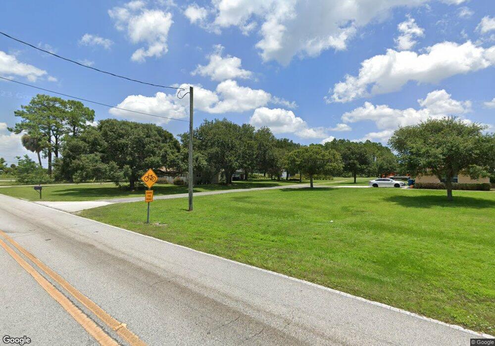
695 Airport Rd New Smyrna Beach, FL 32168
Samsula-Spruce Creek NeighborhoodEstimated Value: $599,000 - $601,456
3
Beds
2
Baths
1,752
Sq Ft
$343/Sq Ft
Est. Value
About This Home
This home is located at 695 Airport Rd, New Smyrna Beach, FL 32168 and is currently estimated at $600,228, approximately $342 per square foot. 695 Airport Rd is a home located in Volusia County with nearby schools including Cypress Creek Elementary School, Creekside Middle School, and New Smyrna Beach High School.
Ownership History
Date
Name
Owned For
Owner Type
Purchase Details
Closed on
Dec 13, 2017
Sold by
Benedict Ii Joseph and Benedict Alice C
Bought by
Benedict Barbara Ann
Current Estimated Value
Purchase Details
Closed on
Sep 6, 2006
Sold by
Benedict Joseph and Benedict Alice C
Bought by
Benedict Joseph Clay and Benedict Debra W
Purchase Details
Closed on
Jun 10, 2002
Sold by
Benedict Joseph and Benedict Alice C
Bought by
Benedict Joseph and Benedict Alice C
Create a Home Valuation Report for This Property
The Home Valuation Report is an in-depth analysis detailing your home's value as well as a comparison with similar homes in the area
Home Values in the Area
Average Home Value in this Area
Purchase History
| Date | Buyer | Sale Price | Title Company |
|---|---|---|---|
| Benedict Barbara Ann | -- | None Available | |
| Massey Constance B | -- | None Available | |
| Benedict Joseph Clay | -- | Attorney | |
| Benedict Joseph | -- | Attorney | |
| Benedict Joseph | -- | -- | |
| Benedict Joseph | -- | -- | |
| Benedict Joseph | -- | -- | |
| Benedict Joseph | -- | -- |
Source: Public Records
Tax History Compared to Growth
Tax History
| Year | Tax Paid | Tax Assessment Tax Assessment Total Assessment is a certain percentage of the fair market value that is determined by local assessors to be the total taxable value of land and additions on the property. | Land | Improvement |
|---|---|---|---|---|
| 2025 | $1,286 | $102,342 | -- | -- |
| 2024 | $1,286 | $99,498 | -- | -- |
| 2023 | $1,286 | $96,491 | $0 | $0 |
| 2022 | $1,236 | $93,717 | $0 | $0 |
| 2021 | $1,247 | $91,024 | $0 | $0 |
| 2020 | $1,219 | $89,785 | $0 | $0 |
| 2019 | $1,224 | $87,794 | $0 | $0 |
| 2018 | $1,155 | $86,180 | $0 | $0 |
| 2017 | $1,160 | $84,433 | $0 | $0 |
| 2016 | $1,158 | $82,722 | $0 | $0 |
| 2015 | $1,180 | $82,156 | $0 | $0 |
| 2014 | $1,164 | $81,514 | $0 | $0 |
Source: Public Records
Map
Nearby Homes
- 1923 Mendocino Ln
- 6808 Forkmead Ln
- 6804 Forkmead Ln
- 652 Airport Rd
- 3625 Pioneer Trail
- 0 Charles St
- 3615 Marisol Ct
- 3611 Marisol Ct
- 3610 Marisol Ct
- 3606 Maribella Dr
- 7093 SE 113th Ln
- 1832 Afshin Ct
- 1804 Creekwater Blvd
- 1821 Creekwater Blvd
- 3583 Maribella Dr
- 594 Marisol Dr
- 1727 Goosecross Ct
- 6824 Vintage Ln
- 2134 Springwater Ln
- 1852 Tara Marie Ln
- 685 Airport Rd
- 3605 Darby Rd
- 722 Airport Rd
- 1936 Mendocino Ln
- 1934 Mendocino Ln
- 1932 Mendocino Ln
- 1930 Mendocino Ln
- 1928 Mendocino Ln
- 1926 Mendocino Ln
- 3625 Darby Rd
- 1933 Mendocino Ln
- 1924 Mendocino Ln
- 1922 Mendocino Ln
- 1931 Mendocino Ln
- 1929 Mendocino Ln
- 1927 Mendocino Ln
- 1925 Mendocino Ln
- 1916 Mendocino Ln
- 1914 Mendocino Ln
- 705 Lost Tree Trail
