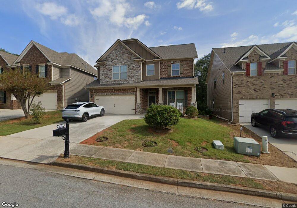
695 Highbranch Cir Unit 2A Lawrenceville, GA 30044
Estimated Value: $454,000 - $495,000
4
Beds
3
Baths
2,966
Sq Ft
$158/Sq Ft
Est. Value
About This Home
This home is located at 695 Highbranch Cir Unit 2A, Lawrenceville, GA 30044 and is currently estimated at $469,542, approximately $158 per square foot. 695 Highbranch Cir Unit 2A is a home located in Gwinnett County with nearby schools including Bethesda Elementary School, Sweetwater Middle School, and Berkmar High School.
Ownership History
Date
Name
Owned For
Owner Type
Purchase Details
Closed on
Mar 30, 2015
Sold by
Wilson Parker Homes Of Highbra
Bought by
Le Son Ky and Tran Kelly
Current Estimated Value
Home Financials for this Owner
Home Financials are based on the most recent Mortgage that was taken out on this home.
Original Mortgage
$164,000
Outstanding Balance
$134,159
Interest Rate
5.75%
Mortgage Type
New Conventional
Estimated Equity
$335,383
Purchase Details
Closed on
Jun 27, 2013
Sold by
Corridor Property Grp Llc
Bought by
Wilson Parker Homes Of Highbr
Home Financials for this Owner
Home Financials are based on the most recent Mortgage that was taken out on this home.
Original Mortgage
$1,668,500
Interest Rate
3.79%
Mortgage Type
New Conventional
Create a Home Valuation Report for This Property
The Home Valuation Report is an in-depth analysis detailing your home's value as well as a comparison with similar homes in the area
Home Values in the Area
Average Home Value in this Area
Purchase History
| Date | Buyer | Sale Price | Title Company |
|---|---|---|---|
| Le Son Ky | $253,650 | -- | |
| Wilson Parker Homes Of Highbr | $350,000 | -- |
Source: Public Records
Mortgage History
| Date | Status | Borrower | Loan Amount |
|---|---|---|---|
| Open | Le Son Ky | $164,000 | |
| Previous Owner | Wilson Parker Homes Of Highbr | $1,668,500 |
Source: Public Records
Tax History Compared to Growth
Tax History
| Year | Tax Paid | Tax Assessment Tax Assessment Total Assessment is a certain percentage of the fair market value that is determined by local assessors to be the total taxable value of land and additions on the property. | Land | Improvement |
|---|---|---|---|---|
| 2025 | $5,422 | $198,760 | $24,000 | $174,760 |
| 2024 | $582 | $184,760 | $24,000 | $160,760 |
| 2023 | $582 | $139,120 | $32,000 | $107,120 |
| 2022 | $4,308 | $139,120 | $32,000 | $107,120 |
| 2021 | $3,776 | $110,680 | $21,800 | $88,880 |
| 2020 | $3,801 | $110,680 | $21,800 | $88,880 |
| 2019 | $3,686 | $110,680 | $21,800 | $88,880 |
| 2018 | $3,690 | $110,680 | $21,800 | $88,880 |
| 2016 | $3,371 | $95,880 | $20,800 | $75,080 |
| 2015 | $3,464 | $88,920 | $18,400 | $70,520 |
| 2014 | $3,440 | $88,920 | $18,400 | $70,520 |
Source: Public Records
Map
Nearby Homes
- 764 Avalon Forest Way
- 660 Maple Crest Dr Unit 1
- 757 Dunlin Fields Dr Unit 2
- 357 Celia Glen Ct
- 400 Autumn Bluff Dr
- 532 Autumn Shore Dr
- 2639 Summerfield Way
- 877 Dunlin Fields Dr
- 3047 Dunlin Way
- 534 Paden Bluff Trail
- 3065 Chandon Ln
- 3002 Cruse Rd
- 841 Woods Ct
- Forsyth Plan at Rosewood Farm
- Reynolds Plan at Rosewood Farm
- 3062 Ferrite Loop
- 2810 Creekwood Ln
- 691 Paden Mill Trail Unit 2
- 524 Provence Gate Ln
- 1072 Casanova Ct
- 695 Highbranch Cir
- 685 Highbranch Cir
- 705 Highbranch Cir Unit 1A
- 705 Highbranch Cir
- 675 Highbranch Cir
- 325 Highbranch Cir
- 666 Highbranch Cir
- 665 Highbranch Cir
- 335 Highbranch Cir Unit 37A
- 335 Highbranch Cir
- 655 Highbranch Cir
- 655 Highbranch Cir Unit 6
- 326 Highbranch Cir
- 694 Bethesda School Rd
- 645 Highbranch Cir
- 345 Highbranch Cir Unit 36A
- 345 Highbranch Cir
- 656 Highbranch Cir
- 355 Highbranch Cir Unit 35A
- 355 Highbranch Cir