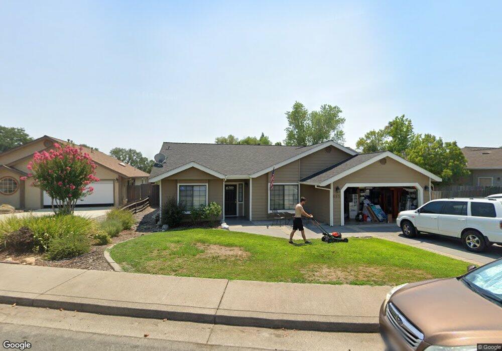
695 St Thomas Pkwy Redding, CA 96003
North Hilltop NeighborhoodEstimated Value: $394,000 - $429,595
3
Beds
2
Baths
1,687
Sq Ft
$242/Sq Ft
Est. Value
About This Home
This home is located at 695 St Thomas Pkwy, Redding, CA 96003 and is currently estimated at $408,399, approximately $242 per square foot. 695 St Thomas Pkwy is a home located in Shasta County with nearby schools including Turtle Bay, Sequoia Middle School, and Shasta High School.
Ownership History
Date
Name
Owned For
Owner Type
Purchase Details
Closed on
Sep 19, 2018
Sold by
Apple Monty and Apple Anna
Bought by
Apple Monty and Apple Anna
Current Estimated Value
Purchase Details
Closed on
May 9, 2017
Sold by
Weaver Benjamin W and Weaver Sarah K
Bought by
Apple Monty and Apple Anna
Purchase Details
Closed on
Apr 3, 2013
Sold by
Weaver Sarah K
Bought by
Weaver Benjamin W and Weaver Sarah K
Home Financials for this Owner
Home Financials are based on the most recent Mortgage that was taken out on this home.
Original Mortgage
$154,000
Interest Rate
3.54%
Mortgage Type
New Conventional
Purchase Details
Closed on
Mar 20, 2013
Sold by
Weaver Benjamin W and Weaver Sarah K
Bought by
Weaver Sarah K
Home Financials for this Owner
Home Financials are based on the most recent Mortgage that was taken out on this home.
Original Mortgage
$154,000
Interest Rate
3.54%
Mortgage Type
New Conventional
Purchase Details
Closed on
Aug 5, 2010
Sold by
The Bank Of New York Mellon
Bought by
Brooks Sarah K
Purchase Details
Closed on
Apr 1, 2010
Sold by
Montana Leslie S
Bought by
The Bank Of New York Mellon
Purchase Details
Closed on
Oct 5, 2008
Sold by
Lees Charles J and Lees Carrie
Bought by
Montana Leslie S
Purchase Details
Closed on
Dec 1, 2007
Sold by
Montana Leslie S
Bought by
Lees Charles J
Purchase Details
Closed on
Nov 19, 2002
Sold by
Montana James V
Bought by
Montana Leslie S
Home Financials for this Owner
Home Financials are based on the most recent Mortgage that was taken out on this home.
Original Mortgage
$152,000
Interest Rate
6.03%
Purchase Details
Closed on
Sep 8, 1998
Sold by
Signature Northwest Partnership
Bought by
Montana James and Montana Leslie S
Home Financials for this Owner
Home Financials are based on the most recent Mortgage that was taken out on this home.
Original Mortgage
$46,000
Interest Rate
6.92%
Mortgage Type
Seller Take Back
Create a Home Valuation Report for This Property
The Home Valuation Report is an in-depth analysis detailing your home's value as well as a comparison with similar homes in the area
Home Values in the Area
Average Home Value in this Area
Purchase History
| Date | Buyer | Sale Price | Title Company |
|---|---|---|---|
| Apple Monty | -- | None Available | |
| Apple Monty | $285,000 | Fidelity Natl Title Co Of Ca | |
| Weaver Benjamin W | -- | None Available | |
| Weaver Sarah K | -- | Fidelity Natl Title Co Of Ca | |
| Brooks Sarah K | $194,000 | Chicago Title Company | |
| The Bank Of New York Mellon | $189,000 | First American Title Ins Co | |
| Montana Leslie S | -- | None Available | |
| Lees Charles J | -- | None Available | |
| Montana Leslie S | -- | Alliance Title Company | |
| Montana James | $56,000 | Placer Title Company |
Source: Public Records
Mortgage History
| Date | Status | Borrower | Loan Amount |
|---|---|---|---|
| Previous Owner | Weaver Sarah K | $154,000 | |
| Previous Owner | Montana Leslie S | $152,000 | |
| Previous Owner | Montana James | $46,000 |
Source: Public Records
Tax History Compared to Growth
Tax History
| Year | Tax Paid | Tax Assessment Tax Assessment Total Assessment is a certain percentage of the fair market value that is determined by local assessors to be the total taxable value of land and additions on the property. | Land | Improvement |
|---|---|---|---|---|
| 2025 | $3,421 | $330,760 | $63,829 | $266,931 |
| 2024 | $3,368 | $324,276 | $62,578 | $261,698 |
| 2023 | $3,368 | $317,918 | $61,351 | $256,567 |
| 2022 | $3,312 | $311,686 | $60,149 | $251,537 |
| 2021 | $3,295 | $305,575 | $58,970 | $246,605 |
| 2020 | $3,337 | $302,443 | $58,366 | $244,077 |
| 2019 | $3,170 | $296,514 | $57,222 | $239,292 |
| 2018 | $3,197 | $290,700 | $56,100 | $234,600 |
| 2017 | $2,475 | $221,293 | $55,194 | $166,099 |
| 2016 | $2,397 | $216,955 | $54,112 | $162,843 |
| 2015 | $2,290 | $206,803 | $53,300 | $153,503 |
| 2014 | $2,274 | $202,753 | $52,256 | $150,497 |
Source: Public Records
Map
Nearby Homes
- 719 Saint Thomas Pkwy
- 454 Alamine Dr
- 720 Stonebriar Trail
- 726 Stonebriar Trail
- 732 Stonebriar Trail
- 738 Stonebriar Trail
- 444 Ridgecrest Trail Unit 119
- 488 Ridgecrest Trail Unit 132
- 488 Ridgecrest Trail Unit 133
- 466 Ridgecrest Trail Unit 136
- 11 Tanglewood Ln
- 200 Ridgetop Dr Unit 4
- 1026 Palisades Ave
- 856 Mission de Oro Dr
- 11037 Erickson Way
- 592 Mill Valley Pkwy
- 654 Rogue River Way
- 823 Mission Sierra Ct
- 825 Mission Sierra Ct
- 953 Tanglewood Dr
- 707 Saint Thomas Pkwy
- 0 Saint Thomas Pkwy
- 695 Saint Thomas Pkwy
- 477 Dominica Ct
- 689 Saint Thomas Pkwy
- 664 St Thomas Pkwy
- 664 Saint Thomas Pkwy
- 683 Saint Thomas Pkwy
- 722 Saint Thomas Pkwy
- 510 Martinique Cir
- 744 Saint Thomas Pkwy
- 546 Martinique Cir
- 522 Martinique Cir
- 677 Saint Thomas Pkwy
- 463 Dominica Ct
- 650 Saint Thomas Pkwy
- 534 Martinique Cir Unit 1
- 534 Martinique Cir
- 558 Martinique Cir
- 470 Dominica Ct