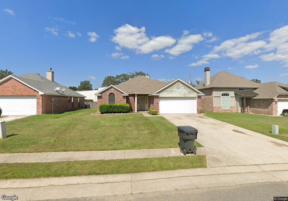
6952 Ash St Shreveport, LA 71129
Pines Road NeighborhoodEstimated Value: $205,227 - $224,000
3
Beds
2
Baths
1,503
Sq Ft
$143/Sq Ft
Est. Value
About This Home
This home is located at 6952 Ash St, Shreveport, LA 71129 and is currently estimated at $214,807, approximately $142 per square foot. 6952 Ash St is a home located in Caddo Parish with nearby schools including Judson Fundamental Elementary School, Fairfield Magnet School, and South Highlands Elementary.
Ownership History
Date
Name
Owned For
Owner Type
Purchase Details
Closed on
Apr 18, 2007
Sold by
Calvary Pentecostal Church
Bought by
Blackshire Lloyd
Current Estimated Value
Home Financials for this Owner
Home Financials are based on the most recent Mortgage that was taken out on this home.
Original Mortgage
$159,500
Outstanding Balance
$96,438
Interest Rate
6.15%
Mortgage Type
Unknown
Estimated Equity
$118,369
Purchase Details
Closed on
Jul 21, 2006
Sold by
F D H Ram Llc
Bought by
Calvary Pentecostal Church
Create a Home Valuation Report for This Property
The Home Valuation Report is an in-depth analysis detailing your home's value as well as a comparison with similar homes in the area
Home Values in the Area
Average Home Value in this Area
Purchase History
| Date | Buyer | Sale Price | Title Company |
|---|---|---|---|
| Blackshire Lloyd | $159,500 | None Available | |
| Calvary Pentecostal Church | $21,500 | None Available |
Source: Public Records
Mortgage History
| Date | Status | Borrower | Loan Amount |
|---|---|---|---|
| Open | Blackshire Lloyd | $159,500 |
Source: Public Records
Tax History Compared to Growth
Tax History
| Year | Tax Paid | Tax Assessment Tax Assessment Total Assessment is a certain percentage of the fair market value that is determined by local assessors to be the total taxable value of land and additions on the property. | Land | Improvement |
|---|---|---|---|---|
| 2024 | $2,845 | $18,251 | $2,917 | $15,334 |
| 2023 | $2,719 | $17,062 | $2,778 | $14,284 |
| 2022 | $2,719 | $17,062 | $2,778 | $14,284 |
| 2021 | $2,678 | $17,062 | $2,778 | $14,284 |
| 2020 | $2,678 | $17,062 | $2,778 | $14,284 |
| 2019 | $2,686 | $16,606 | $2,778 | $13,828 |
| 2018 | $1,173 | $16,606 | $2,778 | $13,828 |
| 2017 | $2,728 | $16,606 | $2,778 | $13,828 |
| 2015 | $1,120 | $16,140 | $2,780 | $13,360 |
| 2014 | $1,128 | $16,140 | $2,780 | $13,360 |
| 2013 | -- | $16,140 | $2,780 | $13,360 |
Source: Public Records
Map
Nearby Homes
- 6956 Ash St
- 0 0 W Bert Kouns Industrial Loop
- 7453 Shirley Francis Rd
- 7824 Oak Creek Trail
- Lot 12 Flournoy Lucas Rd
- 6190 W Bert Kouns Industrial Loop
- Lot 15 Buncombe Rd
- 7400 Glenleaf Rd Unit 45
- 7400 Glenleaf Rd Unit 39
- 7400 Glenleaf Rd Unit 108
- 7400 Glenleaf Rd Unit 32
- 7089 W Bert Kouns Industrial Loop
- 8025 Broadacres Rd
- 8122 Roosevelt Dr
- 6535 Dixieland Dr
- 6371 Buncombe Rd
- 0 Glenleaf Rd
- 7923 Masters Dr
- 7341 Broadacres Rd
- 7805 Hobbs Dr
- 6948 Ash St
- 6960 Ash St
- 6944 Ash St
- 6919 Basilwood St
- 6916 Pepperwood Rd
- 6940 Ash St
- 6964 Ash St
- 6811 Woolworth Rd
- 6915 Basilwood St
- 6918 Basilwood St
- 6968 Ash St
- 6936 Ash St
- 6936 Ash St
- 6912 Pepperwood Rd
- 6914 Basilwood St
- 6917 Pepperwood Rd
- 6911 Basilwood St
- 6908 Pepperwood Rd
- 6932 Ash St
- 6921 Ash St