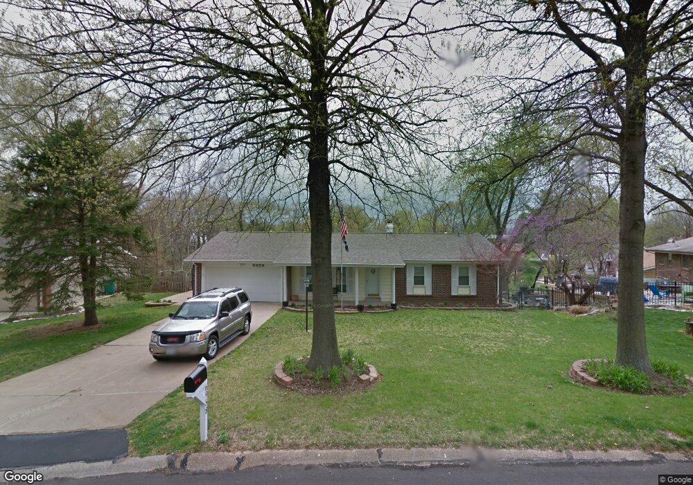
6958 Zaharias Ct Saint Louis, MO 63129
Estimated Value: $287,601 - $332,000
3
Beds
2
Baths
1,620
Sq Ft
$192/Sq Ft
Est. Value
About This Home
This home is located at 6958 Zaharias Ct, Saint Louis, MO 63129 and is currently estimated at $310,650, approximately $191 per square foot. 6958 Zaharias Ct is a home located in St. Louis County with nearby schools including Point Elementary School, Oakville Middle School, and Oakville Senior High School.
Ownership History
Date
Name
Owned For
Owner Type
Purchase Details
Closed on
Oct 7, 2022
Sold by
Johnston Terry Wayne
Bought by
Gould Steven and Kaber Alexis
Current Estimated Value
Home Financials for this Owner
Home Financials are based on the most recent Mortgage that was taken out on this home.
Original Mortgage
$176,000
Outstanding Balance
$169,186
Interest Rate
5.89%
Mortgage Type
New Conventional
Estimated Equity
$141,464
Purchase Details
Closed on
Nov 30, 1998
Sold by
Wayne Johnston Terry
Bought by
Johnston Terry W and Johnston Bruce E
Create a Home Valuation Report for This Property
The Home Valuation Report is an in-depth analysis detailing your home's value as well as a comparison with similar homes in the area
Home Values in the Area
Average Home Value in this Area
Purchase History
| Date | Buyer | Sale Price | Title Company |
|---|---|---|---|
| Gould Steven | -- | -- | |
| Johnston Terry W | -- | -- |
Source: Public Records
Mortgage History
| Date | Status | Borrower | Loan Amount |
|---|---|---|---|
| Open | Gould Steven | $176,000 |
Source: Public Records
Tax History Compared to Growth
Tax History
| Year | Tax Paid | Tax Assessment Tax Assessment Total Assessment is a certain percentage of the fair market value that is determined by local assessors to be the total taxable value of land and additions on the property. | Land | Improvement |
|---|---|---|---|---|
| 2025 | $3,070 | $51,650 | $23,070 | $28,580 |
| 2024 | $3,070 | $45,620 | $14,420 | $31,200 |
| 2023 | $3,031 | $45,620 | $14,420 | $31,200 |
| 2022 | $2,576 | $38,930 | $10,560 | $28,370 |
| 2021 | $2,494 | $38,930 | $10,560 | $28,370 |
| 2020 | $2,547 | $37,830 | $11,480 | $26,350 |
| 2019 | $2,539 | $37,830 | $11,480 | $26,350 |
| 2018 | $2,458 | $33,060 | $9,580 | $23,480 |
| 2017 | $2,455 | $33,060 | $9,580 | $23,480 |
| 2016 | $2,299 | $29,680 | $9,580 | $20,100 |
| 2015 | $2,111 | $29,680 | $9,580 | $20,100 |
| 2014 | $2,101 | $29,240 | $7,140 | $22,100 |
Source: Public Records
Map
Nearby Homes
- 6935 Bluff Springs Ct
- 2581 Christopher Oaks Ct
- 2680 Cripple Creek Dr
- 2692 Queen Bee Ln
- 6834 Black Water Dr
- 6841 River Bow Ct
- 2995 Point Dr
- 6708 Bear Creek Dr
- 3026 Nettie Dr
- 6568 Devonhurst Dr
- 7212 Emerald Bend Dr
- 2503 River Winds Ct
- 6840 Cottage Grove Ln Unit J
- 3049 Grassy Valley Dr
- 6808 Cottage Grove Ln Unit I
- 3036 Caprock Ct
- 3044 Caprock Ct
- 3049 Summerfield Manor Dr
- 7010 Green Tee Ct Unit A
- 2771 Cliffwood Trail
- 6950 Zaharias Ct
- 2668 Baltusrol Dr
- 2676 Baltusrol Dr
- 2656 Baltusrol Dr
- 6912 Birdie Ln
- 6918 Birdie Ln
- 6949 Zaharias Ct
- 2682 Baltusrol Dr
- 6924 Birdie Ln
- 2669 Baltusrol Dr
- 2663 Baltusrol Dr
- 2648 Baltusrol Dr
- 2675 Baltusrol Dr
- 2657 Baltusrol Dr
- 6930 Birdie Ln
- 6925 Zaharias Ct
- 2683 Baltusrol Dr
- 2651 Baltusrol Dr
- 6911 Zaharias Ct
- 6936 Birdie Ln