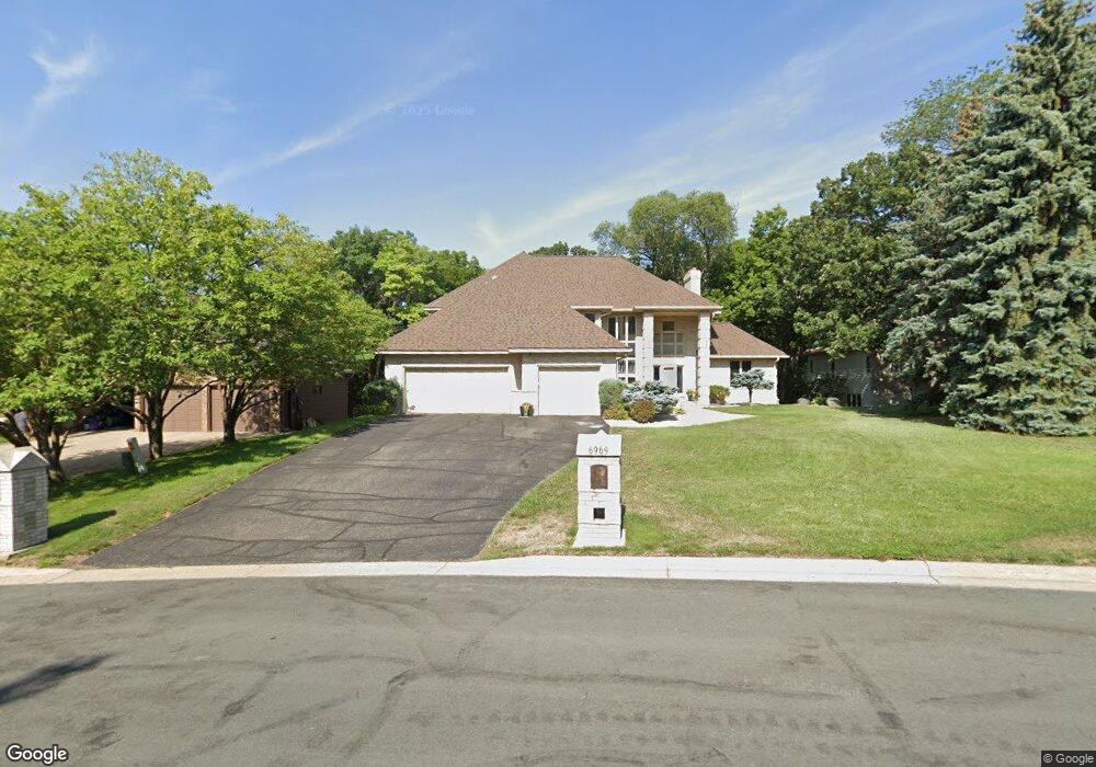
6969 Kenmare Dr Bloomington, MN 55438
West Bloomington NeighborhoodEstimated Value: $832,000 - $1,190,000
5
Beds
4
Baths
5,903
Sq Ft
$167/Sq Ft
Est. Value
About This Home
This home is located at 6969 Kenmare Dr, Bloomington, MN 55438 and is currently estimated at $987,694, approximately $167 per square foot. 6969 Kenmare Dr is a home located in Hennepin County with nearby schools including Olson Elementary School, Olson Middle School, and Jefferson Senior High School.
Ownership History
Date
Name
Owned For
Owner Type
Purchase Details
Closed on
Dec 6, 2021
Sold by
Walsh Kathleen A and Walsh Timothy M
Bought by
Moen Alexandra Louise and Spaeth Travis Anthony
Current Estimated Value
Home Financials for this Owner
Home Financials are based on the most recent Mortgage that was taken out on this home.
Original Mortgage
$438,000
Outstanding Balance
$402,845
Interest Rate
3.11%
Mortgage Type
New Conventional
Estimated Equity
$584,849
Create a Home Valuation Report for This Property
The Home Valuation Report is an in-depth analysis detailing your home's value as well as a comparison with similar homes in the area
Home Values in the Area
Average Home Value in this Area
Purchase History
| Date | Buyer | Sale Price | Title Company |
|---|---|---|---|
| Moen Alexandra Louise | $730,000 | Edina Realty Title Inc |
Source: Public Records
Mortgage History
| Date | Status | Borrower | Loan Amount |
|---|---|---|---|
| Open | Moen Alexandra Louise | $438,000 |
Source: Public Records
Tax History Compared to Growth
Tax History
| Year | Tax Paid | Tax Assessment Tax Assessment Total Assessment is a certain percentage of the fair market value that is determined by local assessors to be the total taxable value of land and additions on the property. | Land | Improvement |
|---|---|---|---|---|
| 2024 | $12,445 | $879,100 | $207,300 | $671,800 |
| 2023 | $11,663 | $887,700 | $268,600 | $619,100 |
| 2022 | $10,614 | $875,100 | $257,500 | $617,600 |
| 2021 | $10,105 | $770,300 | $295,300 | $475,000 |
| 2020 | $11,820 | $744,700 | $287,100 | $457,600 |
| 2019 | $11,354 | $835,000 | $287,100 | $547,900 |
| 2018 | $11,169 | $792,200 | $294,900 | $497,300 |
| 2017 | $11,907 | $809,800 | $292,500 | $517,300 |
| 2016 | $11,668 | $757,100 | $284,900 | $472,200 |
| 2015 | $11,720 | $733,900 | $274,200 | $459,700 |
| 2014 | -- | $744,200 | $309,700 | $434,500 |
Source: Public Records
Map
Nearby Homes
- 7062 W 113th St Unit 1
- 11275 Oregon Cir
- 7019 W 110th Street Cir Unit 15
- 11159 Sumter Ave S
- 7245 Woodstock Curve
- 7229 Woodstock Curve Unit 6
- 7321 Woodstock Curve
- 7401 Landau Dr Unit 12
- 7500 Landau Dr
- 7616 Landau Dr
- 10707 Yukon Ave S
- 11339 Vessey Cir
- 10640 Aquila Ave S
- 10433 Utah Rd
- 10833 Toledo Ave S
- 5157 Balmoral Ln
- 11516 Palmer Rd
- 5275 Balmoral Ln
- 4816 Overlook Dr
- 10754 Toledo Ct
- 6975 Kenmare Dr
- 6963 Kenmare Dr
- 6987 Kenmare Dr
- 7180 Kenmare Dr
- 6981 Kenmare Dr
- 6951 Kenmare Dr
- 6999 Kenmare Dr
- 6962 Kenmare Dr
- 6958 Kenmare Dr
- 7170 Kenmare Dr
- 6950 Kenmare Dr
- 6954 Kenmare Dr
- 6966 Kenmare Dr
- 6988 Kenmare Dr
- 6982 Kenmare Dr
- 6970 Kenmare Dr
- 6992 Kenmare Dr
- 7001 Kenmare Dr
- 6976 Kenmare Dr
- 7160 Kenmare Dr
