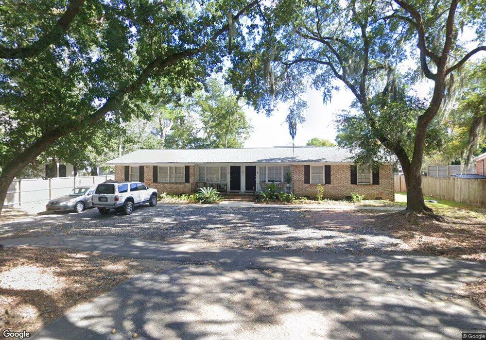
697 Fort Johnson Rd Unit B Charleston, SC 29412
James Island NeighborhoodEstimated Value: $536,000 - $727,322
3
Beds
1
Bath
1,300
Sq Ft
$491/Sq Ft
Est. Value
About This Home
This home is located at 697 Fort Johnson Rd Unit B, Charleston, SC 29412 and is currently estimated at $637,831, approximately $490 per square foot. 697 Fort Johnson Rd Unit B is a home located in Charleston County with nearby schools including Stiles Point Elementary School, Camp Road Middle, and James Island Charter High School.
Ownership History
Date
Name
Owned For
Owner Type
Purchase Details
Closed on
Aug 16, 2021
Sold by
Maurice Carl A
Bought by
697 Ft Johnson Llc
Current Estimated Value
Purchase Details
Closed on
Mar 19, 2020
Sold by
Church Joseph O
Bought by
Maurice Carl A and Maurice Bonnie A
Purchase Details
Closed on
Dec 14, 2004
Sold by
Ravenel Capital Llc
Bought by
Church Joseph O
Purchase Details
Closed on
Jun 11, 2004
Sold by
Condon Virginia F
Bought by
Ravenel Capital Llc
Create a Home Valuation Report for This Property
The Home Valuation Report is an in-depth analysis detailing your home's value as well as a comparison with similar homes in the area
Home Values in the Area
Average Home Value in this Area
Purchase History
| Date | Buyer | Sale Price | Title Company |
|---|---|---|---|
| 697 Ft Johnson Llc | -- | None Listed On Document | |
| Maurice Carl A | $250,000 | None Available | |
| Church Joseph O | $224,500 | -- | |
| Ravenel Capital Llc | $180,000 | -- |
Source: Public Records
Tax History Compared to Growth
Tax History
| Year | Tax Paid | Tax Assessment Tax Assessment Total Assessment is a certain percentage of the fair market value that is determined by local assessors to be the total taxable value of land and additions on the property. | Land | Improvement |
|---|---|---|---|---|
| 2024 | $5,526 | $19,920 | $0 | $0 |
| 2023 | $5,526 | $19,920 | $0 | $0 |
| 2022 | $5,044 | $19,920 | $0 | $0 |
| 2021 | $5,021 | $19,920 | $0 | $0 |
| 2020 | $3,921 | $15,730 | $0 | $0 |
| 2019 | $3,709 | $13,680 | $0 | $0 |
| 2017 | $3,633 | $13,680 | $0 | $0 |
| 2016 | $3,516 | $13,680 | $0 | $0 |
| 2015 | $3,371 | $13,680 | $0 | $0 |
| 2014 | $3,319 | $0 | $0 | $0 |
| 2011 | -- | $0 | $0 | $0 |
Source: Public Records
Map
Nearby Homes
- 939 Mikell Dr
- 865 Duvall St
- 683 Edmonds Dr
- 679 Edmonds Dr
- 3009 Allison Cove Dr
- 734 Sterling Dr
- 965 Mooring Dr
- 562 Fort Johnson Rd
- 762 Swanson Ave
- 853 Whispering Marsh Dr
- 954 Harbortowne Rd
- 969 Harbor View Rd
- 881 Evans Rd
- 525 Yellow Tower Terrace
- 975 Harbor View Rd
- 634 Lynne Ave
- 832 Robert e Lee Blvd
- 637 Lynne Ave
- 897 Kushiwah Creek Ct
- 0 Fort Johnson Rd Unit 25005735
- 697 Fort Johnson Rd
- 703 Fort Johnson Rd
- 625 Bootlegger Ln
- 617 Bootlegger Ln
- 698 Fort Johnson Rd
- 705 Marlin Ln
- 705 Marlin Ln Unit A & B
- 624 Bootlegger Ln
- 613 Bootlegger Ln
- 705 Fort Johnson Rd
- 706 Fort Johnson Rd
- 709 Fort Johnson Rd
- 695 Fort Johnson Rd
- 610 Bootlegger Ln
- 609 Bootlegger Ln
- 709 Marlin Ln
- 685 Highwood Cir
- 683 Highwood Cir
- 704 Marlin Ln
- 704 Marlin Ln Unit A