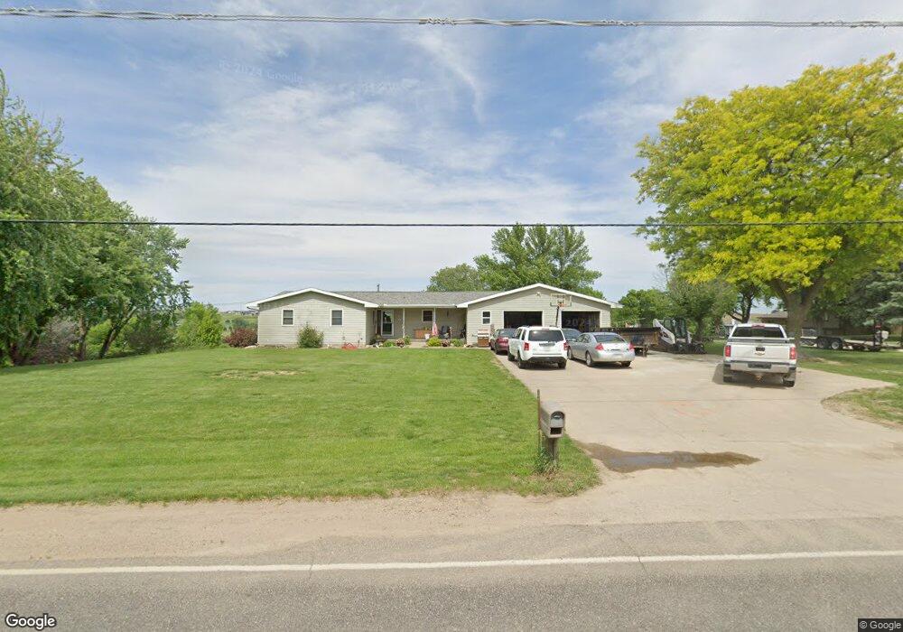
6970 Morningside Ave Sioux City, IA 51106
Estimated Value: $315,428 - $504,000
--
Bed
1
Bath
1,488
Sq Ft
$251/Sq Ft
Est. Value
About This Home
This home is located at 6970 Morningside Ave, Sioux City, IA 51106 and is currently estimated at $373,857, approximately $251 per square foot. 6970 Morningside Ave is a home located in Woodbury County with nearby schools including Nodland Elementary School, East Middle School, and East High School.
Ownership History
Date
Name
Owned For
Owner Type
Purchase Details
Closed on
Aug 16, 2002
Sold by
Manufactures & Traders Trust Co
Bought by
Buschman Randy and Janning Rahana
Current Estimated Value
Home Financials for this Owner
Home Financials are based on the most recent Mortgage that was taken out on this home.
Original Mortgage
$180,000
Interest Rate
3.66%
Mortgage Type
New Conventional
Create a Home Valuation Report for This Property
The Home Valuation Report is an in-depth analysis detailing your home's value as well as a comparison with similar homes in the area
Home Values in the Area
Average Home Value in this Area
Purchase History
| Date | Buyer | Sale Price | Title Company |
|---|---|---|---|
| Buschman Randy | -- | None Available |
Source: Public Records
Mortgage History
| Date | Status | Borrower | Loan Amount |
|---|---|---|---|
| Previous Owner | Buschman Randy | $180,000 |
Source: Public Records
Tax History Compared to Growth
Tax History
| Year | Tax Paid | Tax Assessment Tax Assessment Total Assessment is a certain percentage of the fair market value that is determined by local assessors to be the total taxable value of land and additions on the property. | Land | Improvement |
|---|---|---|---|---|
| 2025 | $3,136 | $311,210 | $63,070 | $248,140 |
| 2024 | $3,136 | $291,400 | $63,070 | $228,330 |
| 2023 | $3,160 | $291,400 | $63,070 | $228,330 |
| 2022 | $3,126 | $246,890 | $63,070 | $183,820 |
| 2021 | $3,126 | $246,890 | $63,070 | $183,820 |
| 2020 | $3,068 | $227,680 | $67,490 | $160,190 |
| 2019 | $3,414 | $227,680 | $67,490 | $160,190 |
| 2018 | $3,324 | $227,680 | $67,490 | $160,190 |
| 2017 | $3,324 | $227,680 | $67,490 | $160,190 |
| 2016 | $3,390 | $226,180 | $0 | $0 |
| 2015 | $3,364 | $211,380 | $63,070 | $148,310 |
| 2014 | $3,455 | $211,380 | $63,070 | $148,310 |
Source: Public Records
Map
Nearby Homes
- 17 Heritage Place
- 6104 Pine View Dr
- 6701 Windsong Ct
- 6700 Windsong Ct
- 6540 Palm Valley Dr
- 5225 Lynx Ct
- 5201 Lynx Ct
- 3441 Glen Ellen Rd
- 6810 Brookside Dr
- 1441 170th St
- 6413 Mickelson St
- 5510 Christy Rd
- 5811 Lorraine Ave
- 6290 Tiger Dr
- 2640 Nicklaus Blvd
- 6119 Morningside Ave
- 2600 Nicklaus Blvd
- 5260 Overlook Ln
- 2564 Nicklaus Blvd
- Overlook 1 Plan at The Overlook at Sunnybrook
- 13 Heritage Place
- 6968 Morningside Ave
- 10 Heritage Place
- 6800 Morningside Ave
- 12 Heritage Place
- 6969 Morningside Ave
- 15 Heritage Place
- 14 Heritage Place
- 6805 Morningside Ave
- 18 Heritage Place
- 41 Arlington Rd
- 16 Heritage Place
- 43 Arlington Rd
- 45 Arlington Rd
- 21 Heritage Place
- 6803 Morningside Ave
- 46 Arlington Rd
- 40 Arlington Rd
- 24 Heritage Place
- 44 Arlington Rd