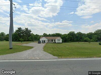
6971 NE St Rt 13 Somerset, OH 43783
Estimated Value: $342,591 - $368,000
3
Beds
2
Baths
1,576
Sq Ft
$224/Sq Ft
Est. Value
About This Home
This home is located at 6971 NE St Rt 13, Somerset, OH 43783 and is currently estimated at $353,648, approximately $224 per square foot. 6971 NE St Rt 13 is a home located in Perry County with nearby schools including Sheridan High School and Holy Trinity Elementary School.
Ownership History
Date
Name
Owned For
Owner Type
Purchase Details
Closed on
Apr 6, 2022
Sold by
Emmert Steve A
Bought by
Brown Madalyn N and Brown Corey J
Current Estimated Value
Purchase Details
Closed on
Oct 23, 2013
Sold by
Layne Karen S and Brown Karen
Bought by
Emmert Steve A
Home Financials for this Owner
Home Financials are based on the most recent Mortgage that was taken out on this home.
Original Mortgage
$110,400
Interest Rate
4.33%
Mortgage Type
New Conventional
Create a Home Valuation Report for This Property
The Home Valuation Report is an in-depth analysis detailing your home's value as well as a comparison with similar homes in the area
Home Values in the Area
Average Home Value in this Area
Purchase History
| Date | Buyer | Sale Price | Title Company |
|---|---|---|---|
| Brown Madalyn N | -- | Sandhu Law Group Llc | |
| Emmert Steve A | $138,000 | Cs Title Agency Inc |
Source: Public Records
Mortgage History
| Date | Status | Borrower | Loan Amount |
|---|---|---|---|
| Previous Owner | Emmert Steve A | $100,000 | |
| Previous Owner | Emmert Steve A | $110,400 |
Source: Public Records
Tax History Compared to Growth
Tax History
| Year | Tax Paid | Tax Assessment Tax Assessment Total Assessment is a certain percentage of the fair market value that is determined by local assessors to be the total taxable value of land and additions on the property. | Land | Improvement |
|---|---|---|---|---|
| 2024 | $2,712 | $74,510 | $9,100 | $65,410 |
| 2023 | $2,712 | $74,510 | $9,100 | $65,410 |
| 2022 | $2,810 | $61,970 | $5,640 | $56,330 |
| 2021 | $2,524 | $61,970 | $5,640 | $56,330 |
| 2020 | $2,523 | $61,970 | $5,640 | $56,330 |
| 2019 | $2,198 | $54,140 | $5,370 | $48,770 |
| 2018 | $2,239 | $54,140 | $5,370 | $48,770 |
| 2017 | $2,030 | $54,140 | $5,370 | $48,770 |
| 2016 | $1,934 | $48,020 | $6,480 | $41,540 |
| 2015 | $1,932 | $48,020 | $6,480 | $41,540 |
| 2014 | $1,858 | $48,020 | $6,480 | $41,540 |
| 2013 | $1,885 | $48,020 | $6,480 | $41,540 |
| 2012 | -- | $48,020 | $6,480 | $41,540 |
Source: Public Records
Map
Nearby Homes
- 217 S Columbus St
- 219 W Sheridan Ave
- 0 High St Unit 225006832
- 0 Ohio 757
- 0 Ohio 669
- 3579 Township Road 124 NE
- 6150 Ohio 669
- 3758 Old Somerset Rd
- 10526 State Route 668 N
- 2655 Township Road 123 NE
- 10705 Township Road 92
- 0 Township Road 92
- 3406 State Route 37 E
- 1305 Cooperriders Rd NW
- 11284 State Route 668 N
- 6250 Zion Rd NW
- 3125 State Route 13 NE
- 8778 Township Road 36 NW
- 5930 U S 22
- 0 Ohio 37
- 6971 NE St Rt 13
- 6971 State Route 13 NE
- 6985 State Route 13 NE
- 6912 State Rt 13 NE
- 6831 State Route 13 NE
- 6912 State Route 13 NE
- 6952 State Route 13 NE
- 6912 Ohio 13
- 6912 Ohio 13
- 6912 St Rt 13 NE
- 6890 State Route 13 NE
- 6852 State Route 13 NE
- 6976 State Route 13 NE
- 6823 State Route 13 NE
- 6840 State Route 13 NE
- 6996 State Route 13 NE
- 7010 State Route 13 NE
- 7010 State Route 13 NE
- 6814 State Route 13 NE
- 3015 State Route 669 NE