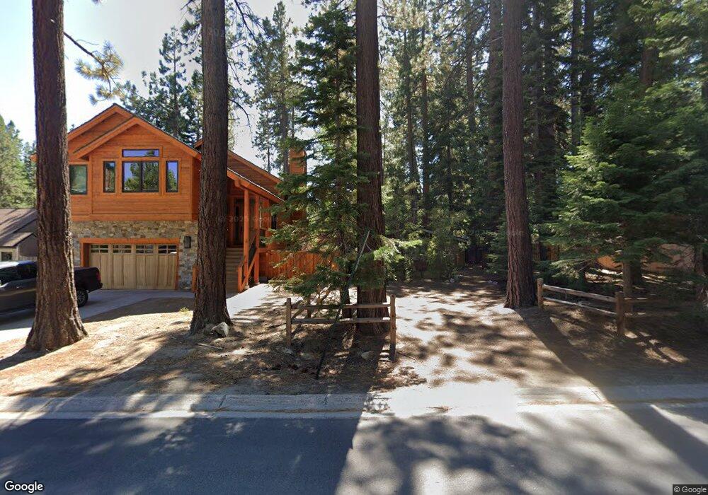
698 Tahoe Island Dr South Lake Tahoe, CA 96150
Estimated Value: $298,650 - $467,000
1
Bed
1
Bath
576
Sq Ft
$677/Sq Ft
Est. Value
About This Home
This home is located at 698 Tahoe Island Dr, South Lake Tahoe, CA 96150 and is currently estimated at $389,913, approximately $676 per square foot. 698 Tahoe Island Dr is a home located in El Dorado County with nearby schools including Tahoe Valley Elementary School, South Tahoe Middle School, and South Tahoe High School.
Ownership History
Date
Name
Owned For
Owner Type
Purchase Details
Closed on
Feb 1, 2022
Sold by
Rosenberg Neal E and Rosenberg Joanne E
Bought by
Rosenberg Living Trust
Current Estimated Value
Purchase Details
Closed on
Aug 23, 2006
Sold by
The Gertrude Lucile Rosenberg Trust
Bought by
Rosenberg Neal E and Rosenberg Joanne E
Home Financials for this Owner
Home Financials are based on the most recent Mortgage that was taken out on this home.
Original Mortgage
$200,000
Interest Rate
6.37%
Mortgage Type
New Conventional
Create a Home Valuation Report for This Property
The Home Valuation Report is an in-depth analysis detailing your home's value as well as a comparison with similar homes in the area
Home Values in the Area
Average Home Value in this Area
Purchase History
| Date | Buyer | Sale Price | Title Company |
|---|---|---|---|
| Rosenberg Living Trust | -- | Elkings Kalt Weintraub Reuben | |
| Rosenberg Neal E | -- | United Independent Title Ins |
Source: Public Records
Mortgage History
| Date | Status | Borrower | Loan Amount |
|---|---|---|---|
| Previous Owner | Rosenberg Neal E | $200,000 |
Source: Public Records
Tax History Compared to Growth
Tax History
| Year | Tax Paid | Tax Assessment Tax Assessment Total Assessment is a certain percentage of the fair market value that is determined by local assessors to be the total taxable value of land and additions on the property. | Land | Improvement |
|---|---|---|---|---|
| 2025 | $495 | $38,036 | $12,664 | $25,372 |
| 2024 | $495 | $37,291 | $12,416 | $24,875 |
| 2023 | $487 | $36,561 | $12,173 | $24,388 |
| 2022 | $482 | $35,845 | $11,935 | $23,910 |
| 2021 | $476 | $35,143 | $11,701 | $23,442 |
| 2020 | $470 | $34,784 | $11,582 | $23,202 |
| 2019 | $467 | $34,103 | $11,355 | $22,748 |
| 2018 | $459 | $33,435 | $11,133 | $22,302 |
| 2017 | $452 | $32,780 | $10,915 | $21,865 |
| 2016 | $444 | $32,138 | $10,701 | $21,437 |
| 2015 | $424 | $31,658 | $10,542 | $21,116 |
| 2014 | $424 | $31,040 | $10,337 | $20,703 |
Source: Public Records
Map
Nearby Homes
- 724 Tahoe Island Dr
- 741 Tahoe Island Dr
- 2191 Butler Ave
- 2071 Venice Dr Unit 294
- 552 Christie Dr Unit 307
- 552 Christie Dr Unit 303
- 2081 Venice Dr Unit 285
- 2081 Venice Dr Unit 280
- 2031 Venice Dr Unit 322
- 673 James Ave
- 2028 13th St
- 776 Patricia Ln
- 629 James Ave
- 569 Lucerne Way
- 1938 Marconi Way
- 2185 Morro Dr
- 914 Tahoe Island Dr
- 2244 Texas Ave
- 516 Emerald Bay Rd Unit 49
- 516 Emerald Bay Rd Unit 426
- 704 Tahoe Island Dr
- 2150 12th St
- 692 Tahoe Island Dr
- 708 Tahoe Island Dr
- 2140 12th St
- 701 Tahoe Island Dr
- 697 Tahoe Island Dr
- 705 Tahoe Island Dr
- 714 Tahoe Island Dr
- 699 Anita Dr Unit 1
- 699 Anita Dr
- 691 Tahoe Island Dr
- 709 Tahoe Island Dr
- 703 Anita Dr
- 683 Tahoe Island Dr
- 720 Tahoe Island Dr
- 693 Anita Dr
- 2147 12th St
- 705 Anita Dr
- 2143 12th St