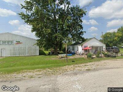
6980 E State Route F Cowgill, MO 64637
Estimated Value: $234,000 - $476,946
--
Bed
--
Bath
2,121
Sq Ft
$168/Sq Ft
Est. Value
About This Home
This home is located at 6980 E State Route F, Cowgill, MO 64637 and is currently estimated at $355,473, approximately $167 per square foot. 6980 E State Route F is a home with nearby schools including New York Elementary School.
Create a Home Valuation Report for This Property
The Home Valuation Report is an in-depth analysis detailing your home's value as well as a comparison with similar homes in the area
Home Values in the Area
Average Home Value in this Area
Tax History Compared to Growth
Tax History
| Year | Tax Paid | Tax Assessment Tax Assessment Total Assessment is a certain percentage of the fair market value that is determined by local assessors to be the total taxable value of land and additions on the property. | Land | Improvement |
|---|---|---|---|---|
| 2024 | $2,336 | $35,350 | $2,730 | $32,620 |
| 2023 | $2,350 | $35,350 | $2,730 | $32,620 |
| 2022 | $2,259 | $34,960 | $2,730 | $32,230 |
| 2021 | $2,140 | $34,960 | $2,730 | $32,230 |
| 2020 | $2,090 | $33,870 | $2,730 | $31,140 |
| 2019 | $2,091 | $33,870 | $2,730 | $31,140 |
| 2018 | $1,779 | $28,770 | $2,010 | $26,760 |
| 2017 | $1,779 | $28,770 | $2,010 | $26,760 |
| 2016 | -- | $28,580 | $1,820 | $26,760 |
| 2015 | -- | $28,580 | $1,820 | $26,760 |
| 2013 | -- | $27,460 | $1,020 | $26,440 |
| 2011 | -- | $26,910 | $0 | $0 |
Source: Public Records
Map
Nearby Homes
- 7226 E State Route F
- 0 SE Sparks Rd
- 0 U Hwy Unit HMS2542483
- 2943 NE Turkey Rd
- 0 B Hwy Unit HMS2542493
- 22805 B Hwy
- 6335 SE Oliver Rd
- 0 NE State Highway B
- 9503 SE Soo Line Dr
- 1034 NE State Route U N A
- 506 Bobcat Ave
- 209 E Main St
- 4717 SE Yankee Ridge Rd
- 405 N Murray Ave
- 305 N Co Road A
- 4560 NW Byard Rd
- 304 N Main St
- 207 E 4th St
- 0 SE Tait Park Dr
- 6585 NE Catawba Rd