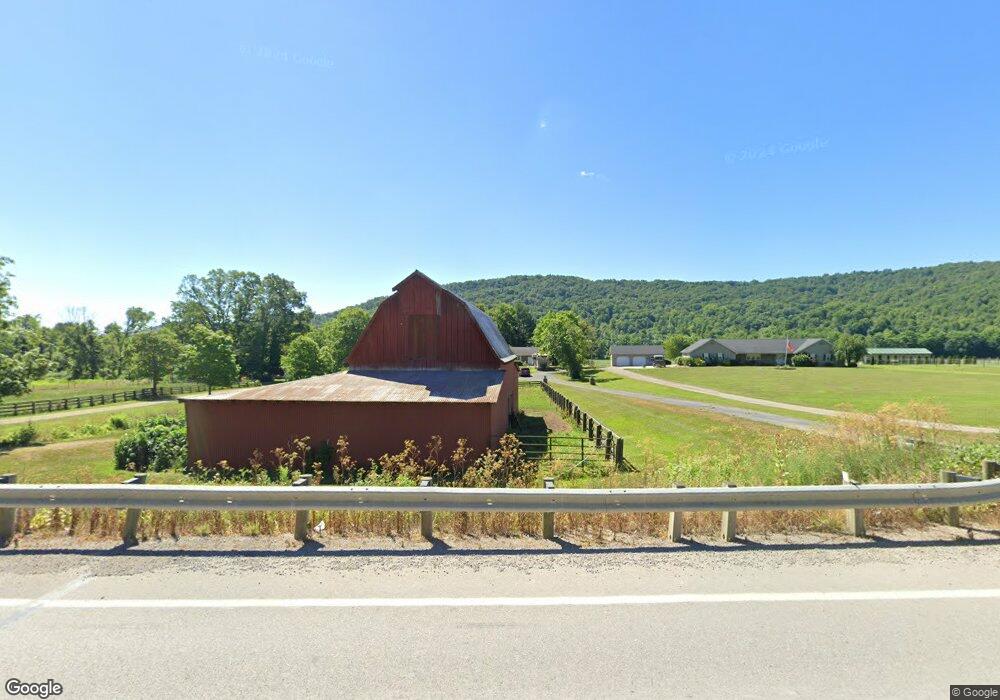
6980 State Route 124 Latham, OH 45646
Estimated Value: $203,000 - $283,000
2
Beds
1
Bath
1,566
Sq Ft
$160/Sq Ft
Est. Value
About This Home
This home is located at 6980 State Route 124, Latham, OH 45646 and is currently estimated at $250,254, approximately $159 per square foot. 6980 State Route 124 is a home located in Pike County with nearby schools including Western Elementary School and Western High School.
Ownership History
Date
Name
Owned For
Owner Type
Purchase Details
Closed on
Mar 30, 2018
Sold by
Bakenhaster Donald Mark and Bakenhaster Melissa R
Bought by
Starett Robert M and Starett Dawnetta J
Current Estimated Value
Home Financials for this Owner
Home Financials are based on the most recent Mortgage that was taken out on this home.
Original Mortgage
$224,000
Outstanding Balance
$192,591
Interest Rate
4.43%
Mortgage Type
New Conventional
Estimated Equity
$57,663
Create a Home Valuation Report for This Property
The Home Valuation Report is an in-depth analysis detailing your home's value as well as a comparison with similar homes in the area
Home Values in the Area
Average Home Value in this Area
Purchase History
| Date | Buyer | Sale Price | Title Company |
|---|---|---|---|
| Starett Robert M | $283,000 | Northwest Title Family Of Co |
Source: Public Records
Mortgage History
| Date | Status | Borrower | Loan Amount |
|---|---|---|---|
| Open | Starett Robert M | $224,000 |
Source: Public Records
Tax History Compared to Growth
Tax History
| Year | Tax Paid | Tax Assessment Tax Assessment Total Assessment is a certain percentage of the fair market value that is determined by local assessors to be the total taxable value of land and additions on the property. | Land | Improvement |
|---|---|---|---|---|
| 2024 | $1,837 | $58,720 | $7,480 | $51,240 |
| 2023 | $1,837 | $58,720 | $7,480 | $51,240 |
| 2022 | $1,729 | $54,310 | $6,300 | $48,010 |
| 2021 | $1,678 | $56,250 | $8,240 | $48,010 |
| 2020 | $1,691 | $56,250 | $8,240 | $48,010 |
| 2019 | $1,500 | $48,890 | $7,210 | $41,680 |
| 2018 | $1,539 | $48,300 | $6,620 | $41,680 |
| 2017 | $1,421 | $41,570 | $6,620 | $34,950 |
| 2016 | $1,578 | $49,390 | $3,480 | $45,910 |
| 2015 | $1,578 | $49,390 | $3,480 | $45,910 |
| 2014 | $1,606 | $49,390 | $3,480 | $45,910 |
| 2013 | $1,728 | $49,190 | $3,280 | $45,910 |
| 2012 | $1,778 | $49,190 | $3,280 | $45,910 |
Source: Public Records
Map
Nearby Homes
- 779 Lapperell Rd
- 4655 Grassy Fork Rd
- 1194 Beekman Ridge Rd Unit T222
- 1437 Green Ridge Rd
- 0 Green Ridge Rd Unit 198065
- 0 Green Ridge Rd Unit 22808921
- 0 Green Ridge Rd Unit 1832842
- 31 ac Green Ridge Rd
- 3750 Ohio 124
- 0 Beavers Ridge Rd Unit 1 225010990
- 0 Auerville Rd
- 321 Red Bridge Rd
- 5283 Drybone Rd
- 0 Pike Lake Rd Unit 23480741
- 0 Pike Lake Rd Unit 23464001
- 0 Pike Lake Rd Unit (Tract 2 Pike Lake G
- 0 Pike Lake Rd Unit (Tract 1 Pike Lake G
- 4999 Auerville Rd
- 0 S Side Chenoweth Fork Rd
- 0 Nace Corner Rd
- 6980 Ohio 124
- 6976 Ohio 124
- 6976 St Rt 124
- 6976 State Route 124
- 7140 State Route 124
- 7205 State Route 124
- 7205 State Route 124
- 7222 Ohio 124
- 7222 State Route 124
- 7246 State Route 124
- 7246 Ohio 124
- 7265 State Route 124
- 7296 State Route 124
- 7306 State Route 124
- 7305 State Route 124
- 7305 State Route 124
- 7000 State Route 124
- 7365 St Rt 124
- 7400 State Route 124
- 7398 State Route 124