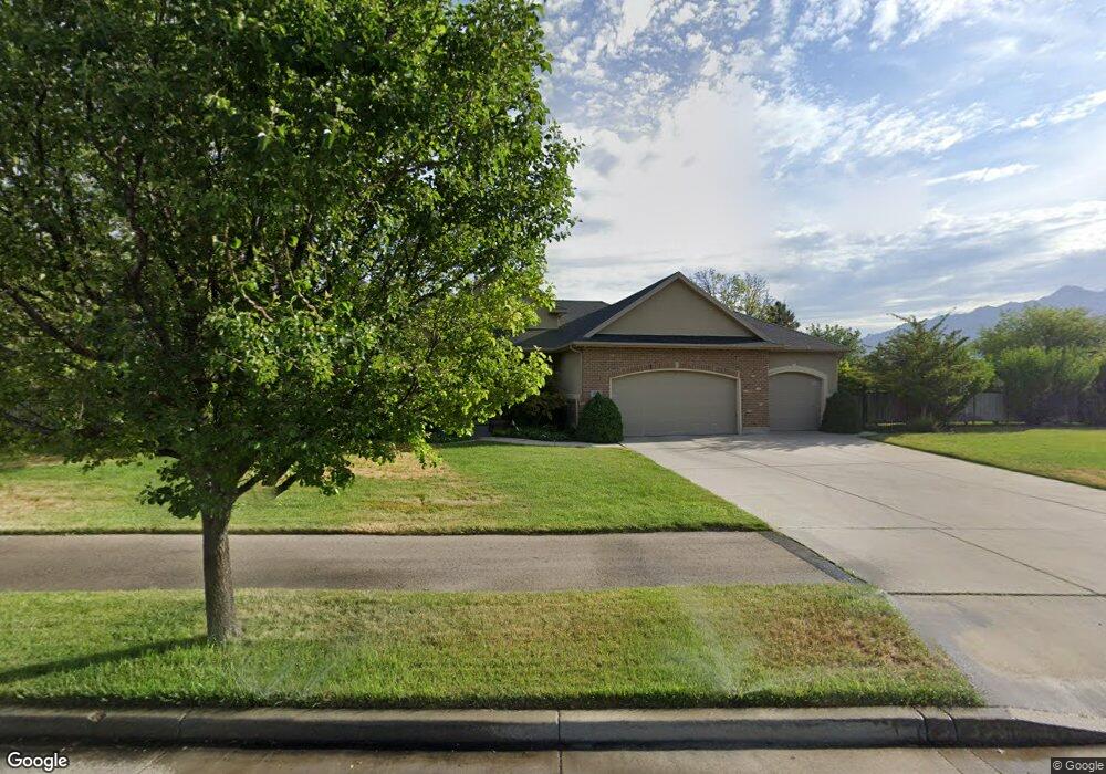
699 Carlquist Dr Draper, UT 84020
Estimated Value: $949,000 - $1,179,000
6
Beds
4
Baths
1,855
Sq Ft
$566/Sq Ft
Est. Value
About This Home
This home is located at 699 Carlquist Dr, Draper, UT 84020 and is currently estimated at $1,049,735, approximately $565 per square foot. 699 Carlquist Dr is a home located in Salt Lake County with nearby schools including Corner Canyon High School, Draper Park Middle School, and Summit Academy - Draper Elementary Campus.
Ownership History
Date
Name
Owned For
Owner Type
Purchase Details
Closed on
Mar 4, 2013
Sold by
Robinson Kenneth C and Robinson Michelle C
Bought by
Beld John Thomas and Beld Lisa L
Current Estimated Value
Home Financials for this Owner
Home Financials are based on the most recent Mortgage that was taken out on this home.
Original Mortgage
$430,761
Outstanding Balance
$302,041
Interest Rate
3.4%
Mortgage Type
VA
Estimated Equity
$747,694
Purchase Details
Closed on
Jan 15, 2003
Sold by
Crystal Meadows Llc
Bought by
Robinson Kenneth C and Robinson Michelle C
Home Financials for this Owner
Home Financials are based on the most recent Mortgage that was taken out on this home.
Original Mortgage
$307,000
Interest Rate
6.15%
Create a Home Valuation Report for This Property
The Home Valuation Report is an in-depth analysis detailing your home's value as well as a comparison with similar homes in the area
Home Values in the Area
Average Home Value in this Area
Purchase History
| Date | Buyer | Sale Price | Title Company |
|---|---|---|---|
| Beld John Thomas | -- | Mt Olympus Title | |
| Robinson Kenneth C | -- | Guardian Title |
Source: Public Records
Mortgage History
| Date | Status | Borrower | Loan Amount |
|---|---|---|---|
| Open | Beld John Thomas | $430,761 | |
| Previous Owner | Robinson Kenneth C | $307,000 |
Source: Public Records
Tax History Compared to Growth
Tax History
| Year | Tax Paid | Tax Assessment Tax Assessment Total Assessment is a certain percentage of the fair market value that is determined by local assessors to be the total taxable value of land and additions on the property. | Land | Improvement |
|---|---|---|---|---|
| 2025 | $4,603 | $916,300 | $328,400 | $587,900 |
| 2024 | $4,603 | $879,300 | $316,300 | $563,000 |
| 2023 | $4,493 | $852,000 | $283,200 | $568,800 |
| 2022 | $4,710 | $862,600 | $277,700 | $584,900 |
| 2021 | $4,078 | $638,100 | $261,600 | $376,500 |
| 2020 | $3,863 | $573,000 | $229,500 | $343,500 |
| 2019 | $3,906 | $566,000 | $229,500 | $336,500 |
| 2018 | $3,769 | $558,200 | $204,600 | $353,600 |
| 2017 | $3,811 | $540,700 | $194,700 | $346,000 |
| 2016 | $3,744 | $516,300 | $187,000 | $329,300 |
| 2015 | $3,632 | $463,700 | $190,700 | $273,000 |
| 2014 | $3,426 | $427,300 | $175,800 | $251,500 |
Source: Public Records
Map
Nearby Homes
- 13181 S Woodridge Oak Dr
- 13080 S Crystal Spring Dr
- 1263 E 13400 S
- 12959 S Fort St
- 13448 Saddle Ridge Dr
- 847 E Willow Springs Ln
- 587 Corner Canyon Dr
- 13302 S Corner Wood Dr
- 13294 Trail Rider Cir
- 848 E Rosefield Ln
- 13216 S Telemark Ln
- 902 E 12650 S
- 963 Old English Rd
- 13128 S Day Meadow Dr
- 633 E Vandalay Ln
- 479 Fox Farm Place
- 480 E Foxstone Cove
- 1201 E 13200 S Unit 4
- 296 E Ireland Ln Unit 101
- 283 E Concord Farm Ln Unit 2
- 699 E Carlquist Dr
- 13172 S Lone Rock Dr
- 687 Midlake Dr
- 738 Fox Meadow Dr
- 738 E Fox Meadow Dr
- 13182 Lone Rock Dr
- 667 Midlake Dr
- 13181 Cougar Ridge Rd
- 13109 S 700 E
- 756 Fox Meadow Dr
- 653 E Midlake Dr
- 653 Midlake Dr
- 13194 S Lone Rock Dr
- 649 Fitz Ln
- 13193 Cougar Ridge Rd
- 757 E Fox Meadow Dr
- 757 Fox Meadow Dr
- 638 Pheasant Haven Ct
- 638 E Pheasant Haven Ct
- 639 Midlake Dr