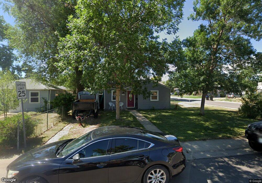
6990 Reno Dr Arvada, CO 80002
Estimated Value: $399,346 - $449,000
About This Home
This home is located at 6990 Reno Dr, Arvada, CO 80002 and is currently estimated at $424,587, approximately $590 per square foot. 6990 Reno Dr is a home located in Jefferson County with nearby schools including Secrest Elementary School, North Arvada Middle School, and Arvada High School.
Ownership History
We collect this data history from publicly available records. To have your information removed, we recommend requesting removal directly through your county’s website.
Purchase Details
Purchase Details
Purchase Details
Home Financials for this Owner
Home Financials are based on the most recent Mortgage that was taken out on this home.Purchase Details
Home Financials for this Owner
Home Financials are based on the most recent Mortgage that was taken out on this home.Purchase Details
Home Financials for this Owner
Home Financials are based on the most recent Mortgage that was taken out on this home.Purchase Details
Home Financials for this Owner
Home Financials are based on the most recent Mortgage that was taken out on this home.Purchase Details
Home Financials for this Owner
Home Financials are based on the most recent Mortgage that was taken out on this home.Purchase History
We collect this data history from publicly available records. To have your information removed, we recommend requesting removal directly through your county’s website.
| Date | Buyer | Sale Price | Title Company |
|---|---|---|---|
| -- | Land Title Guarantee Company | ||
| $301,000 | Land Title Guarantee Co | ||
| $187,200 | Chicago Title | ||
| $149,000 | Land Title Guarantee Company | ||
| $155,000 | Chicago Title Co | ||
| $129,900 | -- | ||
| $60,000 | -- |
Mortgage History
We collect this data history from publicly available records. To have your information removed, we recommend requesting removal directly through your county’s website.
| Date | Status | Borrower | Loan Amount |
|---|---|---|---|
| Previous Owner | $175,180 | ||
| Previous Owner | $141,550 | ||
| Previous Owner | $124,000 | ||
| Previous Owner | $90,900 | ||
| Previous Owner | $60,461 |
Tax History
We collect this data history from publicly available records. To have your information removed, we recommend requesting removal directly through your county’s website.
| Year | Tax Paid | Tax Assessment Tax Assessment Total Assessment is a certain percentage of the fair market value that is determined by local assessors to be the total taxable value of land and additions on the property. | Land | Improvement |
|---|---|---|---|---|
| 2025 | $2,573 | $24,948 | $12,548 | $12,400 |
| 2024 | $2,454 | $25,304 | $11,911 | $13,393 |
| 2023 | $2,454 | $25,304 | $11,911 | $13,393 |
| 2022 | $2,180 | $22,256 | $9,492 | $12,764 |
| 2021 | $2,216 | $22,896 | $9,765 | $13,131 |
| 2020 | $1,861 | $19,285 | $7,427 | $11,858 |
| 2019 | $1,836 | $19,285 | $7,427 | $11,858 |
| 2018 | $1,341 | $13,696 | $5,536 | $8,160 |
| 2017 | $1,228 | $13,696 | $5,536 | $8,160 |
| 2016 | $1,122 | $11,787 | $5,117 | $6,670 |
| 2015 | $928 | $11,787 | $5,117 | $6,670 |
| 2014 | $928 | $9,168 | $4,384 | $4,784 |
Map
- 6935 W 55th Place
- 6940 W 55th Place
- 6900 W 55th Place
- 6865 W 55th Place
- 5525 Pierce Ct
- 7357 Grandview Ave Unit 202
- 7357 Grandview Ave Unit 203
- 6930 W 54th Ave
- 6937 W 53rd Place
- 5246 Pierce St
- 6799 W 52nd Ave
- 6510 Ralston Rd
- 7303 W 59th Ave
- 7607 Ralston Rd
- 7931 W 55th Ave Unit 112
- 5409 Zephyr Ct Unit 5409
- 5392 Allison St Unit 5392
- 5419 Allison St Unit F
- 5551 Allison St
- 5975 Newland St
- 6980 Reno Dr
- 5550 Saulsbury Ct
- 6970 Reno Dr
- 5540 Saulsbury Ct
- 5575 Saulsbury Ct
- 5585 Saulsbury Ct
- 6985 Reno Dr
- 6960 Reno Dr
- 5565 Saulsbury Ct
- 6975 Reno Dr
- 5545 Reed Ct
- 6975 W 55th Place
- 6965 Reno Dr
- 5555 Saulsbury Ct
- 5595 Saulsbury Ct
- 6995 Reno Dr
- 5530 Saulsbury Ct
- 6950 Reno Dr
- 6955 Reno Dr
- 5545 Saulsbury Ct
Ask me questions while you tour the home.