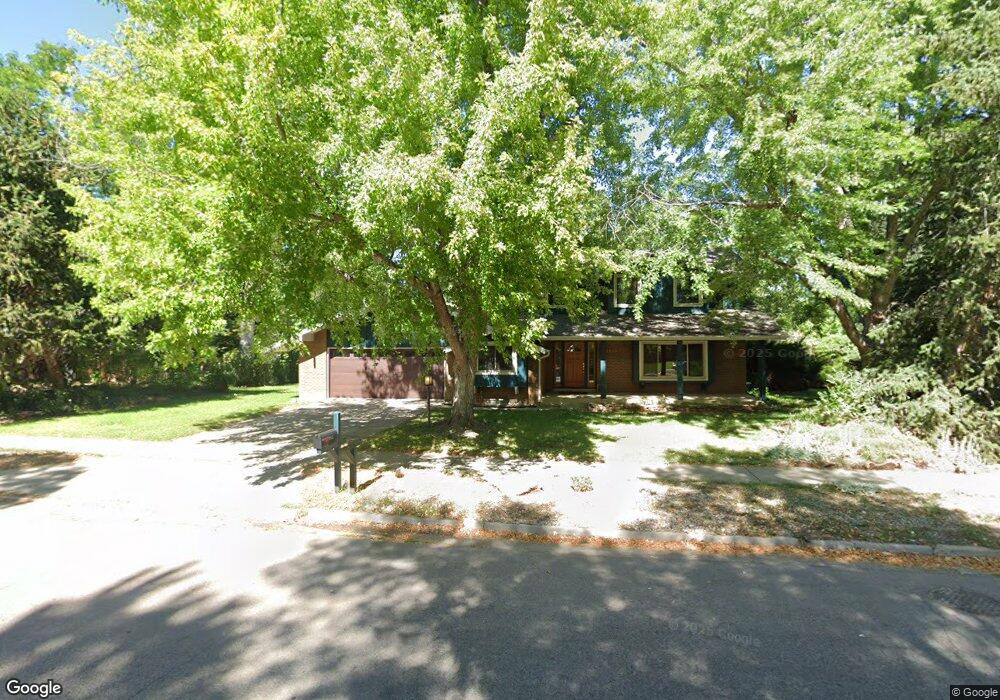
6995 Carter Trail Boulder, CO 80301
Gunbarrel NeighborhoodEstimated Value: $1,117,000 - $1,234,000
5
Beds
3
Baths
2,626
Sq Ft
$443/Sq Ft
Est. Value
About This Home
This home is located at 6995 Carter Trail, Boulder, CO 80301 and is currently estimated at $1,162,663, approximately $442 per square foot. 6995 Carter Trail is a home located in Boulder County with nearby schools including Heatherwood Elementary School, Nevin Platt Middle School, and Boulder High School.
Ownership History
Date
Name
Owned For
Owner Type
Purchase Details
Closed on
Aug 29, 2008
Sold by
Sneary James S and Sneary Anne L
Bought by
Lawrence Bryan and Lawrence Christine A
Current Estimated Value
Home Financials for this Owner
Home Financials are based on the most recent Mortgage that was taken out on this home.
Original Mortgage
$416,000
Outstanding Balance
$269,046
Interest Rate
6.29%
Mortgage Type
Purchase Money Mortgage
Estimated Equity
$893,617
Purchase Details
Closed on
Nov 10, 1981
Bought by
Lawrence Bryan and Lawrence Christine A
Purchase Details
Closed on
Jul 26, 1973
Bought by
Lawrence Bryan and Lawrence Christine A
Create a Home Valuation Report for This Property
The Home Valuation Report is an in-depth analysis detailing your home's value as well as a comparison with similar homes in the area
Home Values in the Area
Average Home Value in this Area
Purchase History
| Date | Buyer | Sale Price | Title Company |
|---|---|---|---|
| Lawrence Bryan | $520,000 | Fahtco | |
| Lawrence Bryan | $138,500 | -- | |
| Lawrence Bryan | $57,000 | -- |
Source: Public Records
Mortgage History
| Date | Status | Borrower | Loan Amount |
|---|---|---|---|
| Open | Lawrence Bryan | $416,000 |
Source: Public Records
Tax History
| Year | Tax Paid | Tax Assessment Tax Assessment Total Assessment is a certain percentage of the fair market value that is determined by local assessors to be the total taxable value of land and additions on the property. | Land | Improvement |
|---|---|---|---|---|
| 2025 | $6,395 | $68,144 | $33,881 | $34,263 |
| 2024 | $6,395 | $68,144 | $33,881 | $34,263 |
| 2023 | $6,289 | $69,164 | $38,130 | $34,719 |
| 2022 | $5,266 | $53,974 | $27,216 | $26,758 |
| 2021 | $5,022 | $55,527 | $27,999 | $27,528 |
| 2020 | $4,576 | $50,029 | $24,811 | $25,218 |
| 2019 | $4,507 | $50,029 | $24,811 | $25,218 |
| 2018 | $4,373 | $48,010 | $21,168 | $26,842 |
| 2017 | $4,243 | $53,077 | $23,402 | $29,675 |
| 2016 | $3,796 | $41,679 | $19,502 | $22,177 |
| 2015 | $3,604 | $37,778 | $19,343 | $18,435 |
| 2014 | $3,526 | $37,778 | $19,343 | $18,435 |
Source: Public Records
Map
Nearby Homes
- 4422 Pali Way
- 7186 Petursdale Ct
- 7028 Indian Peaks Trail
- 7205 Rustic Trail
- 4500 S Meadow Dr
- 4483 Sandpiper Cir
- 7312 Island Cir
- 4862 Silver Sage Ct
- 4872 Country Club Way
- 6686 Jay Rd
- 7088 Indian Peaks Trail
- 4870 Twin Lakes Rd Unit 1
- 4690 Portside Way
- 6545 Kalua Rd Unit 203D
- 4803 Briar Ridge Ct
- 4651 Portside Way
- 6495 Barnacle Ct
- 4788 Briar Ridge Trail
- 4423 Alberta Ct
- 4945 Twin Lakes Rd Unit 39
- 6988 Sweetwater Ct
- 6980 Sweetwater Ct
- 6973 Carter Trail
- 7017 Carter Trail
- 6990 Carter Trail
- 6978 Carter Trail
- 6968 Sweetwater Ct
- 6996 Sweetwater Ct
- 7029 Carter Trail
- 6951 Carter Trail
- 7022 Carter Trail
- 6966 Carter Trail
- 6954 Sweetwater Ct
- 6979 Sweetwater Ct
- 6995 Sweetwater Ct
- 7043 Carter Trail
- 6965 Sweetwater Ct
- 7038 Carter Trail
- 6954 Carter Trail
- 6957 Sweetwater Ct
Your Personal Tour Guide
Ask me questions while you tour the home.