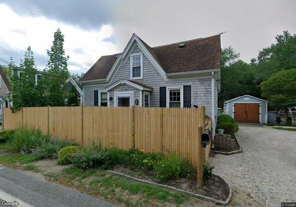
7&9 Maple St Kingston, MA 02364
Estimated Value: $519,000 - $639,000
2
Beds
3
Baths
1,500
Sq Ft
$373/Sq Ft
Est. Value
About This Home
This home is located at 7&9 Maple St, Kingston, MA 02364 and is currently estimated at $559,332, approximately $372 per square foot. 7&9 Maple St is a home located in Plymouth County with nearby schools including Kingston Elementary School, Silver Lake Regional High School, and Kingston Intermediate School.
Ownership History
Date
Name
Owned For
Owner Type
Purchase Details
Closed on
Sep 24, 2025
Sold by
Fleming Faith and Fleming Peter
Bought by
Fleming Faith
Current Estimated Value
Purchase Details
Closed on
Mar 17, 2017
Sold by
Napoli Jennifer L and Napoli Joseph S
Bought by
Fleming Faith and Fleming Peter
Home Financials for this Owner
Home Financials are based on the most recent Mortgage that was taken out on this home.
Original Mortgage
$271,900
Interest Rate
4.19%
Mortgage Type
New Conventional
Purchase Details
Closed on
Dec 14, 2011
Sold by
Ahearn Robert B
Bought by
Ware Jennifer L and Napoli Joseph S
Home Financials for this Owner
Home Financials are based on the most recent Mortgage that was taken out on this home.
Original Mortgage
$214,000
Interest Rate
4.01%
Mortgage Type
Purchase Money Mortgage
Purchase Details
Closed on
Apr 22, 2010
Sold by
Fhlmc
Bought by
Ahearn Robert B
Purchase Details
Closed on
Feb 22, 2010
Sold by
Burke Thomas Michael and Sovereign Bk
Bought by
Fhlmc
Purchase Details
Closed on
Apr 29, 2005
Sold by
Day Brenda J and Hazard Louis F
Bought by
Burke Thomas Michael
Home Financials for this Owner
Home Financials are based on the most recent Mortgage that was taken out on this home.
Original Mortgage
$213,600
Interest Rate
5.95%
Mortgage Type
Purchase Money Mortgage
Create a Home Valuation Report for This Property
The Home Valuation Report is an in-depth analysis detailing your home's value as well as a comparison with similar homes in the area
Home Values in the Area
Average Home Value in this Area
Purchase History
| Date | Buyer | Sale Price | Title Company |
|---|---|---|---|
| Fleming Faith | -- | -- | |
| Fleming Faith | $339,000 | -- | |
| Ware Jennifer L | $267,500 | -- | |
| Ware Jennifer L | $267,500 | -- | |
| Ahearn Robert B | $121,500 | -- | |
| Ahearn Robert B | $121,500 | -- | |
| Fhlmc | $215,233 | -- | |
| Fhlmc | $215,233 | -- | |
| Burke Thomas Michael | $267,000 | -- |
Source: Public Records
Mortgage History
| Date | Status | Borrower | Loan Amount |
|---|---|---|---|
| Previous Owner | Fleming Faith | $271,900 | |
| Previous Owner | Ware Jennifer L | $214,000 | |
| Previous Owner | Burke Thomas Michael | $213,600 |
Source: Public Records
Tax History
| Year | Tax Paid | Tax Assessment Tax Assessment Total Assessment is a certain percentage of the fair market value that is determined by local assessors to be the total taxable value of land and additions on the property. | Land | Improvement |
|---|---|---|---|---|
| 2025 | $5,831 | $449,600 | $190,400 | $259,200 |
| 2024 | $5,618 | $442,000 | $190,400 | $251,600 |
| 2023 | $5,455 | $408,300 | $190,400 | $217,900 |
| 2022 | $5,395 | $370,000 | $169,000 | $201,000 |
| 2021 | $5,379 | $334,500 | $169,000 | $165,500 |
| 2020 | $5,299 | $325,500 | $169,000 | $156,500 |
| 2019 | $5,288 | $313,100 | $169,000 | $144,100 |
| 2018 | $4,826 | $293,400 | $169,000 | $124,400 |
| 2017 | $4,531 | $277,600 | $158,200 | $119,400 |
| 2016 | $5,313 | $301,700 | $150,000 | $151,700 |
| 2015 | $4,225 | $249,400 | $150,000 | $99,400 |
| 2014 | $4,078 | $244,500 | $145,100 | $99,400 |
Source: Public Records
Map
Nearby Homes
- 40 Landing Rd
- 149 Summer St
- Lot 17-1 Howland's Ln
- 100 Parks St Unit 32
- 278 Main St
- 24 Tremont St
- 735 Bay Rd
- 111 Loring St
- 58 Bay Farm Rd
- 35 River St
- 1 Watermans Ln
- 4 Treetop Ln Unit 4
- 13 Atwood St
- 12 Curtis Ave
- 16 Copper Beech Dr Marion Dr
- 130 Buckboard Rd
- Lot 17-3 Howlands Ln
- 94 Main St
- 44 Seabury Point Rd
- 20 Seabury Point Rd
- 7 Maple St
- 9 Maple St
- 11 Maple St
- 11 Maple St Unit 2
- 11 Maple St Unit 1
- 3 Maple St
- 4 Maple St
- 1 Briarwood Ct
- 87 Summer St Unit 1
- 87 Summer St Unit 5
- 87 Summer St
- 91 Summer St
- 1 Bradford Rd
- 85 Summer St
- 99 Summer St
- 95 Summer St
- 95 Summer St Unit 2
- 4 Briarwood Ct
- 79 Summer St
- 79 Summer St Unit JNS realty trust
Your Personal Tour Guide
Ask me questions while you tour the home.