Estimated Value: $980,000 - $1,230,000
3
Beds
2
Baths
1,840
Sq Ft
$608/Sq Ft
Est. Value
About This Home
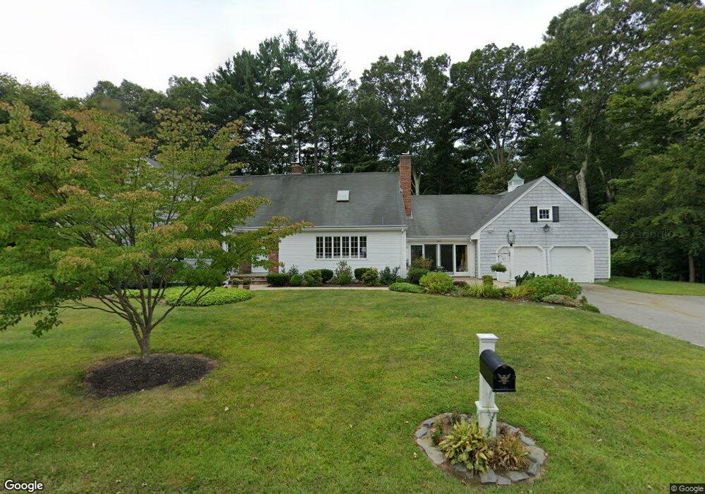
This home is located at 7 Alcott St, Acton, MA 01720 and is currently estimated at $1,119,086, approximately $608 per square foot. 7 Alcott St is a home located in Middlesex County with nearby schools including Acton-Boxborough Regional High School and Nashoba Brooks School.
Ownership History
Date
Name
Owned For
Owner Type
Purchase Details
Closed on
Apr 23, 2010
Sold by
7 Alcott St Nt and Dolan-Stefos Elizabeth
Bought by
Lister Jonathan P and Salamone-Lister Lucia
Current Estimated Value
Home Financials for this Owner
Home Financials are based on the most recent Mortgage that was taken out on this home.
Original Mortgage
$370,000
Outstanding Balance
$246,433
Interest Rate
5%
Mortgage Type
Purchase Money Mortgage
Estimated Equity
$872,653
Purchase Details
Closed on
Mar 11, 2003
Sold by
Dolan Rita Leys
Bought by
7 Alcott Street Nt
Create a Home Valuation Report for This Property
The Home Valuation Report is an in-depth analysis detailing your home's value as well as a comparison with similar homes in the area
Home Values in the Area
Average Home Value in this Area
Purchase History
| Date | Buyer | Sale Price | Title Company |
|---|---|---|---|
| Lister Jonathan P | $475,000 | -- | |
| 7 Alcott Street Nt | -- | -- |
Source: Public Records
Mortgage History
| Date | Status | Borrower | Loan Amount |
|---|---|---|---|
| Open | Lister Jonathan P | $370,000 |
Source: Public Records
Tax History
| Year | Tax Paid | Tax Assessment Tax Assessment Total Assessment is a certain percentage of the fair market value that is determined by local assessors to be the total taxable value of land and additions on the property. | Land | Improvement |
|---|---|---|---|---|
| 2025 | $18,505 | $1,079,000 | $320,400 | $758,600 |
| 2024 | $17,348 | $1,040,700 | $320,400 | $720,300 |
| 2023 | $17,758 | $1,011,300 | $291,000 | $720,300 |
| 2022 | $15,807 | $812,700 | $253,400 | $559,300 |
| 2021 | $15,278 | $755,200 | $234,200 | $521,000 |
| 2020 | $14,012 | $728,300 | $234,200 | $494,100 |
| 2019 | $13,772 | $711,000 | $234,200 | $476,800 |
| 2018 | $11,448 | $590,700 | $234,200 | $356,500 |
| 2017 | $9,793 | $513,800 | $234,200 | $279,600 |
| 2016 | $9,261 | $481,600 | $234,200 | $247,400 |
| 2015 | $9,150 | $480,300 | $234,200 | $246,100 |
| 2014 | $8,910 | $458,100 | $234,200 | $223,900 |
Source: Public Records
Map
Nearby Homes
Your Personal Tour Guide
Ask me questions while you tour the home.