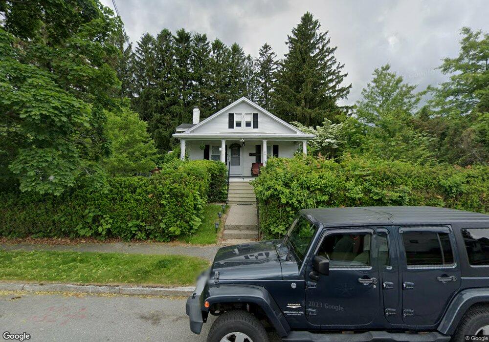
7 Brandon Rd Worcester, MA 01606
Burncoat NeighborhoodEstimated Value: $434,000 - $466,000
3
Beds
2
Baths
1,474
Sq Ft
$307/Sq Ft
Est. Value
About This Home
This home is located at 7 Brandon Rd, Worcester, MA 01606 and is currently estimated at $452,971, approximately $307 per square foot. 7 Brandon Rd is a home located in Worcester County with nearby schools including Jacob Hiatt Magnet School, Chandler Magnet, and Thorndyke Road School.
Create a Home Valuation Report for This Property
The Home Valuation Report is an in-depth analysis detailing your home's value as well as a comparison with similar homes in the area
Home Values in the Area
Average Home Value in this Area
Tax History
| Year | Tax Paid | Tax Assessment Tax Assessment Total Assessment is a certain percentage of the fair market value that is determined by local assessors to be the total taxable value of land and additions on the property. | Land | Improvement |
|---|---|---|---|---|
| 2025 | $5,360 | $406,400 | $119,000 | $287,400 |
| 2024 | $5,235 | $380,700 | $119,000 | $261,700 |
| 2023 | $5,039 | $351,400 | $103,400 | $248,000 |
| 2022 | $4,616 | $303,500 | $82,800 | $220,700 |
| 2021 | $4,567 | $280,500 | $66,200 | $214,300 |
| 2020 | $4,459 | $262,300 | $66,200 | $196,100 |
| 2019 | $4,212 | $234,000 | $59,700 | $174,300 |
| 2018 | $4,190 | $221,600 | $59,700 | $161,900 |
| 2017 | $4,042 | $210,300 | $59,700 | $150,600 |
| 2016 | $4,062 | $197,100 | $44,400 | $152,700 |
| 2015 | $3,956 | $197,100 | $44,400 | $152,700 |
| 2014 | $3,851 | $197,100 | $44,400 | $152,700 |
Source: Public Records
Map
Nearby Homes
- 66 Eunice Ave
- 55 Clark St
- 331 Burncoat St
- 323 Burncoat St
- 58 Osceola Ave
- 13 Fatima Ln
- 169 Whitmarsh Ave
- 3205 Halcyon Dr Unit 3205
- 30 Danielles Way
- 39 Whitmarsh Ave
- 12 Erie Ave
- 15 Ericsson St
- 53 Collins St
- 45 Goldthwaite Rd
- 22 Huron Ave
- 30 Melrose St
- 44 Boardman St
- 41 Mohave Rd
- 37 Mohave Rd
- 31 Boardman St
Your Personal Tour Guide
Ask me questions while you tour the home.