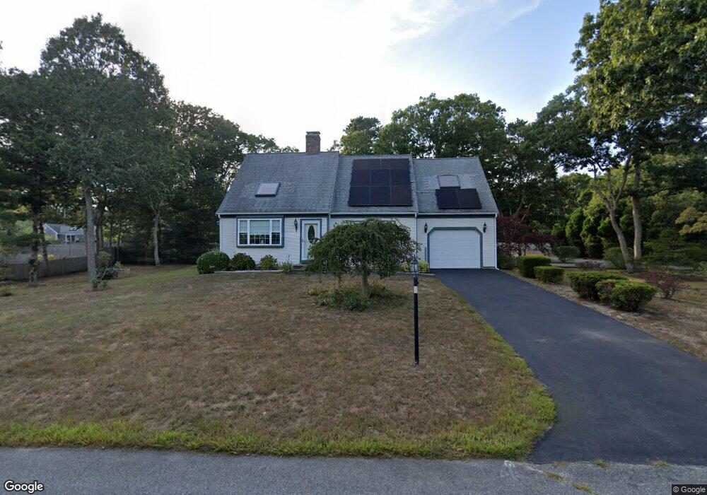
7 Brant Way Hyannis, MA 02601
Estimated Value: $662,134 - $719,000
3
Beds
2
Baths
1,801
Sq Ft
$380/Sq Ft
Est. Value
About This Home
This home is located at 7 Brant Way, Hyannis, MA 02601 and is currently estimated at $684,534, approximately $380 per square foot. 7 Brant Way is a home located in Barnstable County with nearby schools including Barnstable United Elementary School, West Barnstable Elementary School, and Barnstable Intermediate School.
Ownership History
Date
Name
Owned For
Owner Type
Purchase Details
Closed on
Mar 20, 2024
Sold by
Odonnell James H
Bought by
James H Odonnell Lt and Odonnell
Current Estimated Value
Purchase Details
Closed on
Mar 21, 1997
Sold by
Carven Marianne
Bought by
Odonnell James H
Home Financials for this Owner
Home Financials are based on the most recent Mortgage that was taken out on this home.
Original Mortgage
$108,000
Interest Rate
7.68%
Mortgage Type
Purchase Money Mortgage
Create a Home Valuation Report for This Property
The Home Valuation Report is an in-depth analysis detailing your home's value as well as a comparison with similar homes in the area
Home Values in the Area
Average Home Value in this Area
Purchase History
| Date | Buyer | Sale Price | Title Company |
|---|---|---|---|
| James H Odonnell Lt | -- | None Available | |
| James H Odonnell Lt | -- | None Available | |
| Odonnell James H | -- | None Available | |
| Odonnell James H | $120,000 | -- | |
| Odonnell James H | $120,000 | -- |
Source: Public Records
Mortgage History
| Date | Status | Borrower | Loan Amount |
|---|---|---|---|
| Previous Owner | Odonnell James H | $103,000 | |
| Previous Owner | Odonnell James H | $108,000 |
Source: Public Records
Tax History Compared to Growth
Tax History
| Year | Tax Paid | Tax Assessment Tax Assessment Total Assessment is a certain percentage of the fair market value that is determined by local assessors to be the total taxable value of land and additions on the property. | Land | Improvement |
|---|---|---|---|---|
| 2025 | $5,485 | $591,700 | $151,900 | $439,800 |
| 2024 | $5,097 | $563,200 | $151,900 | $411,300 |
| 2023 | $4,854 | $507,200 | $138,100 | $369,100 |
| 2022 | $4,769 | $412,200 | $102,300 | $309,900 |
| 2021 | $4,403 | $369,700 | $102,300 | $267,400 |
| 2020 | $4,466 | $362,200 | $102,300 | $259,900 |
| 2019 | $4,224 | $335,800 | $102,300 | $233,500 |
| 2018 | $3,670 | $298,400 | $107,700 | $190,700 |
| 2017 | $3,471 | $289,500 | $107,700 | $181,800 |
| 2016 | $3,405 | $290,300 | $108,500 | $181,800 |
| 2015 | $3,267 | $282,400 | $105,100 | $177,300 |
Source: Public Records
Map
Nearby Homes
- 15 Square Rigger Ln
- 78 Brant Way
- 25 Daybreak Ln
- 2 Longview Dr
- 270 Old Strawberry Hill Rd
- 386 Bishops Terrace
- 43 Statice Ln
- 21 Brian Ln
- 82 Nobadeer Rd
- 140 Wequaquet Ln
- 296 Lincoln Rd
- 720 Pitchers Way Unit 52
- 86 Arrowhead Dr
- 800 Bearse's Unit 1WD
- 29 Windshore Dr
- 800 Bearses Way Unit 2SB
- 800 Bearses Way Unit 2SF
- 800 Bearses Way Unit 1WD
- 800 Bearses Way Unit 1
- 800 Bearses Way Unit 1NE
- 10 Brant Way
- 450 Old Strawberry Hill Rd
- 21 Brant Way
- 39 Anthony Dr
- 3 Shearwater Way
- 5 Shearwater Way
- 1 Shearwater Way
- 40 Anthony Dr
- 24 Brant Way
- 436 Old Strawberry Hill Rd
- 471 Old Strawberry Hill Rd
- 37 Anthony Dr
- 438 Old Strawberry Hill Rd
- 35 Brant Way
- 424 Old Strawberry Hill Rd
- 39 Shearwater Way
- 36 Anthony Dr
- 38 Brant Way
- 42 Bishops Terrace
- 26 Bishops Terrace