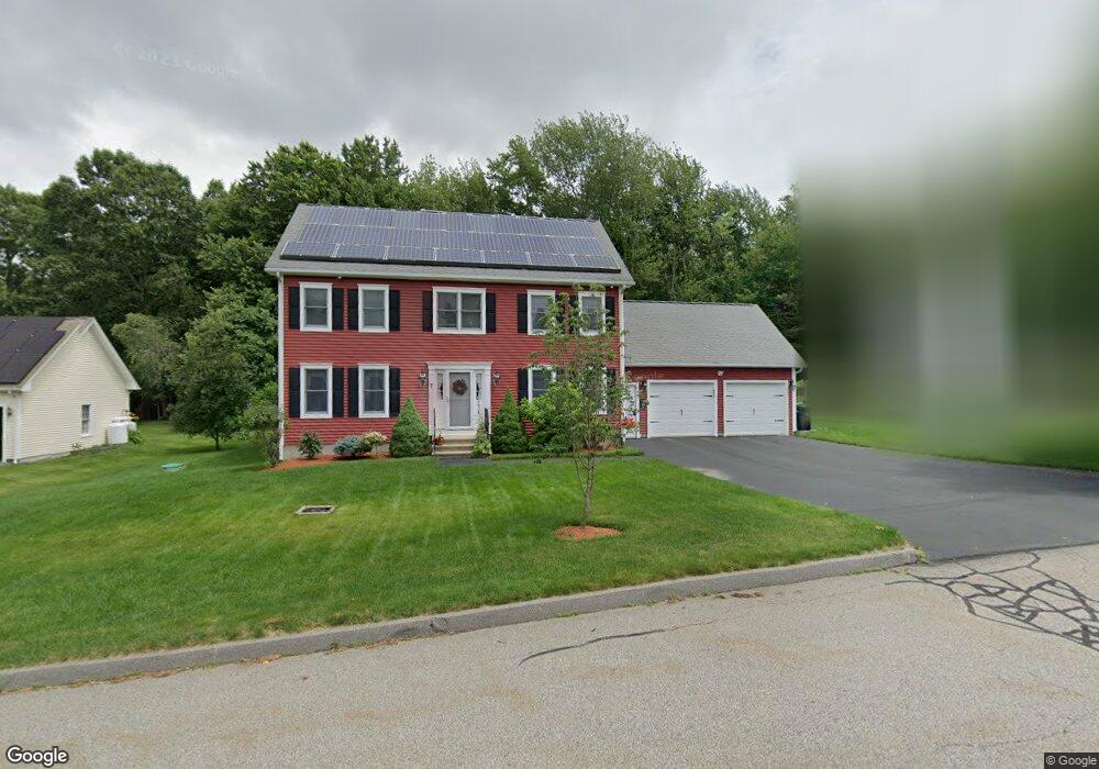
7 Bridle Path Auburn, MA 01501
West Auburn NeighborhoodEstimated Value: $564,000 - $757,000
4
Beds
3
Baths
1,990
Sq Ft
$321/Sq Ft
Est. Value
About This Home
This home is located at 7 Bridle Path, Auburn, MA 01501 and is currently estimated at $639,476, approximately $321 per square foot. 7 Bridle Path is a home located in Worcester County with nearby schools including Auburn Senior High School and Shrewsbury Montessori School - Auburn Campus.
Ownership History
Date
Name
Owned For
Owner Type
Purchase Details
Closed on
Dec 27, 2011
Sold by
Daniel Pamela J
Bought by
Daniel Stephen E and Daniel Pamela J
Current Estimated Value
Purchase Details
Closed on
Apr 25, 2006
Sold by
Emerson Homes Inc
Bought by
Daniel Pamela J
Home Financials for this Owner
Home Financials are based on the most recent Mortgage that was taken out on this home.
Original Mortgage
$115,000
Interest Rate
6.37%
Mortgage Type
Purchase Money Mortgage
Purchase Details
Closed on
Sep 30, 2005
Sold by
Emerson Homes Inc
Bought by
Daniel Pamela J
Home Financials for this Owner
Home Financials are based on the most recent Mortgage that was taken out on this home.
Original Mortgage
$115,000
Interest Rate
5.84%
Mortgage Type
Purchase Money Mortgage
Create a Home Valuation Report for This Property
The Home Valuation Report is an in-depth analysis detailing your home's value as well as a comparison with similar homes in the area
Home Values in the Area
Average Home Value in this Area
Purchase History
| Date | Buyer | Sale Price | Title Company |
|---|---|---|---|
| Daniel Stephen E | -- | -- | |
| Daniel Pamela J | -- | -- | |
| Emerson Homes Inc | -- | -- | |
| Daniel Pamela J | $325,000 | -- | |
| Emerson Homes Inc | $100,000 | -- |
Source: Public Records
Mortgage History
| Date | Status | Borrower | Loan Amount |
|---|---|---|---|
| Previous Owner | Emerson Homes Inc | $115,000 | |
| Previous Owner | Daniel Pamela J | $115,000 |
Source: Public Records
Tax History
| Year | Tax Paid | Tax Assessment Tax Assessment Total Assessment is a certain percentage of the fair market value that is determined by local assessors to be the total taxable value of land and additions on the property. | Land | Improvement |
|---|---|---|---|---|
| 2025 | $85 | $597,600 | $180,600 | $417,000 |
| 2024 | $8,634 | $578,300 | $173,900 | $404,400 |
| 2023 | $8,073 | $508,400 | $147,600 | $360,800 |
| 2022 | $7,495 | $445,600 | $147,600 | $298,000 |
| 2021 | $7,055 | $388,900 | $121,100 | $267,800 |
| 2020 | $6,982 | $388,300 | $121,100 | $267,200 |
| 2019 | $6,942 | $376,900 | $119,900 | $257,000 |
| 2018 | $6,756 | $366,400 | $112,100 | $254,300 |
| 2017 | $6,525 | $355,800 | $101,500 | $254,300 |
| 2016 | $6,391 | $353,300 | $104,700 | $248,600 |
| 2015 | $5,970 | $345,900 | $104,700 | $241,200 |
| 2014 | $5,784 | $334,500 | $99,600 | $234,900 |
Source: Public Records
Map
Nearby Homes
- 104 Appleton Rd
- 4 Athens St
- 0 Athens St
- 808 Washington St
- 49 Prospect St
- 19 Thayer Pond Dr Unit 3
- 17 Thayer Pond Dr Unit 2
- 24 Thayer Pond Dr Unit 17
- 4 Thayer Pond Dr Unit 20
- 6 Thayer Pond Dr Unit 11
- 34 Thayer Pond Dr Unit 8
- 155 Southbridge Rd
- 35 Waterman Rd
- 634 Oxford St S
- 31-37 Leicester St
- 45 Leicester St
- 6 Laurelwood Dr
- 9 B Wellington Rd
- 751 Washington St Unit 43A
- 1 Shady Ln
Your Personal Tour Guide
Ask me questions while you tour the home.