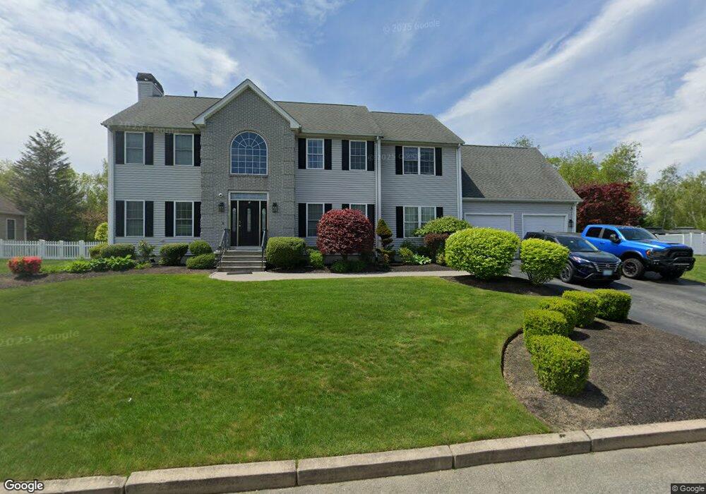
7 Cassandra Ct Cranston, RI 02921
Comstock Gardens NeighborhoodEstimated Value: $943,000 - $1,073,000
4
Beds
3
Baths
3,256
Sq Ft
$309/Sq Ft
Est. Value
About This Home
This home is located at 7 Cassandra Ct, Cranston, RI 02921 and is currently estimated at $1,005,896, approximately $308 per square foot. 7 Cassandra Ct is a home located in Providence County with nearby schools including Orchard Farms El. School, Western Hills Middle School, and Cranston High School West.
Ownership History
Date
Name
Owned For
Owner Type
Purchase Details
Closed on
Jul 21, 2024
Sold by
Delbonis Daniel S
Bought by
Daniel S Delbonis Ret and Delbonis
Current Estimated Value
Purchase Details
Closed on
Sep 5, 2003
Sold by
Marchetti Quality Hom
Bought by
Delbonis Daniel and Delbonis Gloria
Home Financials for this Owner
Home Financials are based on the most recent Mortgage that was taken out on this home.
Original Mortgage
$352,000
Interest Rate
6.02%
Create a Home Valuation Report for This Property
The Home Valuation Report is an in-depth analysis detailing your home's value as well as a comparison with similar homes in the area
Home Values in the Area
Average Home Value in this Area
Purchase History
| Date | Buyer | Sale Price | Title Company |
|---|---|---|---|
| Daniel S Delbonis Ret | -- | None Available | |
| Daniel S Delbonis Ret | -- | None Available | |
| Daniel S Delbonis Ret | -- | None Available | |
| Delbonis Daniel | $100,000 | -- | |
| Delbonis Daniel | $100,000 | -- |
Source: Public Records
Mortgage History
| Date | Status | Borrower | Loan Amount |
|---|---|---|---|
| Previous Owner | Delbonis Daniel | $352,000 |
Source: Public Records
Tax History Compared to Growth
Tax History
| Year | Tax Paid | Tax Assessment Tax Assessment Total Assessment is a certain percentage of the fair market value that is determined by local assessors to be the total taxable value of land and additions on the property. | Land | Improvement |
|---|---|---|---|---|
| 2025 | $11,698 | $842,800 | $173,400 | $669,400 |
| 2024 | $11,471 | $842,800 | $173,400 | $669,400 |
| 2023 | $11,325 | $599,200 | $123,800 | $475,400 |
| 2022 | $11,091 | $599,200 | $123,800 | $475,400 |
| 2021 | $10,786 | $599,200 | $123,800 | $475,400 |
| 2020 | $10,483 | $504,700 | $145,100 | $359,600 |
| 2019 | $10,483 | $504,700 | $145,100 | $359,600 |
| 2018 | $8,419 | $504,700 | $145,100 | $359,600 |
| 2017 | $11,156 | $486,300 | $153,700 | $332,600 |
| 2016 | $10,917 | $486,300 | $153,700 | $332,600 |
| 2015 | $10,917 | $486,300 | $153,700 | $332,600 |
| 2014 | $9,883 | $432,700 | $128,100 | $304,600 |
Source: Public Records
Map
Nearby Homes
- 0 W Bluebird Ln
- 5 Braeburn Cir
- 191 Pippin Orchard Rd
- 11 Raven Cir
- 130 Alpine Estates Dr
- 2073 Plainfield Pike
- 7 Taylor Rd
- 0 Peck Hill Rd
- 79 Taylor Rd
- 9 Gray Coach E
- 02 Paula Ln
- 01 Paula Ln
- 4 Byron Randall Rd
- 2202 Scituate Ave
- 12 Beechwood Dr
- 121 Ashbrook Dr
- 53 Charcalee Dr
- 136 White Birch Cir
- 129 Valerie Ct
- 560 Seven Mile Rd
- 17 Cassandra Ct
- 306 Alpine Estates Dr
- 1 Cassandra Ct
- 10 Cassandra Ct
- 314 Alpine Estates Dr
- 2 Cassandra Ct
- 16 Cassandra Ct
- 0 Cassandra Ct
- 21 Cassandra Ct
- 320 Alpine Estates Dr
- 20 Cassandra Ct
- 293 Alpine Estates Dr
- 279 Alpine Estates Dr
- 291 Alpine Estates Dr
- 7 Bluebird Ln
- 275 Alpine Estates Dr
- 290 Alpine Estates Dr
- 173 W Bluebird Ln
- 171 W Bluebird Ln
- 174 W Bluebird Ln