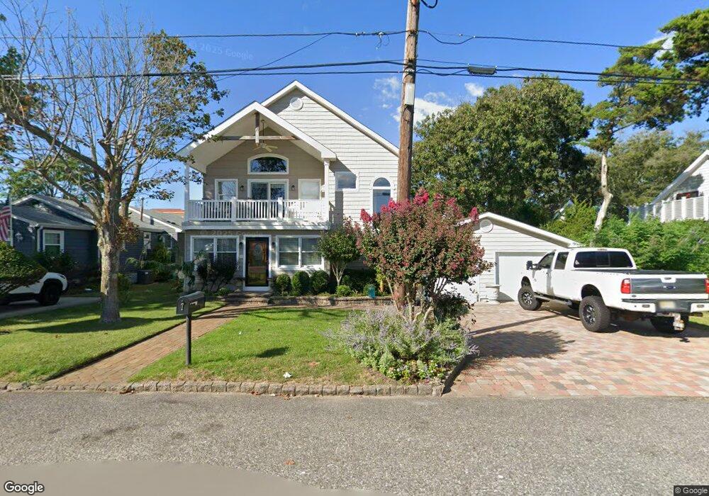
7 Cliffside Rd Cape May, NJ 08204
Estimated Value: $760,093 - $971,000
--
Bed
--
Bath
1,860
Sq Ft
$463/Sq Ft
Est. Value
About This Home
This home is located at 7 Cliffside Rd, Cape May, NJ 08204 and is currently estimated at $861,273, approximately $463 per square foot. 7 Cliffside Rd is a home located in Cape May County with nearby schools including Carl T. Mitnick School, David C. Douglass Veterans Memorial School, and Maud Abrams School.
Ownership History
Date
Name
Owned For
Owner Type
Purchase Details
Closed on
Jun 27, 1996
Sold by
Est Ernest Obst
Bought by
Tester Scott and Ianiro Joanne
Current Estimated Value
Home Financials for this Owner
Home Financials are based on the most recent Mortgage that was taken out on this home.
Original Mortgage
$80,000
Outstanding Balance
$5,686
Interest Rate
8.05%
Estimated Equity
$855,587
Create a Home Valuation Report for This Property
The Home Valuation Report is an in-depth analysis detailing your home's value as well as a comparison with similar homes in the area
Home Values in the Area
Average Home Value in this Area
Purchase History
| Date | Buyer | Sale Price | Title Company |
|---|---|---|---|
| Tester Scott | $80,000 | -- |
Source: Public Records
Mortgage History
| Date | Status | Borrower | Loan Amount |
|---|---|---|---|
| Open | Tester Scott | $80,000 |
Source: Public Records
Tax History Compared to Growth
Tax History
| Year | Tax Paid | Tax Assessment Tax Assessment Total Assessment is a certain percentage of the fair market value that is determined by local assessors to be the total taxable value of land and additions on the property. | Land | Improvement |
|---|---|---|---|---|
| 2025 | $6,481 | $319,600 | $160,000 | $159,600 |
| 2024 | $6,481 | $319,600 | $160,000 | $159,600 |
| 2023 | $6,389 | $319,600 | $160,000 | $159,600 |
| 2022 | $6,194 | $319,600 | $160,000 | $159,600 |
| 2021 | $6,008 | $319,600 | $160,000 | $159,600 |
| 2020 | $5,913 | $319,600 | $160,000 | $159,600 |
| 2019 | $5,766 | $319,600 | $160,000 | $159,600 |
| 2018 | $5,628 | $319,600 | $160,000 | $159,600 |
| 2017 | $5,635 | $319,600 | $160,000 | $159,600 |
| 2016 | $5,548 | $319,600 | $160,000 | $159,600 |
| 2015 | $5,369 | $319,600 | $160,000 | $159,600 |
| 2014 | $5,194 | $319,600 | $160,000 | $159,600 |
Source: Public Records
Map
Nearby Homes
- 10 Folsom Ave
- 106 Racetrack Dr
- 111A Racetrack Dr
- 1607 Scott Ave
- 1310 Browning Ave
- 604 Lawnside Rd
- 2 Fernwood Rd
- 101 Avalon Rd
- 66 Beachhurst Dr
- 103 Fernwood Rd
- 18 Pinewood Rd
- 401 Beach Dr
- 113 Beachhurst Dr
- 503 Beach Dr
- 319 Roseann Ave
- 702 Gordon Terrace
- 508 Adriatic Ave
- 1500 Franklin Ave
- 236 Roseann Ave
- 1400 Franklin Ave
- 5 Cliffside Rd
- 9 Cliffside Rd
- 6 Beverly Rd
- 8 Beverly Rd
- 12 Cliffside Rd
- 14 Cliffside Rd
- 4 Beverly Rd
- 11 Cliffside Rd
- 3 Cliffside Rd
- 8 Cliffside Rd
- 16 Cliffside Rd
- 6 Cliffside Rd
- 2 Beverly Rd
- 13 Cliffside Rd
- 12 Beverly Rd
- 4 Cliffside Rd
- 9 Beverly Rd
- 109 Town Bank Rd Unit 111
- 107 Town Bank Rd
- 7 Beverly Rd