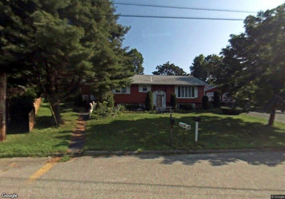
7 Colony Rd Westbrook, ME 04092
Estimated Value: $455,000 - $677,000
3
Beds
2
Baths
1,248
Sq Ft
$433/Sq Ft
Est. Value
About This Home
This home is located at 7 Colony Rd, Westbrook, ME 04092 and is currently estimated at $540,533, approximately $433 per square foot. 7 Colony Rd is a home located in Cumberland County with nearby schools including Westbrook High School, St. Brigid School, and Breakwater School.
Ownership History
Date
Name
Owned For
Owner Type
Purchase Details
Closed on
Oct 30, 2006
Sold by
Poulin Jutta I
Bought by
Guibincan Karen C and Barnes Jason
Current Estimated Value
Home Financials for this Owner
Home Financials are based on the most recent Mortgage that was taken out on this home.
Original Mortgage
$33,000
Outstanding Balance
$19,815
Interest Rate
6.48%
Mortgage Type
Purchase Money Mortgage
Estimated Equity
$520,718
Create a Home Valuation Report for This Property
The Home Valuation Report is an in-depth analysis detailing your home's value as well as a comparison with similar homes in the area
Home Values in the Area
Average Home Value in this Area
Purchase History
| Date | Buyer | Sale Price | Title Company |
|---|---|---|---|
| Guibincan Karen C | -- | -- |
Source: Public Records
Mortgage History
| Date | Status | Borrower | Loan Amount |
|---|---|---|---|
| Open | Guibincan Karen C | $33,000 | |
| Closed | Guibincan Karen C | $33,000 |
Source: Public Records
Tax History Compared to Growth
Tax History
| Year | Tax Paid | Tax Assessment Tax Assessment Total Assessment is a certain percentage of the fair market value that is determined by local assessors to be the total taxable value of land and additions on the property. | Land | Improvement |
|---|---|---|---|---|
| 2023 | $4,592 | $275,300 | $87,200 | $188,100 |
| 2022 | $4,163 | $230,000 | $72,700 | $157,300 |
| 2021 | $4,101 | $230,000 | $72,700 | $157,300 |
| 2020 | $4,108 | $230,000 | $72,700 | $157,300 |
| 2019 | $4,108 | $230,000 | $72,700 | $157,300 |
| 2018 | $3,370 | $193,600 | $63,200 | $130,400 |
| 2017 | $3,655 | $193,600 | $63,200 | $130,400 |
| 2016 | $3,562 | $193,600 | $63,200 | $130,400 |
| 2015 | $3,477 | $193,600 | $63,200 | $130,400 |
| 2014 | $3,330 | $193,600 | $63,200 | $130,400 |
| 2013 | $3,330 | $193,600 | $63,200 | $130,400 |
Source: Public Records
Map
Nearby Homes
- 10 Kasseys Way Unit 1
- 57 Marlu St
- 5 Crestwood Dr
- 84 Hillside Rd
- 22 Collins Place Dr Unit 4
- 72 Pride St
- 0 Reed St
- 7 Collins Place Unit 6
- 7 Apex Dr Unit 2
- 5 Apex Dr Unit 1
- 290 Bridgton Rd Unit 1
- Lot TBD Epping St
- 106 Euclid Ave
- 41 Villa Rd
- 95 Lane Ave
- 13 Waterhouse Ct
- 17 Graham Rd Unit 3
- 24 Celebration Ct Unit 13
- 375 Bridgton Rd Unit 43
- 3 Collins Place Unit 5