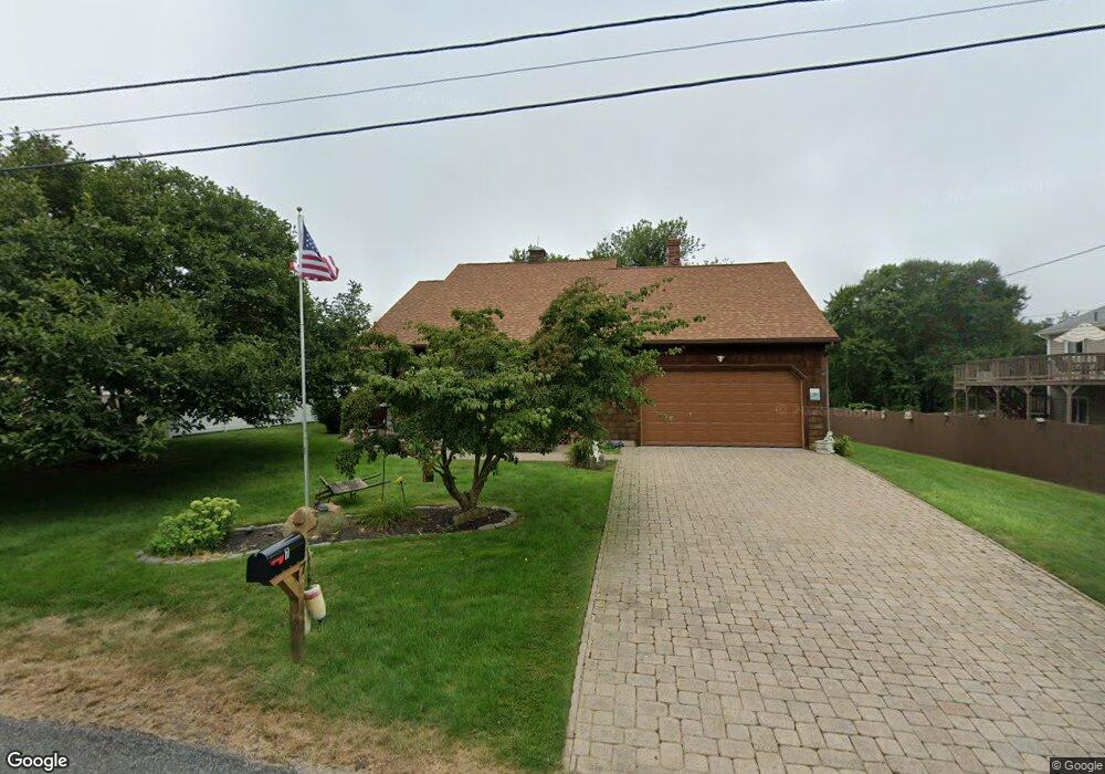
7 Crest Dr Narragansett, RI 02882
Estimated Value: $834,000 - $1,004,000
3
Beds
3
Baths
1,240
Sq Ft
$733/Sq Ft
Est. Value
About This Home
This home is located at 7 Crest Dr, Narragansett, RI 02882 and is currently estimated at $908,604, approximately $732 per square foot. 7 Crest Dr is a home located in Washington County with nearby schools including Narragansett Elementary School, Narragansett Pier Middle School, and Narragansett High School.
Create a Home Valuation Report for This Property
The Home Valuation Report is an in-depth analysis detailing your home's value as well as a comparison with similar homes in the area
Home Values in the Area
Average Home Value in this Area
Tax History Compared to Growth
Tax History
| Year | Tax Paid | Tax Assessment Tax Assessment Total Assessment is a certain percentage of the fair market value that is determined by local assessors to be the total taxable value of land and additions on the property. | Land | Improvement |
|---|---|---|---|---|
| 2025 | $4,610 | $678,900 | $291,400 | $387,500 |
| 2024 | $4,447 | $678,900 | $291,400 | $387,500 |
| 2023 | $4,116 | $442,100 | $188,000 | $254,100 |
| 2022 | $3,979 | $442,100 | $188,000 | $254,100 |
| 2021 | $3,917 | $442,100 | $188,000 | $254,100 |
| 2020 | $4,282 | $408,600 | $160,900 | $247,700 |
| 2019 | $4,180 | $408,600 | $160,900 | $247,700 |
| 2018 | $4,066 | $408,600 | $160,900 | $247,700 |
| 2017 | $3,596 | $340,500 | $149,100 | $191,400 |
| 2016 | $3,432 | $340,500 | $149,100 | $191,400 |
| 2015 | $3,385 | $340,500 | $149,100 | $191,400 |
| 2014 | $3,419 | $340,500 | $149,100 | $191,400 |
Source: Public Records
Map
Nearby Homes
- 0 Houston Ave
- 0 Point Judith Rd
- 110 Houston Ave
- 124 Houston Ave
- 0 Hemlock Ave
- 31 E Pond Rd
- 1125 Point Judith Rd Unit B6
- 8 Pocono Rd
- 89 Sand Hill Cove Rd
- 1044 Ocean Rd
- 1046 Ocean Rd
- 45 Durkin Dr
- 17 Goose Island Rd
- 8 Knowlesway
- 25 Scallop Shell Rd
- 100 Chestnut Ave
- 129 Sand Hill Cove Rd
- 20 Marine Dr
- 64 Burnside Ave
- 271 Great Island Rd