Estimated Value: $1,227,164 - $1,813,000
3
Beds
3
Baths
2,919
Sq Ft
$474/Sq Ft
Est. Value
About This Home
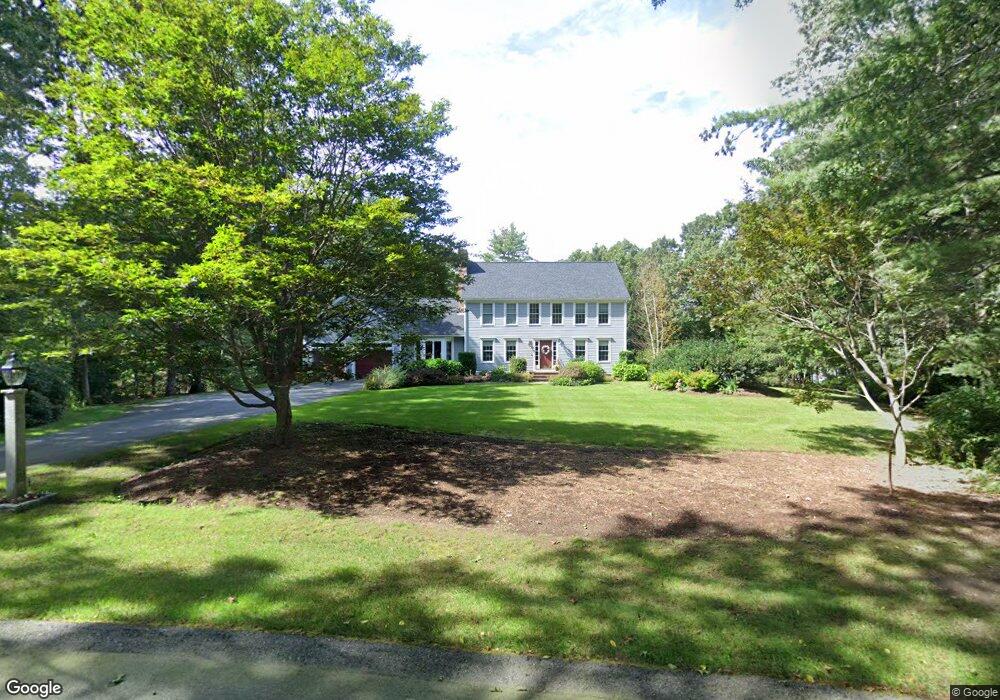
This home is located at 7 Crest Dr W, Dover, MA 02030 and is currently estimated at $1,384,291, approximately $474 per square foot. 7 Crest Dr W is a home located in Norfolk County with nearby schools including Chickering Elementary School, Dover-Sherborn Regional Middle School, and Dover-Sherborn Regional High School.
Ownership History
Date
Name
Owned For
Owner Type
Purchase Details
Closed on
Nov 17, 1993
Sold by
Brook Run Dev Corp
Bought by
Guyer Deborah J and Guyer Eric C
Current Estimated Value
Home Financials for this Owner
Home Financials are based on the most recent Mortgage that was taken out on this home.
Original Mortgage
$80,000
Interest Rate
6.77%
Mortgage Type
Purchase Money Mortgage
Create a Home Valuation Report for This Property
The Home Valuation Report is an in-depth analysis detailing your home's value as well as a comparison with similar homes in the area
Home Values in the Area
Average Home Value in this Area
Purchase History
| Date | Buyer | Sale Price | Title Company |
|---|---|---|---|
| Guyer Deborah J | $425,000 | -- |
Source: Public Records
Mortgage History
| Date | Status | Borrower | Loan Amount |
|---|---|---|---|
| Closed | Guyer Deborah J | $80,000 |
Source: Public Records
Tax History
| Year | Tax Paid | Tax Assessment Tax Assessment Total Assessment is a certain percentage of the fair market value that is determined by local assessors to be the total taxable value of land and additions on the property. | Land | Improvement |
|---|---|---|---|---|
| 2025 | $13,114 | $1,163,600 | $615,100 | $548,500 |
| 2024 | $12,452 | $1,136,100 | $615,100 | $521,000 |
| 2023 | $12,230 | $1,003,300 | $537,300 | $466,000 |
| 2022 | $11,233 | $904,400 | $493,800 | $410,600 |
| 2021 | $11,467 | $889,600 | $493,800 | $395,800 |
| 2020 | $11,422 | $889,600 | $493,800 | $395,800 |
| 2019 | $11,503 | $889,600 | $493,800 | $395,800 |
| 2018 | $10,662 | $830,400 | $450,200 | $380,200 |
| 2017 | $10,985 | $841,800 | $450,200 | $391,600 |
| 2016 | $10,562 | $820,000 | $428,400 | $391,600 |
| 2015 | $10,414 | $820,000 | $428,400 | $391,600 |
Source: Public Records
Map
Nearby Homes
Your Personal Tour Guide
Ask me questions while you tour the home.