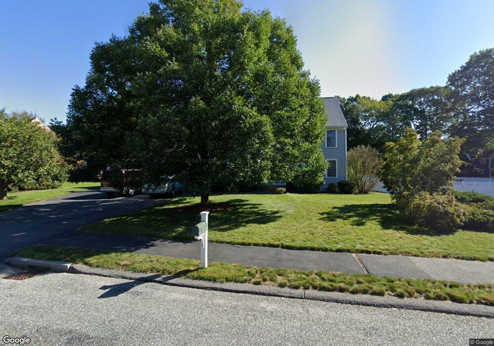
7 Crestview Ave Medway, MA 02053
Estimated Value: $801,841 - $1,003,000
4
Beds
3
Baths
2,715
Sq Ft
$339/Sq Ft
Est. Value
About This Home
This home is located at 7 Crestview Ave, Medway, MA 02053 and is currently estimated at $920,210, approximately $338 per square foot. 7 Crestview Ave is a home located in Norfolk County with nearby schools including John D. McGovern Elementary School, Burke-Memorial Elementary, and Medway Middle School.
Ownership History
Date
Name
Owned For
Owner Type
Purchase Details
Closed on
May 31, 2001
Sold by
Teig David C and Teig Christine D
Bought by
Reynolds Mark M and Reynolds Christina L
Current Estimated Value
Purchase Details
Closed on
Jun 23, 2000
Sold by
Cervera James J and Cervera Alejandra P
Bought by
Teig David C and Teig Christine D
Purchase Details
Closed on
Aug 18, 1998
Sold by
Susi Thomas F
Bought by
Cervera James J and Cervera Alejandra P
Purchase Details
Closed on
Dec 30, 1996
Sold by
Espinosa Andrew A and Espinosa Charla J
Bought by
Susi Thomas F
Purchase Details
Closed on
Jul 29, 1994
Sold by
Hartman Mark A and Hartman Krysten J
Bought by
Espinosa Andrew A and Espinosa Charla J
Purchase Details
Closed on
Dec 6, 1990
Sold by
Larkin John H
Bought by
Hartman Mark A
Create a Home Valuation Report for This Property
The Home Valuation Report is an in-depth analysis detailing your home's value as well as a comparison with similar homes in the area
Home Values in the Area
Average Home Value in this Area
Purchase History
| Date | Buyer | Sale Price | Title Company |
|---|---|---|---|
| Reynolds Mark M | $391,000 | -- | |
| Teig David C | $358,000 | -- | |
| Cervera James J | $305,000 | -- | |
| Susi Thomas F | $257,500 | -- | |
| Espinosa Andrew A | $252,500 | -- | |
| Hartman Mark A | $235,000 | -- |
Source: Public Records
Mortgage History
| Date | Status | Borrower | Loan Amount |
|---|---|---|---|
| Open | Hartman Mark A | $216,000 | |
| Closed | Hartman Mark A | $273,000 |
Source: Public Records
Tax History
| Year | Tax Paid | Tax Assessment Tax Assessment Total Assessment is a certain percentage of the fair market value that is determined by local assessors to be the total taxable value of land and additions on the property. | Land | Improvement |
|---|---|---|---|---|
| 2025 | $10,139 | $711,500 | $323,500 | $388,000 |
| 2024 | $10,246 | $711,500 | $323,500 | $388,000 |
| 2023 | $10,144 | $636,400 | $294,400 | $342,000 |
| 2022 | $9,330 | $551,100 | $217,700 | $333,400 |
| 2021 | $9,364 | $536,300 | $203,200 | $333,100 |
| 2020 | $9,335 | $533,400 | $203,200 | $330,200 |
| 2019 | $8,524 | $502,300 | $194,900 | $307,400 |
| 2018 | $8,590 | $486,400 | $186,600 | $299,800 |
| 2017 | $8,505 | $474,600 | $182,500 | $292,100 |
| 2016 | $8,148 | $449,900 | $168,000 | $281,900 |
| 2015 | $8,078 | $442,900 | $165,900 | $277,000 |
| 2014 | $7,817 | $414,900 | $165,900 | $249,000 |
Source: Public Records
Map
Nearby Homes
- 58 Holliston St
- 5 Richardson St
- 19 Evergreen St Unit A
- 20 Broad St Unit 1
- 20 Broad St Unit 6
- 20 Broad St Unit A
- 20 Broad St Unit 4
- 8 Winthrop St
- 50 Main St
- 10 Barber St
- 14 Sanford St Unit 47
- 33 Gorwin Dr
- 10 Franklin St
- 839 Lincoln St
- 1391 Pond St
- 79 Lovering St Unit B
- 8 Woodhaven Dr
- 33 Elm St
- 29 Elm St
- 6 Freedom Trail
Your Personal Tour Guide
Ask me questions while you tour the home.