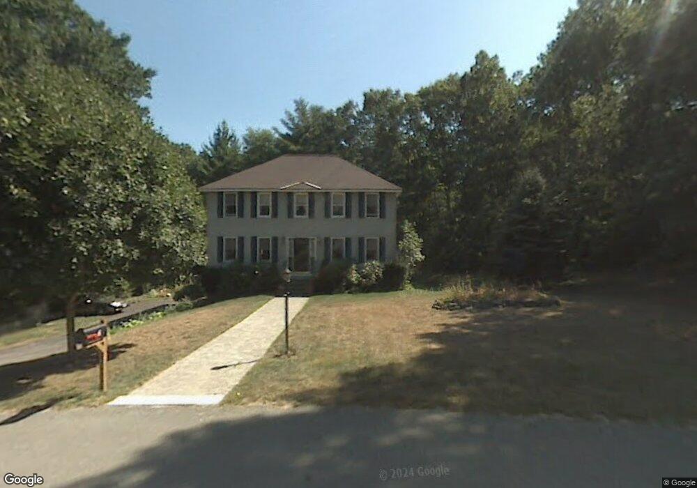
7 Crossman Cir Newton, NH 03858
Estimated Value: $625,281 - $673,000
3
Beds
2
Baths
2,281
Sq Ft
$283/Sq Ft
Est. Value
About This Home
This home is located at 7 Crossman Cir, Newton, NH 03858 and is currently estimated at $644,820, approximately $282 per square foot. 7 Crossman Cir is a home located in Rockingham County with nearby schools including Memorial School, Sanborn Regional Middle School, and Sanborn Regional High School.
Ownership History
Date
Name
Owned For
Owner Type
Purchase Details
Closed on
Sep 3, 2002
Sold by
Barnes Jerry D and Barnes Mary D
Bought by
Orourke Brian J and Orourke Christine
Current Estimated Value
Home Financials for this Owner
Home Financials are based on the most recent Mortgage that was taken out on this home.
Original Mortgage
$140,000
Interest Rate
6.55%
Create a Home Valuation Report for This Property
The Home Valuation Report is an in-depth analysis detailing your home's value as well as a comparison with similar homes in the area
Home Values in the Area
Average Home Value in this Area
Purchase History
| Date | Buyer | Sale Price | Title Company |
|---|---|---|---|
| Orourke Brian J | $280,000 | -- |
Source: Public Records
Mortgage History
| Date | Status | Borrower | Loan Amount |
|---|---|---|---|
| Open | Orourke Brian J | $148,000 | |
| Closed | Orourke Brian J | $150,000 | |
| Closed | Orourke Brian J | $140,000 |
Source: Public Records
Tax History Compared to Growth
Tax History
| Year | Tax Paid | Tax Assessment Tax Assessment Total Assessment is a certain percentage of the fair market value that is determined by local assessors to be the total taxable value of land and additions on the property. | Land | Improvement |
|---|---|---|---|---|
| 2024 | $8,618 | $339,700 | $132,000 | $207,700 |
| 2023 | $8,360 | $339,700 | $132,000 | $207,700 |
| 2022 | $7,640 | $339,700 | $132,000 | $207,700 |
| 2021 | $7,100 | $339,700 | $132,000 | $207,700 |
| 2020 | $7,100 | $339,700 | $132,000 | $207,700 |
| 2019 | $7,476 | $283,400 | $102,000 | $181,400 |
| 2018 | $7,249 | $283,400 | $102,000 | $181,400 |
| 2017 | $7,533 | $283,400 | $102,000 | $181,400 |
| 2016 | $7,414 | $283,400 | $102,000 | $181,400 |
| 2015 | $7,417 | $283,400 | $102,000 | $181,400 |
| 2014 | $7,333 | $282,700 | $102,000 | $180,700 |
| 2013 | $7,152 | $282,700 | $102,000 | $180,700 |
Source: Public Records
Map
Nearby Homes
- 15 Bootland Farm Rd
- 1 White Cedar Way Unit 1
- 18 Horizon Way
- 17 Horizon Way
- 4 Quaker St
- 25 Crane Crossing Rd
- 9 Crane Crossing Rd Unit 6-1
- 6 Palmer Ave
- 55 Sweet Hill Rd
- 24 Crane Crossing Rd
- 2 Major Ln
- 3 Bent Grass Cir Unit 34
- 120 Newton Rd Unit 2D
- 98 Sweet Hill Rd
- 1 Elm St
- 34 Bel's Way
- 8 Chongor Dr
- 2 Country Pond Rd
- 193 Main St
- 15 Canterbury Forest Unit B
- 10 Crossman Cir
- 5 Crossman Cir
- 71 Smith Corner Rd
- 9 Crossman Cir
- 67 Smith Corner Rd
- 69 Smith Corner Rd
- 11 Crossman Cir
- 3 Crossman Cir
- 65 Smith Corner Rd
- 8 Crossman Cir
- 60 Smith Corner Rd
- 1 Crossman Cir
- 66 Smith Corner Rd
- 64 Smith Corner Rd
- 59 Smith Corner Rd
- 57 Smith Corner Rd
- 0 Smith Corner Rd
- 55 Smith Corner Rd
- 6 Crossman Cir
- 68 Smith Corner Rd