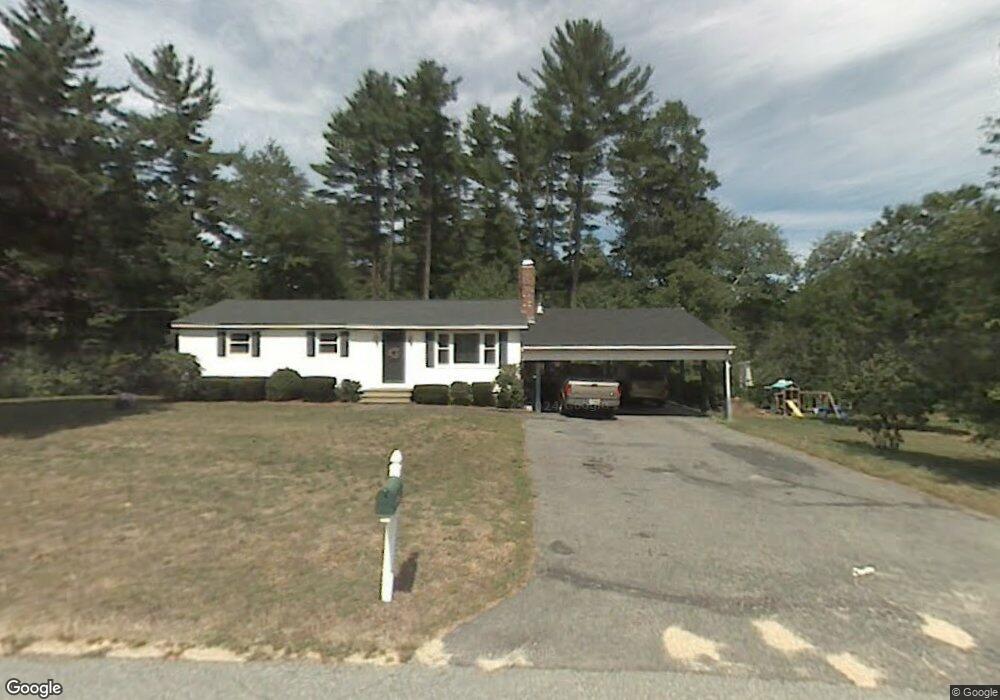
7 Dale Ave Pelham, NH 03076
Estimated Value: $503,000 - $534,000
3
Beds
2
Baths
1,299
Sq Ft
$401/Sq Ft
Est. Value
About This Home
This home is located at 7 Dale Ave, Pelham, NH 03076 and is currently estimated at $520,437, approximately $400 per square foot. 7 Dale Ave is a home with nearby schools including Pelham Elementary School, Pelham Memorial School, and Pelham High School.
Ownership History
Date
Name
Owned For
Owner Type
Purchase Details
Closed on
Oct 29, 2001
Sold by
Streechon Peter C
Bought by
Ferchak Michael J and Ferchak Laurie J
Current Estimated Value
Home Financials for this Owner
Home Financials are based on the most recent Mortgage that was taken out on this home.
Original Mortgage
$185,250
Interest Rate
6.86%
Purchase Details
Closed on
Dec 24, 1997
Sold by
Domigan Richard C and Domigan Ann M
Bought by
Streechon Peter C
Create a Home Valuation Report for This Property
The Home Valuation Report is an in-depth analysis detailing your home's value as well as a comparison with similar homes in the area
Home Values in the Area
Average Home Value in this Area
Purchase History
| Date | Buyer | Sale Price | Title Company |
|---|---|---|---|
| Ferchak Michael J | $195,000 | -- | |
| Streechon Peter C | $115,000 | -- |
Source: Public Records
Mortgage History
| Date | Status | Borrower | Loan Amount |
|---|---|---|---|
| Open | Streechon Peter C | $45,000 | |
| Open | Streechon Peter C | $187,400 | |
| Closed | Streechon Peter C | $70,000 | |
| Closed | Streechon Peter C | $185,250 |
Source: Public Records
Tax History Compared to Growth
Tax History
| Year | Tax Paid | Tax Assessment Tax Assessment Total Assessment is a certain percentage of the fair market value that is determined by local assessors to be the total taxable value of land and additions on the property. | Land | Improvement |
|---|---|---|---|---|
| 2024 | $6,052 | $330,000 | $139,600 | $190,400 |
| 2023 | $6,003 | $330,000 | $139,600 | $190,400 |
| 2022 | $5,749 | $330,000 | $139,600 | $190,400 |
| 2021 | $5,348 | $335,100 | $139,600 | $195,500 |
| 2020 | $5,474 | $271,000 | $111,300 | $159,700 |
| 2019 | $5,257 | $271,000 | $111,300 | $159,700 |
| 2018 | $5,399 | $251,600 | $111,300 | $140,300 |
| 2017 | $5,397 | $251,600 | $111,300 | $140,300 |
| 2016 | $5,267 | $251,400 | $111,300 | $140,100 |
| 2015 | $5,013 | $215,500 | $105,900 | $109,600 |
| 2014 | $4,928 | $215,500 | $105,900 | $109,600 |
| 2013 | $4,928 | $215,500 | $105,900 | $109,600 |
Source: Public Records
Map
Nearby Homes
- 1 Redwood Rd
- 45 Hobbs Rd
- 96 Simpson Rd
- 4 Haystack Cir
- 6 Yellow Wood Dr
- Lot 4 Canterbury Rd Unit 4
- 10 Dutton Rd
- 63 Marsh Rd
- 45 Sharon Rd
- 1119 Mammoth Rd
- 27 Wellesley Dr
- 11 Venus Way
- 7 Venus Way Unit 22
- 1 Currier Rd
- 5 Stephanie Dr
- 50 Dutton Rd
- 508 Mammoth Rd
- 26 Plower Rd Unit 6
- 23 Ryan Farm Rd
- 2 S Shore Dr