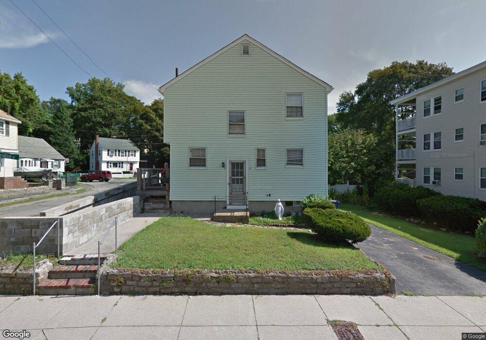
7 Delore Cir Roslindale, MA 02131
Roslindale NeighborhoodEstimated Value: $706,000 - $905,000
4
Beds
2
Baths
1,710
Sq Ft
$463/Sq Ft
Est. Value
About This Home
This home is located at 7 Delore Cir, Roslindale, MA 02131 and is currently estimated at $792,199, approximately $463 per square foot. 7 Delore Cir is a home located in Suffolk County with nearby schools including Brooke Charter School Roslindale, Sacred Heart STEM School, and St. Clare High School.
Ownership History
Date
Name
Owned For
Owner Type
Purchase Details
Closed on
Jun 30, 1997
Sold by
Jean-Michel Francky and Jean-Michel Marie R
Bought by
Williams Keith and Williams Thora B
Current Estimated Value
Purchase Details
Closed on
Sep 29, 1993
Sold by
Webber Richard J and Webber Lisa M
Bought by
Jean Michel Francky and Jean Michel Marie R
Purchase Details
Closed on
Oct 16, 1987
Sold by
Reynolds R F
Bought by
Webber Richard J
Create a Home Valuation Report for This Property
The Home Valuation Report is an in-depth analysis detailing your home's value as well as a comparison with similar homes in the area
Home Values in the Area
Average Home Value in this Area
Purchase History
| Date | Buyer | Sale Price | Title Company |
|---|---|---|---|
| Williams Keith | $131,000 | -- | |
| Jean Michel Francky | $114,000 | -- | |
| Webber Richard J | $127,000 | -- |
Source: Public Records
Mortgage History
| Date | Status | Borrower | Loan Amount |
|---|---|---|---|
| Open | Webber Richard J | $223,500 | |
| Closed | Webber Richard J | $224,952 | |
| Closed | Webber Richard J | $194,656 |
Source: Public Records
Tax History Compared to Growth
Tax History
| Year | Tax Paid | Tax Assessment Tax Assessment Total Assessment is a certain percentage of the fair market value that is determined by local assessors to be the total taxable value of land and additions on the property. | Land | Improvement |
|---|---|---|---|---|
| 2025 | $7,473 | $645,300 | $202,900 | $442,400 |
| 2024 | $6,823 | $626,000 | $198,100 | $427,900 |
| 2023 | $6,282 | $584,900 | $185,100 | $399,800 |
| 2022 | $5,894 | $541,700 | $171,400 | $370,300 |
| 2021 | $5,498 | $515,300 | $164,800 | $350,500 |
| 2020 | $5,366 | $508,100 | $159,800 | $348,300 |
| 2019 | $5,098 | $483,700 | $125,400 | $358,300 |
| 2018 | $4,827 | $460,600 | $125,400 | $335,200 |
| 2017 | $4,603 | $434,700 | $125,400 | $309,300 |
| 2016 | $4,387 | $398,800 | $125,400 | $273,400 |
| 2015 | $4,303 | $355,300 | $114,200 | $241,100 |
| 2014 | $4,060 | $322,700 | $114,200 | $208,500 |
Source: Public Records
Map
Nearby Homes
- 16 Hilburn Place
- 543 Hyde Park Ave Unit 1
- 25 Pinedale Rd Unit 1
- 27 Rowe St
- 417 Poplar St
- 415 Poplar St
- 25 Crandall St
- 87 Clare Ave
- 273 Metropolitan Ave Unit 2
- 67 Cummins Hwy Unit 101
- 8 Mount Calvary Rd Unit 4
- 142 Metropolitan Ave Unit A
- 32 Jewett St
- 108 Florence St Unit 3
- 108 Florence St Unit 1
- 108 Florence St Unit 4
- 187 Florence St Unit 2L
- 36 Neponset Ave Unit 1
- 175 Clare Ave Unit B3
- 69 Metropolitan Ave
- 3 Delore Cir
- 11 Delore Cir
- 36 Seymour St
- 36 Seymour St Unit 3
- 36 Seymour St Unit 1
- 40 Seymour St
- 40 Seymour St
- 2 Delore Cir
- 14 Delore Cir
- 6 Delore Cir
- 22 Seymour St
- 20 Seymour St Unit 3
- 20 Seymour St Unit 2
- 20 Seymour St Unit 1
- 10 Delore Cir
- 44 Seymour St Unit 46
- 44 Seymour St Unit 2
- 29 Seymour St
- 29 Seymour St Unit 3
- 223 Cummins Hwy