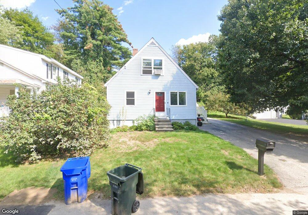
7 Dunbar St Manchester, NH 03103
Highlands NeighborhoodEstimated Value: $370,000 - $420,404
3
Beds
1
Bath
1,075
Sq Ft
$374/Sq Ft
Est. Value
About This Home
This home is located at 7 Dunbar St, Manchester, NH 03103 and is currently estimated at $402,351, approximately $374 per square foot. 7 Dunbar St is a home located in Hillsborough County with nearby schools including Bakersville School, Southside Middle School, and Manchester Memorial High School.
Ownership History
Date
Name
Owned For
Owner Type
Purchase Details
Closed on
Sep 11, 2023
Sold by
Somers Matthew S
Bought by
Matt Somers Ret and Somers
Current Estimated Value
Purchase Details
Closed on
Aug 9, 2023
Sold by
Somers Ft and Somers
Bought by
Somers Matthew S
Purchase Details
Closed on
Jun 6, 2017
Sold by
Somers Matthew S
Bought by
Somers Ft and Somers
Purchase Details
Closed on
Jun 30, 2000
Sold by
Carter Derek M and Carter Patricia L
Bought by
Somers Matthew S
Home Financials for this Owner
Home Financials are based on the most recent Mortgage that was taken out on this home.
Original Mortgage
$119,839
Interest Rate
8.59%
Mortgage Type
Purchase Money Mortgage
Purchase Details
Closed on
Oct 1, 1998
Sold by
Gosselin Norman D and Gosselin Mellissa L
Bought by
Carter Derek M and Carter Patricia L
Home Financials for this Owner
Home Financials are based on the most recent Mortgage that was taken out on this home.
Original Mortgage
$95,031
Interest Rate
6.89%
Mortgage Type
Purchase Money Mortgage
Create a Home Valuation Report for This Property
The Home Valuation Report is an in-depth analysis detailing your home's value as well as a comparison with similar homes in the area
Home Values in the Area
Average Home Value in this Area
Purchase History
| Date | Buyer | Sale Price | Title Company |
|---|---|---|---|
| Matt Somers Ret | -- | None Available | |
| Somers Matthew S | -- | None Available | |
| Somers Ft | -- | -- | |
| Somers Matthew S | $119,900 | -- | |
| Carter Derek M | $95,900 | -- |
Source: Public Records
Mortgage History
| Date | Status | Borrower | Loan Amount |
|---|---|---|---|
| Previous Owner | Carter Derek M | $181,000 | |
| Previous Owner | Carter Derek M | $182,000 | |
| Previous Owner | Carter Derek M | $119,839 | |
| Previous Owner | Carter Derek M | $95,031 |
Source: Public Records
Tax History Compared to Growth
Tax History
| Year | Tax Paid | Tax Assessment Tax Assessment Total Assessment is a certain percentage of the fair market value that is determined by local assessors to be the total taxable value of land and additions on the property. | Land | Improvement |
|---|---|---|---|---|
| 2024 | $5,277 | $269,500 | $93,000 | $176,500 |
| 2023 | $5,083 | $269,500 | $93,000 | $176,500 |
| 2022 | $4,916 | $269,500 | $93,000 | $176,500 |
| 2021 | $4,765 | $269,500 | $93,000 | $176,500 |
| 2020 | $4,301 | $174,400 | $58,000 | $116,400 |
| 2019 | $4,241 | $174,400 | $58,000 | $116,400 |
| 2018 | $4,083 | $174,400 | $58,000 | $116,400 |
| 2017 | $4,051 | $174,400 | $58,000 | $116,400 |
| 2016 | $4,036 | $174,400 | $58,000 | $116,400 |
| 2015 | $4,004 | $170,800 | $55,000 | $115,800 |
| 2014 | $4,014 | $170,800 | $55,000 | $115,800 |
| 2013 | $3,872 | $170,800 | $55,000 | $115,800 |
Source: Public Records
Map
Nearby Homes
- 412 W Mitchell St
- 80 Billings St
- 139 Dunbar St
- 80 Emerald St
- 112 Riverdale Ave
- 35 W Mitchell St
- 505 Brown Ave
- 118 W Hillcrest Ave
- 33 W Elmhurst Ave Unit B
- 23 Rosedale Ave
- 664 S Main St
- 49 Harvell St Unit 9
- 545 Calef Rd Unit 26
- 52 Erie St
- 264 Calef Rd
- 55 Salem St
- 202 Mitchell St
- 23 Vernon St Unit 3
- 15 Patterson St
- 161 Flint St
- 13 Dunbar St
- 31 Dunbar St
- 489 Riverdale Ave
- 460 Riverdale Ave
- 466 Riverdale Ave
- 421 Riverdale Ave
- 499 Riverdale Ave
- 444 Riverdale Ave
- 51 Dunbar St
- 365 W Mitchell St
- 365 W Mitchell St Unit B
- 411 Riverdale Ave Unit 1
- 409 Riverdale Ave
- 409 Riverdale Ave Unit 1
- 488 Riverdale Ave
- 424 Riverdale Ave
- 409 Riverdale Ave
- 505 Riverdale Ave
- 355 W Mitchell St
- 500 Riverdale Ave