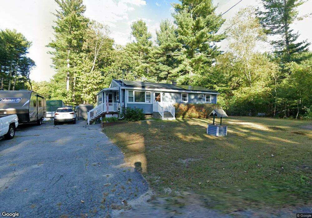
7 Dunstable Rd Westford, MA 01886
Estimated Value: $523,000 - $649,000
3
Beds
1
Bath
944
Sq Ft
$601/Sq Ft
Est. Value
About This Home
This home is located at 7 Dunstable Rd, Westford, MA 01886 and is currently estimated at $567,582, approximately $601 per square foot. 7 Dunstable Rd is a home located in Middlesex County with nearby schools including Rita E. Miller Elementary School, Day Elementary School, and Stony Brook School.
Ownership History
Date
Name
Owned For
Owner Type
Purchase Details
Closed on
Aug 18, 2025
Sold by
Alton Philip R
Bought by
Alton Philip R and Alton Irene R
Current Estimated Value
Purchase Details
Closed on
Nov 15, 1994
Sold by
Alton Florence
Bought by
Alton Philip R and Alton Peggy
Home Financials for this Owner
Home Financials are based on the most recent Mortgage that was taken out on this home.
Original Mortgage
$74,715
Interest Rate
8.78%
Mortgage Type
Purchase Money Mortgage
Create a Home Valuation Report for This Property
The Home Valuation Report is an in-depth analysis detailing your home's value as well as a comparison with similar homes in the area
Home Values in the Area
Average Home Value in this Area
Purchase History
| Date | Buyer | Sale Price | Title Company |
|---|---|---|---|
| Alton Philip R | -- | -- | |
| Alton Philip R | -- | -- | |
| Alton Philip R | $73,250 | -- | |
| Alton Philip R | $73,250 | -- |
Source: Public Records
Mortgage History
| Date | Status | Borrower | Loan Amount |
|---|---|---|---|
| Previous Owner | Alton Philip R | $100,000 | |
| Previous Owner | Alton Philip R | $24,476 | |
| Previous Owner | Alton Philip R | $74,715 |
Source: Public Records
Tax History Compared to Growth
Tax History
| Year | Tax Paid | Tax Assessment Tax Assessment Total Assessment is a certain percentage of the fair market value that is determined by local assessors to be the total taxable value of land and additions on the property. | Land | Improvement |
|---|---|---|---|---|
| 2025 | $5,873 | $436,000 | $303,900 | $132,100 |
| 2024 | $5,717 | $415,200 | $289,400 | $125,800 |
| 2023 | $5,725 | $387,900 | $275,700 | $112,200 |
| 2022 | $5,600 | $347,400 | $235,200 | $112,200 |
| 2021 | $7,698 | $325,700 | $235,200 | $90,500 |
| 2020 | $7,486 | $325,700 | $235,200 | $90,500 |
| 2019 | $5,269 | $318,200 | $235,200 | $83,000 |
| 2018 | $4,983 | $308,000 | $225,000 | $83,000 |
| 2017 | $7,291 | $293,300 | $225,000 | $68,300 |
| 2016 | $4,571 | $280,400 | $212,100 | $68,300 |
| 2015 | $4,490 | $276,500 | $212,100 | $64,400 |
| 2014 | $4,445 | $267,800 | $203,400 | $64,400 |
Source: Public Records
Map
Nearby Homes
- 16 Shipley Cir
- 5 Fawn Rd
- 4 Lady Constance Way Unit 20
- 3 Blue Heron Dr
- 6 Lady Constance Way
- 6 Lady Constance Way Unit 21
- Copley Plan at Wendell Place
- Williamstown Plan at Wendell Place
- 2 Wendell Place Unit 1
- 2 Lady Constance Way Unit 19
- 239 Groton Rd
- 16 Saint Paul Ln Unit Lot 20
- 8 Loon Way
- 1 Appian Way
- 9 Loon Way
- 3 Loon Way
- 2 Alder Point Unit 2
- 35 Keyes Rd
- 3 Colonel Rolls Dr
- 55 Lawson Rd