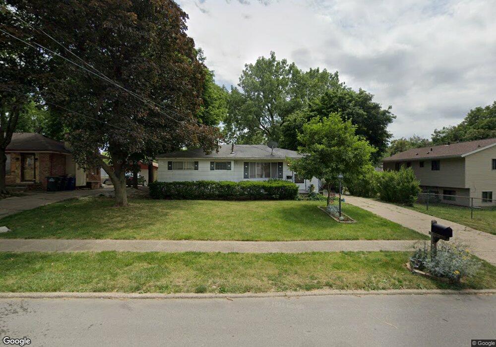
7 E Philip St Des Moines, IA 50315
South Central DSM NeighborhoodEstimated Value: $170,000 - $201,000
3
Beds
1
Bath
948
Sq Ft
$195/Sq Ft
Est. Value
About This Home
This home is located at 7 E Philip St, Des Moines, IA 50315 and is currently estimated at $184,585, approximately $194 per square foot. 7 E Philip St is a home located in Polk County with nearby schools including South Union Elementary School, Weeks Middle School, and Lincoln High School.
Ownership History
Date
Name
Owned For
Owner Type
Purchase Details
Closed on
Jun 13, 2014
Sold by
Bjb Company Inc
Bought by
Arl Properties Llc
Current Estimated Value
Purchase Details
Closed on
Feb 28, 2013
Sold by
Stanley Mark W and Stanley Mark William
Bought by
Federal National Mortgage Association
Purchase Details
Closed on
Aug 2, 2007
Sold by
Wells Fargo Bank Na
Bought by
Hud
Purchase Details
Closed on
May 17, 2007
Sold by
Griffin Paul J
Bought by
Wells Fargo Bank Na
Purchase Details
Closed on
Dec 21, 2001
Sold by
Transamerica Life Insurance Company
Bought by
Baal Ione I
Create a Home Valuation Report for This Property
The Home Valuation Report is an in-depth analysis detailing your home's value as well as a comparison with similar homes in the area
Home Values in the Area
Average Home Value in this Area
Purchase History
| Date | Buyer | Sale Price | Title Company |
|---|---|---|---|
| Arl Properties Llc | -- | None Available | |
| Federal National Mortgage Association | $89,837 | None Available | |
| Hud | $129,500 | None Available | |
| Wells Fargo Bank Na | $129,963 | None Available | |
| Baal Ione I | $33,500 | -- |
Source: Public Records
Tax History Compared to Growth
Tax History
| Year | Tax Paid | Tax Assessment Tax Assessment Total Assessment is a certain percentage of the fair market value that is determined by local assessors to be the total taxable value of land and additions on the property. | Land | Improvement |
|---|---|---|---|---|
| 2025 | $2,796 | $160,100 | $38,500 | $121,600 |
| 2024 | $2,796 | $142,100 | $34,000 | $108,100 |
| 2023 | $2,828 | $142,100 | $34,000 | $108,100 |
| 2022 | $2,806 | $120,000 | $29,700 | $90,300 |
| 2021 | $2,720 | $120,000 | $29,700 | $90,300 |
| 2020 | $2,826 | $109,000 | $26,800 | $82,200 |
| 2019 | $2,578 | $109,000 | $26,800 | $82,200 |
| 2018 | $2,552 | $95,900 | $23,100 | $72,800 |
| 2017 | $2,446 | $95,900 | $23,100 | $72,800 |
| 2016 | $2,382 | $90,400 | $21,400 | $69,000 |
| 2015 | $2,382 | $90,400 | $21,400 | $69,000 |
| 2014 | $1,956 | $88,700 | $20,600 | $68,100 |
Source: Public Records
Map
Nearby Homes
- 108 E Philip St
- 102 E Emma Ave
- 126 E Maxwelton Dr
- 209 E Philip St
- 115 Mckinley Ave
- 304 Herold Ave
- 311 E Emma Ave
- 4316 SE 4th St
- 117 E Watrous Ave
- 515 Emma Ave
- 409 Wilmers Ave
- 518 Maxwelton Dr
- 212 Titus Ave
- 612 Emma Ave
- 117 E Rose Ave
- 299 Hackley Ave
- 606 Marion St
- 448 Scandia Ave
- 4204 SW 7th St
- 433 E Marion St
- 11 E Philip St
- 4421 & 4423 S Union St
- 4421 South Union St
- 6 E Maxwelton Dr
- 17 E Philip St
- 10 E Maxwelton Dr
- 4501 South Union St
- 4501 S Union St
- 8 E Philip St
- 16 E Maxwelton Dr
- 12 E Philip St
- 4401 South Union St
- 4401 S Union St
- 23 E Philip St
- 16 E Philip St
- 22 E Maxwelton Dr
- 22 E Philip St
- 4414 South Union St
- 4412 South Union St
- 101 E Philip St