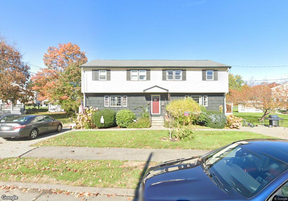
7 Edwards Rd Unit A Woburn, MA 01801
North Woburn NeighborhoodEstimated Value: $544,212 - $605,000
3
Beds
2
Baths
1,115
Sq Ft
$511/Sq Ft
Est. Value
About This Home
This home is located at 7 Edwards Rd Unit A, Woburn, MA 01801 and is currently estimated at $570,053, approximately $511 per square foot. 7 Edwards Rd Unit A is a home located in Middlesex County with nearby schools including Linscott-Rumford Elementary School, John F. Kennedy Middle School, and Woburn High School.
Ownership History
Date
Name
Owned For
Owner Type
Purchase Details
Closed on
Apr 1, 2013
Sold by
Burgman Aaron L and Burgman Gabriela V
Bought by
Burgman
Current Estimated Value
Purchase Details
Closed on
Sep 20, 2005
Sold by
Ortins Marc P
Bought by
Burgman Aaron L and Burgman Gabriela V
Home Financials for this Owner
Home Financials are based on the most recent Mortgage that was taken out on this home.
Original Mortgage
$262,400
Interest Rate
5.84%
Mortgage Type
Purchase Money Mortgage
Purchase Details
Closed on
May 24, 2002
Sold by
Mcsheffrey Robert C
Bought by
Ortins Marc P
Home Financials for this Owner
Home Financials are based on the most recent Mortgage that was taken out on this home.
Original Mortgage
$199,920
Interest Rate
7.01%
Mortgage Type
Purchase Money Mortgage
Create a Home Valuation Report for This Property
The Home Valuation Report is an in-depth analysis detailing your home's value as well as a comparison with similar homes in the area
Home Values in the Area
Average Home Value in this Area
Purchase History
| Date | Buyer | Sale Price | Title Company |
|---|---|---|---|
| Burgman | -- | -- | |
| A & G Burgman Ret | -- | -- | |
| Burgman Aaron L | $328,000 | -- | |
| Burgman Aaron L | $328,000 | -- | |
| Ortins Marc P | $249,900 | -- | |
| Ortins Marc P | $249,900 | -- |
Source: Public Records
Mortgage History
| Date | Status | Borrower | Loan Amount |
|---|---|---|---|
| Previous Owner | Burgman Aaron L | $262,400 | |
| Previous Owner | Ortins Marc P | $199,920 | |
| Previous Owner | Ortins Marc P | $152,000 |
Source: Public Records
Tax History Compared to Growth
Tax History
| Year | Tax Paid | Tax Assessment Tax Assessment Total Assessment is a certain percentage of the fair market value that is determined by local assessors to be the total taxable value of land and additions on the property. | Land | Improvement |
|---|---|---|---|---|
| 2025 | $4,022 | $471,000 | $0 | $471,000 |
| 2024 | $3,761 | $466,600 | $0 | $466,600 |
| 2023 | $3,578 | $411,300 | $0 | $411,300 |
| 2022 | $3,686 | $394,600 | $0 | $394,600 |
| 2021 | $3,551 | $380,600 | $0 | $380,600 |
| 2020 | $3,447 | $369,900 | $0 | $369,900 |
| 2019 | $2,901 | $305,400 | $0 | $305,400 |
| 2018 | $2,897 | $292,900 | $0 | $292,900 |
| 2017 | $2,776 | $279,300 | $0 | $279,300 |
| 2016 | $2,640 | $262,700 | $0 | $262,700 |
| 2015 | $2,598 | $255,500 | $0 | $255,500 |
| 2014 | $2,522 | $241,600 | $0 | $241,600 |
Source: Public Records
Map
Nearby Homes
- 7 Edwards Rd
- 7 Edwards Rd Unit 7
- 9 Edwards Rd Unit A
- 9 Edwards Rd
- 9 Edwards Rd Unit 9
- 2 Keith Cir Unit A
- 2 Keith Cir
- 8 Edwards Rd Unit 8
- 8 Edwards Rd Unit A
- 8 Edwards Rd
- 4 Keith Cir Unit A
- 6 Edwards Rd Unit A
- 6 Edwards Rd
- 6 Edwards Rd Unit L
- 6 Edwards Rd Unit 6
- 4a Keith Cir Unit 4A
- 10 Edwards Rd Unit 10
- 10A Edwards Rd
- 10 Edwards Rd Unit A
- 10 Edwards Rd