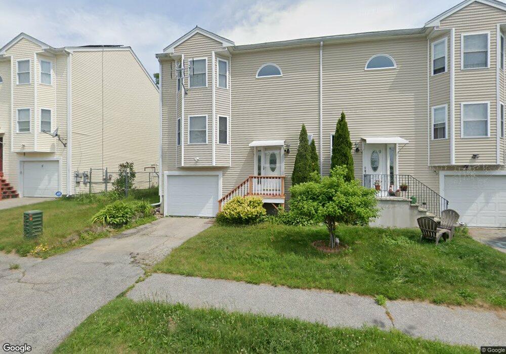
7 Fenton Dr Worcester, MA 01602
West Tatnuck NeighborhoodEstimated Value: $390,000 - $426,785
3
Beds
2
Baths
1,536
Sq Ft
$268/Sq Ft
Est. Value
About This Home
This home is located at 7 Fenton Dr, Worcester, MA 01602 and is currently estimated at $412,196, approximately $268 per square foot. 7 Fenton Dr is a home located in Worcester County with nearby schools including Tatnuck Magnet School, Chandler Magnet, and Jacob Hiatt Magnet School.
Ownership History
Date
Name
Owned For
Owner Type
Purchase Details
Closed on
Dec 28, 2012
Sold by
Spaho Theodhor and Spaho Meropi
Bought by
Spaho Theodhor and Spaho Meropi
Current Estimated Value
Purchase Details
Closed on
Apr 9, 2012
Sold by
Spaho Theodhor and Spaho Meropi
Bought by
Spaho Theodhor and Spaho Meropi
Home Financials for this Owner
Home Financials are based on the most recent Mortgage that was taken out on this home.
Original Mortgage
$142,500
Interest Rate
3.95%
Mortgage Type
New Conventional
Purchase Details
Closed on
Apr 6, 2004
Sold by
Fenton Ests Nt and Rad Abbas
Bought by
Spaho Meropi and Spaho Theodhor
Home Financials for this Owner
Home Financials are based on the most recent Mortgage that was taken out on this home.
Original Mortgage
$120,000
Interest Rate
5.56%
Mortgage Type
Purchase Money Mortgage
Create a Home Valuation Report for This Property
The Home Valuation Report is an in-depth analysis detailing your home's value as well as a comparison with similar homes in the area
Home Values in the Area
Average Home Value in this Area
Purchase History
| Date | Buyer | Sale Price | Title Company |
|---|---|---|---|
| Spaho Theodhor | -- | -- | |
| Spaho Theodhor | -- | -- | |
| Spaho Meropi | $189,900 | -- |
Source: Public Records
Mortgage History
| Date | Status | Borrower | Loan Amount |
|---|---|---|---|
| Previous Owner | Spaho Theodhor | $142,500 | |
| Previous Owner | Spaho Meropi | $120,000 |
Source: Public Records
Tax History
| Year | Tax Paid | Tax Assessment Tax Assessment Total Assessment is a certain percentage of the fair market value that is determined by local assessors to be the total taxable value of land and additions on the property. | Land | Improvement |
|---|---|---|---|---|
| 2025 | $4,977 | $377,300 | $84,900 | $292,400 |
| 2024 | $4,703 | $342,000 | $84,900 | $257,100 |
| 2023 | $4,508 | $314,400 | $73,800 | $240,600 |
| 2022 | $4,066 | $267,300 | $59,100 | $208,200 |
| 2021 | $3,987 | $244,900 | $47,200 | $197,700 |
| 2020 | $3,949 | $232,300 | $47,300 | $185,000 |
| 2019 | $3,798 | $211,000 | $42,500 | $168,500 |
| 2018 | $3,786 | $200,200 | $42,500 | $157,700 |
| 2017 | $3,569 | $185,700 | $42,500 | $143,200 |
| 2016 | $3,551 | $172,300 | $32,200 | $140,100 |
| 2015 | $3,458 | $172,300 | $32,200 | $140,100 |
| 2014 | $3,367 | $172,300 | $32,200 | $140,100 |
Source: Public Records
Map
Nearby Homes
- 15 Chesterfield Rd
- 122 Copperfield Rd
- 118 Beaconsfield Rd
- 12 Cardinal Rd
- 23 Tiverton Pkwy
- 73 Moore Ave
- 44 Drexel St
- 23 Orrison St
- 19 Kenilworth Rd
- 163 Moreland St
- 31 Lenox St
- 47R Yarnie Unit 3A
- 47R Yarnie Unit 1B
- 47R Yarnie Unit 2B
- 47R Yarnie Unit 4B
- 47R Yarnie Unit 8B
- 47R Yarnie Unit 5A
- 47R Yarnie Unit 6B
- 47R Yarnie Unit 4A
- 47R Yarnie Unit 1A
- 5 Fenton Dr
- 9 Fenton Dr
- 3 Fenton Dr
- 11 Fenton Dr
- 13 Fenton Dr
- 14 Wrentham Rd
- 15 Fenton Dr
- 10 Wrentham Rd Unit 314
- 10 Wrentham Rd Unit 313
- 10 Wrentham Rd Unit 312
- 10 Wrentham Rd Unit 311
- 10 Wrentham Rd Unit 310
- 10 Wrentham Rd Unit 309
- 10 Wrentham Rd Unit 308
- 10 Wrentham Rd Unit 307
- 10 Wrentham Rd Unit 306
- 10 Wrentham Rd Unit 305
- 10 Wrentham Rd Unit 304
- 10 Wrentham Rd Unit 303
- 10 Wrentham Rd Unit 302
Your Personal Tour Guide
Ask me questions while you tour the home.