Estimated Value: $797,562 - $956,000
4
Beds
2
Baths
1,783
Sq Ft
$494/Sq Ft
Est. Value
About This Home
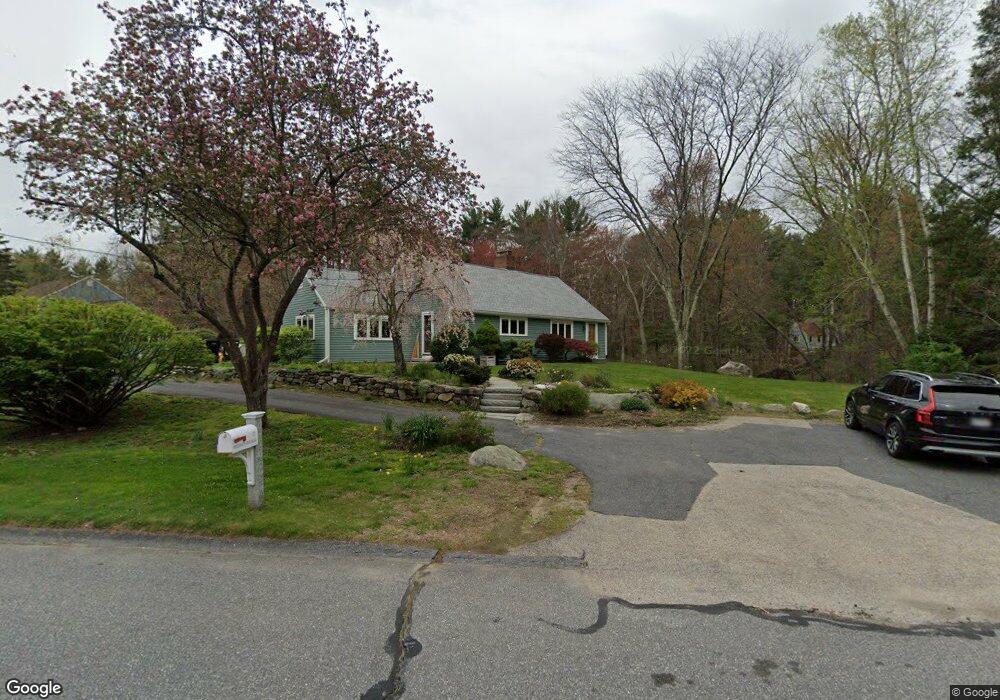
This home is located at 7 Freedom Farme Rd, Acton, MA 01720 and is currently estimated at $881,141, approximately $494 per square foot. 7 Freedom Farme Rd is a home located in Middlesex County with nearby schools including Acton-Boxborough Regional High School.
Ownership History
Date
Name
Owned For
Owner Type
Purchase Details
Closed on
Jul 8, 1980
Bought by
Bloomstran F David
Current Estimated Value
Create a Home Valuation Report for This Property
The Home Valuation Report is an in-depth analysis detailing your home's value as well as a comparison with similar homes in the area
Home Values in the Area
Average Home Value in this Area
Purchase History
| Date | Buyer | Sale Price | Title Company |
|---|---|---|---|
| Bloomstran F David | -- | -- |
Source: Public Records
Mortgage History
| Date | Status | Borrower | Loan Amount |
|---|---|---|---|
| Open | Bloomstran F David | $25,000 | |
| Open | Bloomstran F David | $139,135 | |
| Closed | Bloomstran F David | $105,000 | |
| Closed | Bloomstran F David | $105,000 |
Source: Public Records
Tax History
| Year | Tax Paid | Tax Assessment Tax Assessment Total Assessment is a certain percentage of the fair market value that is determined by local assessors to be the total taxable value of land and additions on the property. | Land | Improvement |
|---|---|---|---|---|
| 2025 | $12,545 | $731,500 | $362,500 | $369,000 |
| 2024 | $11,884 | $712,900 | $362,500 | $350,400 |
| 2023 | $12,122 | $690,300 | $329,800 | $360,500 |
| 2022 | $11,020 | $566,600 | $286,700 | $279,900 |
| 2021 | $10,637 | $525,800 | $265,200 | $260,600 |
| 2020 | $9,859 | $512,400 | $265,200 | $247,200 |
| 2019 | $9,489 | $489,900 | $265,200 | $224,700 |
| 2018 | $9,463 | $488,300 | $265,200 | $223,100 |
| 2017 | $9,307 | $488,300 | $265,200 | $223,100 |
| 2016 | $8,898 | $462,700 | $265,200 | $197,500 |
| 2015 | $8,803 | $462,100 | $265,200 | $196,900 |
| 2014 | $8,646 | $444,500 | $265,200 | $179,300 |
Source: Public Records
Map
Nearby Homes
- 5 Perkins Ln
- 79 Charter Rd
- 60 Nashoba Rd
- 20 Joseph Reed Ln
- 4 Littlefield Rd
- 96 Newtown Rd
- 235 Arlington St
- 18 Hayward Rd
- 11 Braebrook
- 631 Massachusetts Ave Unit 631
- 246 Main St Unit 2
- 33 Meadowbrook Rd
- 7 Kelley Rd
- 4 Omega Way
- 46 Taylor Rd
- 491 Main St
- 92 Willow St Unit 3
- 92 Willow St Unit 2
- 90 Willow St Unit 1
- 524 Main St
- 8 Freedom Farme Rd
- 9 Freedom Farme Rd
- 10 Freedom Farme Rd
- 11 Freedom Farme Rd
- 4 Freedom Farme Rd
- 5 Freedom Farme Rd
- 12 Freedom Farme Rd
- 1 Olde Barn Way
- 4 Olde Barn Way
- 14 Freedom Farme Rd
- 2 Olde Barn Way
- 17 Freedom Farme Rd
- 73 Arlington St
- 1 Freedom Farme Rd
- 18 Freedom Farme Rd
- 2 Freedom Farme Rd
- 3 Olde Barn Way
- 67 Arlington St
- 19 Freedom Farme Rd
- 16 Freedom Farme Rd
Your Personal Tour Guide
Ask me questions while you tour the home.