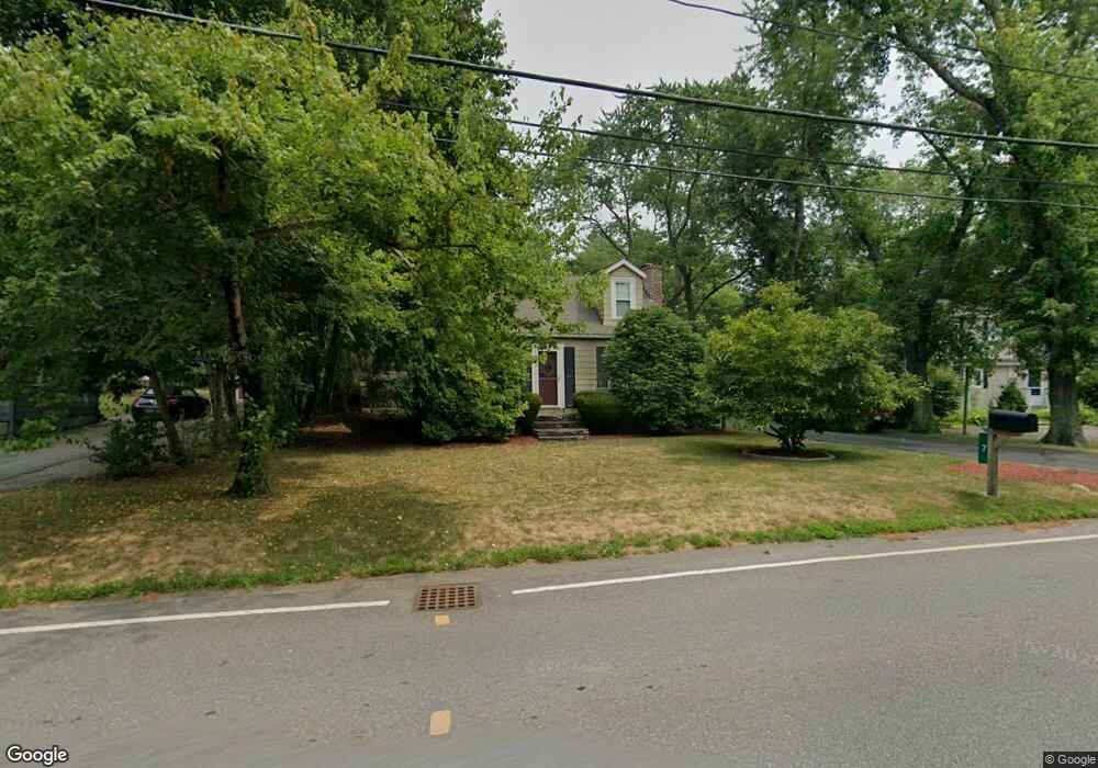
7 Freeman St Norton, MA 02766
Estimated Value: $481,620 - $563,000
3
Beds
2
Baths
1,350
Sq Ft
$392/Sq Ft
Est. Value
About This Home
This home is located at 7 Freeman St, Norton, MA 02766 and is currently estimated at $529,405, approximately $392 per square foot. 7 Freeman St is a home located in Bristol County with nearby schools including J.C. Solmonese Elementary School, Henri A. Yelle Elementary School, and Norton Middle School.
Ownership History
Date
Name
Owned For
Owner Type
Purchase Details
Closed on
Nov 30, 1998
Sold by
Munger Kenneth A and Munger Ellen G
Bought by
Lyle Kent S and Lyle Michelle L
Current Estimated Value
Home Financials for this Owner
Home Financials are based on the most recent Mortgage that was taken out on this home.
Original Mortgage
$141,626
Interest Rate
6.83%
Mortgage Type
Purchase Money Mortgage
Purchase Details
Closed on
Dec 12, 1988
Sold by
Doucette Eugene
Bought by
Mulnger Kenneth A
Purchase Details
Closed on
Sep 27, 1988
Sold by
Grant Patricia C
Bought by
Iliad Rlty Trust
Create a Home Valuation Report for This Property
The Home Valuation Report is an in-depth analysis detailing your home's value as well as a comparison with similar homes in the area
Home Values in the Area
Average Home Value in this Area
Purchase History
| Date | Buyer | Sale Price | Title Company |
|---|---|---|---|
| Lyle Kent S | $146,400 | -- | |
| Mulnger Kenneth A | $135,000 | -- | |
| Iliad Rlty Trust | $55,000 | -- |
Source: Public Records
Mortgage History
| Date | Status | Borrower | Loan Amount |
|---|---|---|---|
| Open | Iliad Rlty Trust | $244,150 | |
| Closed | Iliad Rlty Trust | $42,000 | |
| Closed | Iliad Rlty Trust | $141,626 |
Source: Public Records
Tax History
| Year | Tax Paid | Tax Assessment Tax Assessment Total Assessment is a certain percentage of the fair market value that is determined by local assessors to be the total taxable value of land and additions on the property. | Land | Improvement |
|---|---|---|---|---|
| 2025 | $53 | $409,300 | $177,200 | $232,100 |
| 2024 | $5,231 | $403,900 | $168,800 | $235,100 |
| 2023 | $4,909 | $377,900 | $159,200 | $218,700 |
| 2022 | $4,760 | $333,800 | $144,700 | $189,100 |
| 2021 | $3,071 | $302,800 | $137,900 | $164,900 |
| 2020 | $4,351 | $294,000 | $133,800 | $160,200 |
| 2019 | $4,215 | $282,900 | $128,700 | $154,200 |
| 2018 | $11,590 | $266,100 | $128,700 | $137,400 |
| 2017 | $3,935 | $256,000 | $128,700 | $127,300 |
| 2016 | $3,820 | $244,700 | $128,700 | $116,000 |
| 2015 | $3,684 | $239,400 | $126,200 | $113,200 |
| 2014 | $3,507 | $228,200 | $120,200 | $108,000 |
Source: Public Records
Map
Nearby Homes
- 83 W Main St
- 5 Robin Cir Unit 5
- 26 Barrows Ct
- 20 Lloyd Cir Unit 32
- 14 Lloyd Cir Unit 29
- 93 Mansfield Ave
- 8 Country Cir
- 2 Edgewater Dr Unit 2
- 178 S Worcester St
- 170 S Worcester St Unit 3
- 1 Heritage Rd Unit 1
- 3 Heritage Rd Unit 3
- 108 S Worcester St
- 90 Pine St
- 101 Godfrey Dr Unit 101
- 157 Mansfield Ave Unit 27
- 157 Mansfield Ave Unit 14
- 343 Godfrey Dr
- 60 S Worcester St
- 143 Oak St Unit 10
- 7R Freeman St
- 5 Freeman St
- 95 W Main St
- 97 W Main St
- 9 Freeman St
- 93 W Main St
- 99 W Main St
- 11 Freeman St
- 8 Freeman St
- 2 Freeman St
- 91 W Main St Unit 6
- 91 W Main St Unit 5
- 91 W Main St Unit 4
- 91 W Main St Unit 3
- 91 W Main St Unit 2
- 91 W Main St Unit 1
- 96 W Main St
- 96 W Main St Unit 2
- 96 W Main St Unit 3
- 96 W Main St Unit 1
Your Personal Tour Guide
Ask me questions while you tour the home.