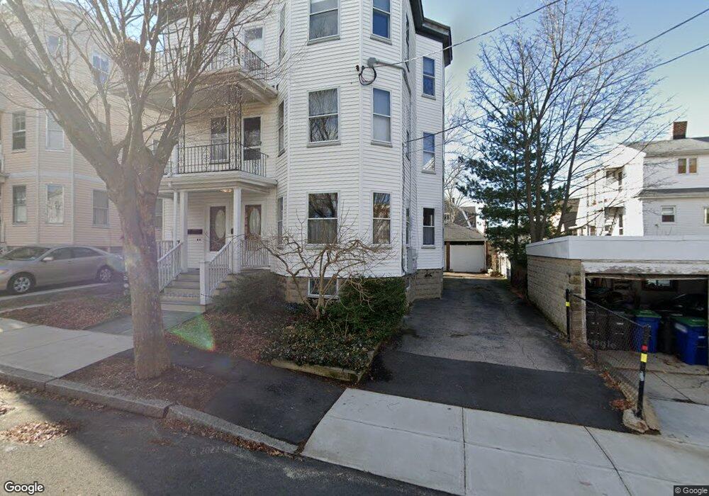
7 Hardan Rd Somerville, MA 02144
Teele Square NeighborhoodEstimated Value: $1,456,429 - $1,721,000
6
Beds
3
Baths
3,837
Sq Ft
$422/Sq Ft
Est. Value
About This Home
This home is located at 7 Hardan Rd, Somerville, MA 02144 and is currently estimated at $1,617,357, approximately $421 per square foot. 7 Hardan Rd is a home located in Middlesex County with nearby schools including Somerville High School, St. Clement Elementary School, and International School of Boston.
Ownership History
Date
Name
Owned For
Owner Type
Purchase Details
Closed on
Feb 26, 2022
Sold by
Hardan Road T
Bought by
Steinberg Benjamin R and White Darla A
Current Estimated Value
Purchase Details
Closed on
Jul 10, 2013
Sold by
Steinberg Ann G
Bought by
Hardan Road T and Steinberg Margaret A
Create a Home Valuation Report for This Property
The Home Valuation Report is an in-depth analysis detailing your home's value as well as a comparison with similar homes in the area
Home Values in the Area
Average Home Value in this Area
Purchase History
| Date | Buyer | Sale Price | Title Company |
|---|---|---|---|
| Steinberg Benjamin R | -- | None Available | |
| Hardan Road T | -- | -- |
Source: Public Records
Tax History Compared to Growth
Tax History
| Year | Tax Paid | Tax Assessment Tax Assessment Total Assessment is a certain percentage of the fair market value that is determined by local assessors to be the total taxable value of land and additions on the property. | Land | Improvement |
|---|---|---|---|---|
| 2025 | $18,456 | $1,691,700 | $844,300 | $847,400 |
| 2024 | $17,411 | $1,655,000 | $844,300 | $810,700 |
| 2023 | $16,899 | $1,634,300 | $844,300 | $790,000 |
| 2022 | $16,074 | $1,579,000 | $804,100 | $774,900 |
| 2021 | $15,754 | $1,546,000 | $798,200 | $747,800 |
| 2020 | $15,604 | $1,546,500 | $798,700 | $747,800 |
| 2019 | $14,896 | $1,384,400 | $727,000 | $657,400 |
| 2018 | $12,966 | $1,146,400 | $660,900 | $485,500 |
| 2017 | $12,662 | $1,085,000 | $623,600 | $461,400 |
| 2016 | $11,994 | $957,200 | $556,800 | $400,400 |
| 2015 | $11,152 | $884,400 | $514,200 | $370,200 |
Source: Public Records
Map
Nearby Homes
- 202 Powder House Blvd Unit 2
- 11 Watson St Unit 1
- 11 Watson St Unit 2
- 34 Belknap St
- 33 Conwell Ave
- 235 Powder House Blvd
- 6 Hamilton Rd Unit 6
- 55 Packard Ave Unit 1
- 29 Packard Ave
- 23 Ossipee Rd
- 57 Garrison Ave
- 16 High St Unit 2
- 69 Clarendon Ave Unit A
- 20 Electric Ave Unit 2
- 21 High St
- 327 Alewife Brook Pkwy Unit A
- 31 Fairfax St
- 9 Woods Ave
- 24 Washburn Ave Unit 1
- 39 Seven Pines Ave
- 9 Hardan Rd Unit 3
- 9 Hardan Rd Unit 2
- 11 Hardan Rd
- 11 Hardan Rd Unit 2
- 11 Hardan Rd Unit 3
- 11 Hardan Rd Unit 1
- 186 Powder House Blvd
- 186 Powder House Blvd Unit 2
- 186 Powder House Blvd Unit 3
- 182 Powder House Blvd
- 188 Powder House Blvd
- 188 Powder House Blvd Unit 2
- 192 Powder House Blvd
- 31 Ware St
- 29 Ware St
- 29 Ware St Unit 2
- 31 Ware St Unit 31B
- 29 Ware St Unit 29
- 31 Ware St Unit 31A
- 35 Ware St