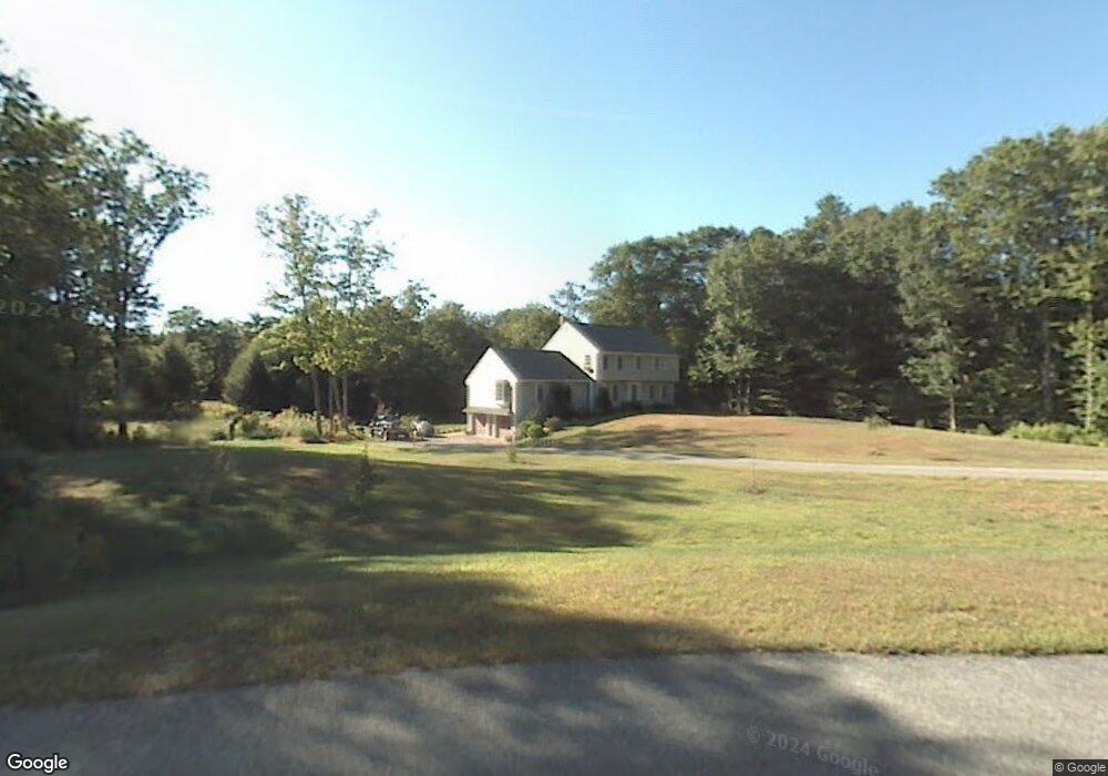
7 Hemlock Rd Kingston, NH 03848
Estimated Value: $660,280 - $773,000
5
Beds
4
Baths
3,025
Sq Ft
$230/Sq Ft
Est. Value
About This Home
This home is located at 7 Hemlock Rd, Kingston, NH 03848 and is currently estimated at $697,070, approximately $230 per square foot. 7 Hemlock Rd is a home located in Rockingham County with nearby schools including Daniel J. Bakie School, Sanborn Regional Middle School, and Sanborn Regional High School.
Ownership History
Date
Name
Owned For
Owner Type
Purchase Details
Closed on
Feb 4, 2000
Sold by
Spring Brook Rt
Bought by
Cournoyer Timothy G and Cournoyer Gladys A
Current Estimated Value
Home Financials for this Owner
Home Financials are based on the most recent Mortgage that was taken out on this home.
Original Mortgage
$110,000
Outstanding Balance
$35,699
Interest Rate
7.91%
Estimated Equity
$661,371
Purchase Details
Closed on
Jan 28, 1999
Sold by
35 Mill Brook Rt
Bought by
Spring Brook Rt
Create a Home Valuation Report for This Property
The Home Valuation Report is an in-depth analysis detailing your home's value as well as a comparison with similar homes in the area
Home Values in the Area
Average Home Value in this Area
Purchase History
| Date | Buyer | Sale Price | Title Company |
|---|---|---|---|
| Cournoyer Timothy G | $255,700 | -- | |
| Spring Brook Rt | $55,000 | -- |
Source: Public Records
Mortgage History
| Date | Status | Borrower | Loan Amount |
|---|---|---|---|
| Open | Spring Brook Rt | $110,000 |
Source: Public Records
Tax History Compared to Growth
Tax History
| Year | Tax Paid | Tax Assessment Tax Assessment Total Assessment is a certain percentage of the fair market value that is determined by local assessors to be the total taxable value of land and additions on the property. | Land | Improvement |
|---|---|---|---|---|
| 2024 | $10,248 | $617,000 | $167,400 | $449,600 |
| 2023 | $9,736 | $617,000 | $167,400 | $449,600 |
| 2022 | $8,677 | $382,100 | $99,000 | $283,100 |
| 2020 | $8,124 | $389,100 | $99,000 | $290,100 |
| 2019 | $8,560 | $389,100 | $99,000 | $290,100 |
| 2018 | $8,187 | $389,100 | $99,000 | $290,100 |
| 2017 | $8,095 | $314,000 | $88,800 | $225,200 |
| 2016 | $7,867 | $308,500 | $88,800 | $219,700 |
| 2015 | $8,002 | $308,500 | $88,800 | $219,700 |
| 2014 | $7,780 | $308,500 | $88,800 | $219,700 |
| 2013 | $7,490 | $308,500 | $88,800 | $219,700 |
Source: Public Records
Map
Nearby Homes
- 39 Colby Rd
- 28 Morning Dove Rd
- 27 Jericho Dr
- 31 Creek Hill Dr
- 9 Lefevre Dr
- 12 W Shore Park Rd
- 21 W Shore Park Rd
- 129 New Hampshire 125
- 17B Page Rd
- 62 & 43 Wilders Grove Rd
- 32 Pillsbury Pasture Rd
- 203 Kingston Rd
- 2 Country Pond Rd
- 333 Main St
- 57 Hampstead Rd
- 3 Bent Grass Cir Unit 34
- 1 Remington Dr Unit 904C
- 21 Marcoux Rd
- 6 Russett Ln
- 314 Main St
- 5 Hemlock Rd
- 9 Hemlock Rd
- 3 Hemlock Rd
- 8 Hemlock Rd
- 6 Hemlock Rd
- 10 Hemlock Rd
- 4 Hemlock Rd
- 1 Hemlock Rd
- 12 Morning Dove Rd
- 10 Morning Dove Rd
- 16 Morning Dove Rd
- 14 Morning Dove Rd
- 16 Morning Dove Rd
- 31 Colby Rd
- 8 Morning Dove Rd
- 29 Colby Rd
- 19 Colby Rd
- 11 Morning Dove Rd
- 6 Morning Dove Rd
- 18 Morning Dove Rd