Estimated Value: $749,000 - $936,000
Studio
--
Bath
2,812
Sq Ft
$293/Sq Ft
Est. Value
About This Home
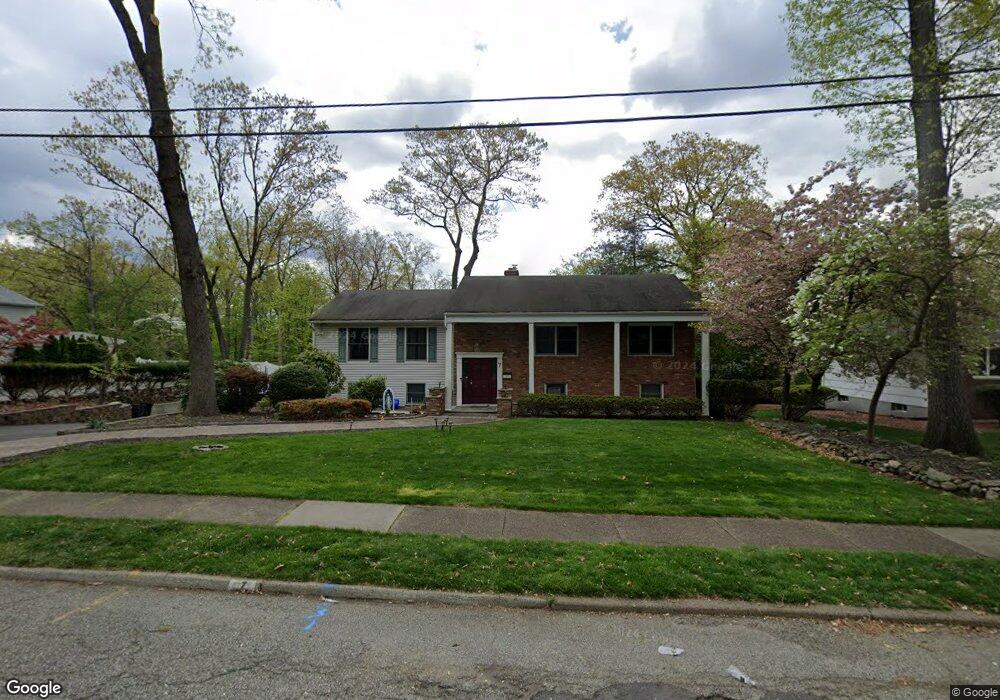
This home is located at 7 Hershey Rd, Wayne, NJ 07470 and is currently estimated at $824,214, approximately $293 per square foot. 7 Hershey Rd is a home located in Passaic County with nearby schools including Packanack Elementary School, George Washington Middle School, and Wayne Valley High School.
Ownership History
Date
Name
Owned For
Owner Type
Purchase Details
Closed on
Mar 23, 2006
Sold by
Schmidt Joseph M
Bought by
Beyjoun George and Beyjoun Mouna
Current Estimated Value
Home Financials for this Owner
Home Financials are based on the most recent Mortgage that was taken out on this home.
Original Mortgage
$250,000
Outstanding Balance
$155,312
Interest Rate
6.1%
Mortgage Type
Adjustable Rate Mortgage/ARM
Estimated Equity
$668,902
Purchase Details
Closed on
Jun 1, 1996
Sold by
Halliwell Paul
Bought by
Schmidt Joseph and Schmidt Karen
Home Financials for this Owner
Home Financials are based on the most recent Mortgage that was taken out on this home.
Original Mortgage
$175,000
Interest Rate
8.05%
Create a Home Valuation Report for This Property
The Home Valuation Report is an in-depth analysis detailing your home's value as well as a comparison with similar homes in the area
Home Values in the Area
Average Home Value in this Area
Purchase History
| Date | Buyer | Sale Price | Title Company |
|---|---|---|---|
| Beyjoun George | $560,000 | -- | |
| Schmidt Joseph | $260,000 | -- |
Source: Public Records
Mortgage History
| Date | Status | Borrower | Loan Amount |
|---|---|---|---|
| Open | Beyjoun George | $250,000 | |
| Previous Owner | Schmidt Joseph | $175,000 |
Source: Public Records
Tax History
| Year | Tax Paid | Tax Assessment Tax Assessment Total Assessment is a certain percentage of the fair market value that is determined by local assessors to be the total taxable value of land and additions on the property. | Land | Improvement |
|---|---|---|---|---|
| 2025 | $15,483 | $260,400 | $133,700 | $126,700 |
| 2024 | $14,640 | $260,400 | $133,700 | $126,700 |
| 2022 | $14,457 | $260,400 | $133,700 | $126,700 |
| 2021 | $14,707 | $260,400 | $133,700 | $126,700 |
| 2020 | $14,642 | $260,400 | $133,700 | $126,700 |
| 2019 | $14,358 | $260,400 | $133,700 | $126,700 |
| 2018 | $14,231 | $260,400 | $133,700 | $126,700 |
| 2017 | $14,101 | $260,400 | $133,700 | $126,700 |
| 2016 | $13,653 | $260,400 | $133,700 | $126,700 |
| 2015 | $13,486 | $260,400 | $133,700 | $126,700 |
| 2014 | $13,098 | $260,400 | $133,700 | $126,700 |
Source: Public Records
Map
Nearby Homes
- 174 Hillcrest Dr
- 177 Chestnut Dr
- 5 Bourbon St
- 6 Brentwood Ct
- 72 Lenox Rd
- 77 Chestnut Dr
- 63 Chestnut Dr
- 139 Webster Dr
- 36 Yellow Brick Rd
- 35 Beechwood Dr
- 5 Ferndale Rd
- 10 Lake Dr W
- 27 Archung Rd
- 45 Kime Ave
- 1316 Alps Rd
- 26 Pequannock Ave
- 24 Peterson Rd
- 0 Oakwood Ave Unit 3989632
- 00 Oakwood Ave
- 108 Packanack Lake Rd
Your Personal Tour Guide
Ask me questions while you tour the home.