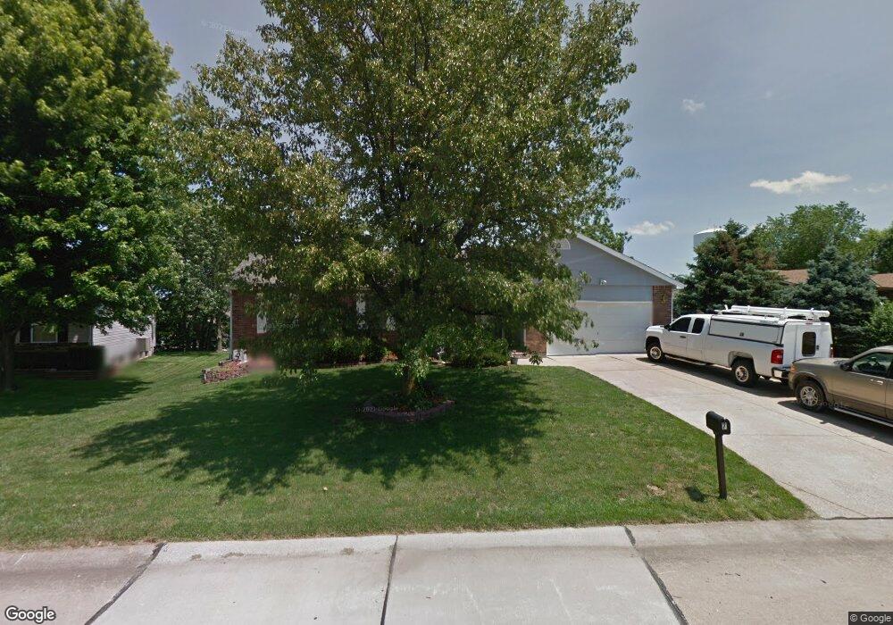
7 Hillcrest Estates Ln Saint Peters, MO 63376
Estimated Value: $360,961 - $395,000
3
Beds
2
Baths
1,898
Sq Ft
$201/Sq Ft
Est. Value
About This Home
This home is located at 7 Hillcrest Estates Ln, Saint Peters, MO 63376 and is currently estimated at $380,990, approximately $200 per square foot. 7 Hillcrest Estates Ln is a home located in St. Charles County with nearby schools including Rock Creek Elementary School, Fort Zumwalt South Middle School, and Fort Zumwalt South High School.
Ownership History
Date
Name
Owned For
Owner Type
Purchase Details
Closed on
Mar 31, 2000
Sold by
Henry Rodney C and Henry Mona Lisa
Bought by
Davis William A and Davis Wanda S
Current Estimated Value
Home Financials for this Owner
Home Financials are based on the most recent Mortgage that was taken out on this home.
Original Mortgage
$85,000
Outstanding Balance
$29,330
Interest Rate
8.33%
Estimated Equity
$351,660
Purchase Details
Closed on
Nov 3, 1999
Sold by
Hillcrest Properties L L C
Bought by
Henry Rodney C and Henry Mona Lisa
Create a Home Valuation Report for This Property
The Home Valuation Report is an in-depth analysis detailing your home's value as well as a comparison with similar homes in the area
Home Values in the Area
Average Home Value in this Area
Purchase History
| Date | Buyer | Sale Price | Title Company |
|---|---|---|---|
| Davis William A | $138,500 | -- | |
| Henry Rodney C | -- | -- |
Source: Public Records
Mortgage History
| Date | Status | Borrower | Loan Amount |
|---|---|---|---|
| Open | Davis William A | $85,000 |
Source: Public Records
Tax History Compared to Growth
Tax History
| Year | Tax Paid | Tax Assessment Tax Assessment Total Assessment is a certain percentage of the fair market value that is determined by local assessors to be the total taxable value of land and additions on the property. | Land | Improvement |
|---|---|---|---|---|
| 2025 | $3,624 | $60,567 | -- | -- |
| 2023 | $3,622 | $59,375 | $0 | $0 |
| 2022 | $3,230 | $49,298 | $0 | $0 |
| 2021 | $3,228 | $49,298 | $0 | $0 |
| 2020 | $3,024 | $44,662 | $0 | $0 |
| 2019 | $3,014 | $44,662 | $0 | $0 |
| 2018 | $2,896 | $41,055 | $0 | $0 |
| 2017 | $2,881 | $41,055 | $0 | $0 |
| 2016 | $2,517 | $35,805 | $0 | $0 |
| 2015 | $2,332 | $35,805 | $0 | $0 |
| 2014 | $2,277 | $34,134 | $0 | $0 |
Source: Public Records
Map
Nearby Homes
- 5 Arborgate Dr Unit 69A
- 211 Butternut Stage Dr
- 31 Lace Bark Ct
- 113 Stage Coach Landing Dr
- 32 Gulf Shores Dr
- 7 Park City Ct
- 307 Santa Fe Trail Dr
- 1814 Springhill Dr
- 1910 Pebble Brook Dr
- 146 Huntington Crossing Dr
- 367 Shamrock St
- 361 Shamrock St
- 217 Roaring River Dr
- 300 Mill Pond Dr
- 1 Pauley Cir
- 212 Jacobs Way
- 225 Jacobs Way
- 2612 Breezy Point Ln
- 42 Kingspointe Dr
- 114 Knaust Rd
- 5 Hillcrest Estates Ln
- 9 Hillcrest Estates Ln
- 181 Fairgate Dr
- 185 Fairgate Dr
- 185 Fairgate Dr Unit 51B
- 187 Fairgate Dr
- 3 Hillcrest Estates Ln
- 179 Fairgate Dr
- 4 Hillcrest Estates Ln
- 189 Fairgate Dr
- 177 Fairgate Dr
- 8 Hillcrest Estates Ln
- 195 Fairgate Dr
- 175 Fairgate Dr
- 1 Hillcrest Estates Ln
- 380 Erin Dr
- 10 Hillcrest Estates Ln
- 11 Hillcrest Estates Ln
- 391 Laura Hill Rd
- 64 Huntgate Dr