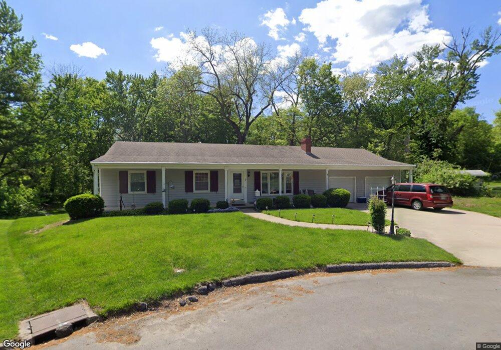
7 Holley Cir Saint Joseph, MO 64506
Lovers Lane NeighborhoodEstimated Value: $250,601 - $332,000
Studio
--
Bath
1,802
Sq Ft
$166/Sq Ft
Est. Value
About This Home
This home is located at 7 Holley Cir, Saint Joseph, MO 64506 and is currently estimated at $299,900, approximately $166 per square foot. 7 Holley Cir is a home located in Buchanan County with nearby schools including Field Elementary School, Bode Middle School, and Central High School.
Ownership History
Date
Name
Owned For
Owner Type
Purchase Details
Closed on
Jun 27, 2005
Sold by
Schultz Paul G and Schultz Susan K
Bought by
Heeler Sylvester E and Heeler Marla D
Current Estimated Value
Home Financials for this Owner
Home Financials are based on the most recent Mortgage that was taken out on this home.
Original Mortgage
$141,600
Outstanding Balance
$73,451
Interest Rate
5.76%
Mortgage Type
New Conventional
Estimated Equity
$226,449
Create a Home Valuation Report for This Property
The Home Valuation Report is an in-depth analysis detailing your home's value as well as a comparison with similar homes in the area
Home Values in the Area
Average Home Value in this Area
Purchase History
| Date | Buyer | Sale Price | Title Company |
|---|---|---|---|
| Heeler Sylvester E | -- | Preferred Title Of St Joseph |
Source: Public Records
Mortgage History
| Date | Status | Borrower | Loan Amount |
|---|---|---|---|
| Open | Heeler Sylvester E | $141,600 |
Source: Public Records
Tax History
| Year | Tax Paid | Tax Assessment Tax Assessment Total Assessment is a certain percentage of the fair market value that is determined by local assessors to be the total taxable value of land and additions on the property. | Land | Improvement |
|---|---|---|---|---|
| 2025 | $2,219 | $30,920 | $5,520 | $25,400 |
| 2024 | $1,851 | $25,760 | $5,520 | $20,240 |
| 2023 | $1,851 | $25,760 | $5,520 | $20,240 |
| 2022 | $1,709 | $25,760 | $5,520 | $20,240 |
| 2021 | $1,717 | $25,760 | $5,520 | $20,240 |
| 2020 | $1,706 | $25,760 | $5,520 | $20,240 |
| 2019 | $1,648 | $25,760 | $5,520 | $20,240 |
| 2018 | $1,489 | $25,760 | $5,520 | $20,240 |
| 2017 | $1,475 | $25,760 | $0 | $0 |
| 2015 | $0 | $25,760 | $0 | $0 |
| 2014 | $1,616 | $25,760 | $0 | $0 |
Source: Public Records
Map
Nearby Homes
- 3111 Carlisle Ct
- 3109 Carlisle Ct
- 3107 Carlisle Ct
- 28 Court Ln
- 3117 Miller Ave
- 3413 W Colony Square
- 2610 Parallel Ave
- 2611 Parallel Ave
- 2634 Lucille Ave
- 2502 Flintstone Dr
- 3309 Mueller Ln
- 2204 Ashland Ave
- 00 Lot 2 Highway 169
- 2715 Cook Rd
- 2918 Kimbrough Ln
- 2520 N 35th St
- 3309 Westwood Dr
- 2324 Goff Ave
- 3103 Cook Rd
- 2110 Ashland Ave
Your Personal Tour Guide
Ask me questions while you tour the home.