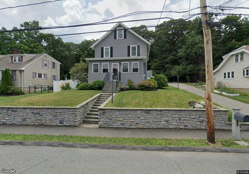
7 Home Ave Natick, MA 01760
Estimated Value: $710,000 - $838,000
4
Beds
2
Baths
1,464
Sq Ft
$543/Sq Ft
Est. Value
About This Home
This home is located at 7 Home Ave, Natick, MA 01760 and is currently estimated at $795,380, approximately $543 per square foot. 7 Home Ave is a home located in Middlesex County with nearby schools including Natick High School, J F Kennedy Middle School, and Brown Elementary School.
Ownership History
Date
Name
Owned For
Owner Type
Purchase Details
Closed on
Feb 9, 1998
Sold by
Cooke John J and Cooke Eleanor G
Bought by
Marden Kevin M and Hughes Heather A
Current Estimated Value
Home Financials for this Owner
Home Financials are based on the most recent Mortgage that was taken out on this home.
Original Mortgage
$146,000
Outstanding Balance
$25,271
Interest Rate
7.11%
Estimated Equity
$770,109
Purchase Details
Closed on
Jan 27, 1997
Sold by
Galvin John J and Galvin Nancy M
Bought by
Cooke John J and Cooke Eleanor G
Create a Home Valuation Report for This Property
The Home Valuation Report is an in-depth analysis detailing your home's value as well as a comparison with similar homes in the area
Home Values in the Area
Average Home Value in this Area
Purchase History
| Date | Buyer | Sale Price | Title Company |
|---|---|---|---|
| Marden Kevin M | $190,000 | -- | |
| Cooke John J | $3,000 | -- |
Source: Public Records
Mortgage History
| Date | Status | Borrower | Loan Amount |
|---|---|---|---|
| Open | Cooke John J | $25,000 | |
| Open | Cooke John J | $146,000 |
Source: Public Records
Tax History
| Year | Tax Paid | Tax Assessment Tax Assessment Total Assessment is a certain percentage of the fair market value that is determined by local assessors to be the total taxable value of land and additions on the property. | Land | Improvement |
|---|---|---|---|---|
| 2025 | $8,507 | $711,300 | $426,500 | $284,800 |
| 2024 | $8,214 | $670,000 | $401,400 | $268,600 |
| 2023 | $8,195 | $648,300 | $386,200 | $262,100 |
| 2022 | $7,992 | $599,100 | $351,000 | $248,100 |
| 2021 | $7,653 | $562,300 | $330,900 | $231,400 |
| 2020 | $7,449 | $547,300 | $315,900 | $231,400 |
| 2019 | $8,743 | $547,300 | $315,900 | $231,400 |
| 2018 | $5,464 | $529,900 | $300,800 | $229,100 |
| 2017 | $6,489 | $481,000 | $256,000 | $225,000 |
| 2016 | $6,214 | $457,900 | $235,000 | $222,900 |
| 2015 | $5,756 | $416,500 | $235,000 | $181,500 |
Source: Public Records
Map
Nearby Homes
- 26 Wellesley Ave Unit B
- 8 Village Way Unit 11
- 3 Silver Hill Ln Unit 6
- 36 Silver Hill Ln Unit 21
- 15 Village Way Unit 8
- 46 Silver Hill Ln Unit 1
- 1 Post Oak Ln Unit 19
- 57 Village Brook Ln Unit 5
- 52 Village Brook Ln Unit 14
- 11 Village Rock Ln Unit 21
- 54 Pilgrim Rd
- 3 Oxbow Rd
- 34 Walden Dr Unit 5
- 30 Walden Dr Unit 7
- 8 Walden Dr Unit 13
- 4 Village Rock Ln Unit 9
- 21 Village Rock Ln Unit 4
- 9 Village Hill Ln Unit 15
- 5 Village Rock Ln Unit 24
- 44 Village Hill Ln
- 9 Home Ave Unit 1
- 9 Home Ave Unit 2
- 5 Home Ave
- 6 Home Ave
- 8A Home Ave Unit a
- 8A Home Ave
- 8 Home Ave
- 8 Home Ave Unit A
- 8 Home Ave Unit 8
- 8 Home Ave Unit 8-A
- 4A Home Ave
- 11 Home Ave
- 11 Home Ave Unit 2
- 226 W Central St
- 2 A Home Ave Unit 2A
- 2 Home Ave Unit 2A
- 4 Home Ave Unit A
- 4 Home Ave
- 2 Home Ave Unit A
- 2 Home Ave
Your Personal Tour Guide
Ask me questions while you tour the home.