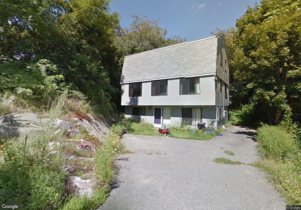
7 Hudson Rd Gloucester, MA 01930
Riverview NeighborhoodEstimated Value: $743,000 - $921,000
3
Beds
2
Baths
1,792
Sq Ft
$453/Sq Ft
Est. Value
About This Home
This home is located at 7 Hudson Rd, Gloucester, MA 01930 and is currently estimated at $812,664, approximately $453 per square foot. 7 Hudson Rd is a home located in Essex County with nearby schools including Beeman Memorial, Ralph B O'maley Middle School, and Gloucester High School.
Ownership History
Date
Name
Owned For
Owner Type
Purchase Details
Closed on
Sep 2, 2005
Sold by
Viola Grace A and Viola Joseph
Bought by
Lojacono Terence P and Lojacono Kristen M
Current Estimated Value
Home Financials for this Owner
Home Financials are based on the most recent Mortgage that was taken out on this home.
Original Mortgage
$308,000
Interest Rate
5.81%
Mortgage Type
Purchase Money Mortgage
Purchase Details
Closed on
Sep 22, 1987
Sold by
Julian Anthony
Bought by
Viola Joseph
Create a Home Valuation Report for This Property
The Home Valuation Report is an in-depth analysis detailing your home's value as well as a comparison with similar homes in the area
Home Values in the Area
Average Home Value in this Area
Purchase History
| Date | Buyer | Sale Price | Title Company |
|---|---|---|---|
| Lojacono Terence P | $385,000 | -- | |
| Viola Joseph | $60,000 | -- |
Source: Public Records
Mortgage History
| Date | Status | Borrower | Loan Amount |
|---|---|---|---|
| Open | Viola Joseph | $293,700 | |
| Closed | Viola Joseph | $308,000 |
Source: Public Records
Tax History
| Year | Tax Paid | Tax Assessment Tax Assessment Total Assessment is a certain percentage of the fair market value that is determined by local assessors to be the total taxable value of land and additions on the property. | Land | Improvement |
|---|---|---|---|---|
| 2025 | $6,577 | $676,600 | $234,700 | $441,900 |
| 2024 | $6,526 | $670,700 | $223,600 | $447,100 |
| 2023 | $6,243 | $589,500 | $199,600 | $389,900 |
| 2022 | $5,989 | $510,600 | $169,700 | $340,900 |
| 2021 | $5,775 | $464,200 | $154,300 | $309,900 |
| 2020 | $5,764 | $467,500 | $154,300 | $313,200 |
| 2019 | $5,502 | $433,600 | $154,300 | $279,300 |
| 2018 | $5,304 | $410,200 | $154,300 | $255,900 |
| 2017 | $5,135 | $389,300 | $146,900 | $242,400 |
| 2016 | $4,957 | $364,200 | $147,400 | $216,800 |
| 2015 | $4,739 | $347,200 | $147,400 | $199,800 |
Source: Public Records
Map
Nearby Homes
- 13 Honeysuckle Rd
- 3 Deacon Farm Ln
- 31 Echo Ave
- 2 Breezy Point Rd
- 672 Washington St
- 3 Rockland St
- 167 Atlantic St
- 13 Mystic Ave
- 178 Atlantic St
- 8 Mystic Ave
- 6 Monroe Ct
- 98 Maplewood Ave
- 226 Atlantic St
- 9 Cleveland Place
- 12 Arthur St
- 40 Sargent St
- 15 Harvard St
- 19 Trask St Unit 2
- 145 Essex Ave Unit 402
- 33 Maplewood Ave Unit 310
Your Personal Tour Guide
Ask me questions while you tour the home.