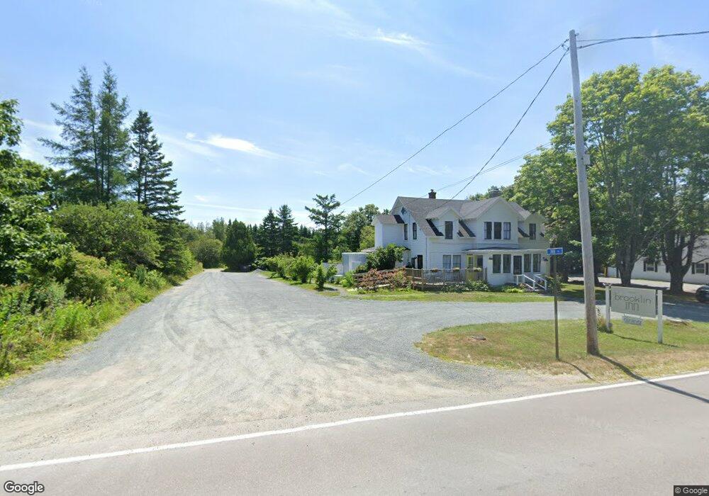
7 Inn Ln Brooklin, ME 04616
Estimated Value: $484,000 - $1,036,000
5
Beds
6
Baths
1,200
Sq Ft
$537/Sq Ft
Est. Value
About This Home
This home is located at 7 Inn Ln, Brooklin, ME 04616 and is currently estimated at $644,650, approximately $537 per square foot. 7 Inn Ln is a home with nearby schools including Brooklin School.
Ownership History
Date
Name
Owned For
Owner Type
Purchase Details
Closed on
Mar 15, 2019
Sold by
Brooklin Inn Llc
Bought by
Peninsula Hldg Co Llc
Current Estimated Value
Home Financials for this Owner
Home Financials are based on the most recent Mortgage that was taken out on this home.
Original Mortgage
$363,000
Outstanding Balance
$315,877
Interest Rate
4.4%
Mortgage Type
New Conventional
Estimated Equity
$328,773
Create a Home Valuation Report for This Property
The Home Valuation Report is an in-depth analysis detailing your home's value as well as a comparison with similar homes in the area
Purchase History
| Date | Buyer | Sale Price | Title Company |
|---|---|---|---|
| Peninsula Hldg Co Llc | -- | -- |
Source: Public Records
Mortgage History
| Date | Status | Borrower | Loan Amount |
|---|---|---|---|
| Open | Peninsula Hldg Co Llc | $363,000 |
Source: Public Records
Tax History
| Year | Tax Paid | Tax Assessment Tax Assessment Total Assessment is a certain percentage of the fair market value that is determined by local assessors to be the total taxable value of land and additions on the property. | Land | Improvement |
|---|---|---|---|---|
| 2025 | $3,368 | $426,300 | $92,500 | $333,800 |
| 2024 | $3,112 | $426,300 | $92,500 | $333,800 |
| 2023 | $2,525 | $345,900 | $92,500 | $253,400 |
| 2022 | $2,250 | $304,100 | $89,000 | $215,100 |
| 2021 | $2,302 | $304,100 | $89,000 | $215,100 |
| 2020 | $2,220 | $304,100 | $89,000 | $215,100 |
| 2019 | $2,339 | $313,900 | $89,000 | $224,900 |
| 2018 | $2,319 | $313,400 | $89,000 | $224,400 |
| 2017 | $2,288 | $313,400 | $89,000 | $224,400 |
| 2016 | $2,256 | $313,400 | $89,000 | $224,400 |
| 2015 | $2,256 | $313,400 | $89,000 | $224,400 |
| 2014 | $2,256 | $313,400 | $89,000 | $224,400 |
| 2013 | $2,068 | $313,400 | $89,000 | $224,400 |
Source: Public Records
Map
Nearby Homes
- 00 Periwinkle Ln
- 392 Bay Rd
- 0 Flye Point Unit Lot 3
- 9 River Rd Unit Lot 6
- 9 River Rd Unit Lot 3
- 75 Old Cove Ln
- 111 Old Place Rd
- 13 Mcmullen Ave
- 17 E Side Rd
- 70 Owens Way
- 284 Christy Hill Rd
- 36 Greenlaw District Rd
- 684 Falls Bridge Rd
- 2 Bar Island
- 138 Caterpillar Hill Rd
- 0 Quaco Rd Unit 1625807
- 36 Treasure Ln
- 005-054 Bridge St
- 36 Wiegand Place
- 08-02A Sedgwick Ridge Rd
Your Personal Tour Guide
Ask me questions while you tour the home.