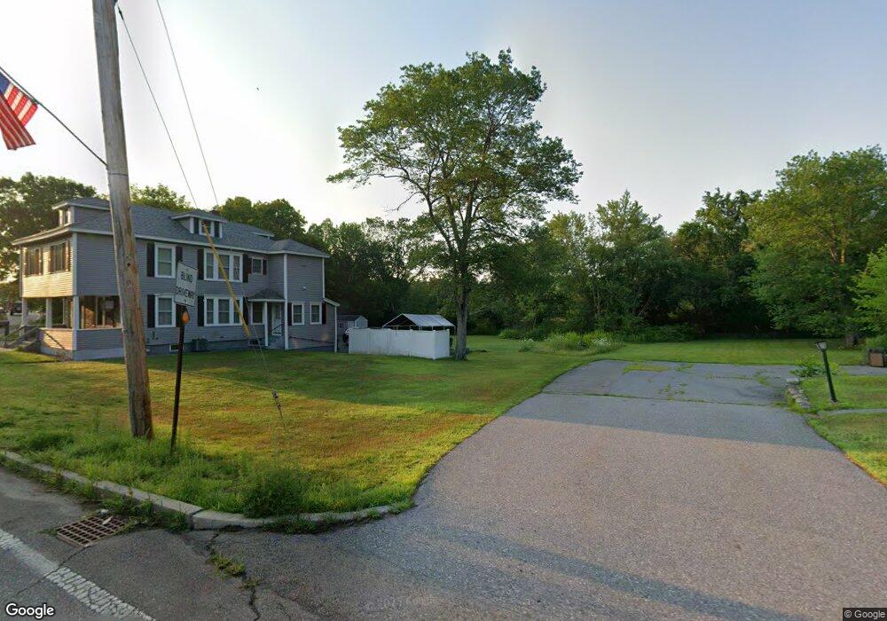
7 Inoa Dracut, MA 01826
Estimated Value: $576,000 - $649,000
4
Beds
3
Baths
1,344
Sq Ft
$447/Sq Ft
Est. Value
About This Home
This home is located at 7 Inoa, Dracut, MA 01826 and is currently estimated at $601,286, approximately $447 per square foot. 7 Inoa is a home located in Middlesex County with nearby schools including Greenmont Avenue School, Richardson Middle School, and Dracut Senior High School.
Ownership History
Date
Name
Owned For
Owner Type
Purchase Details
Closed on
Mar 29, 2012
Sold by
Mcnamara Paul J and Mcnamara Jeanne F
Bought by
Ruiz Isael J
Current Estimated Value
Home Financials for this Owner
Home Financials are based on the most recent Mortgage that was taken out on this home.
Original Mortgage
$175,437
Outstanding Balance
$121,005
Interest Rate
3.88%
Mortgage Type
New Conventional
Estimated Equity
$480,281
Purchase Details
Closed on
May 31, 1994
Sold by
Monette Daniel P and Monette Kimberly
Bought by
Mcnamara Paul J and Mcnamara Jeanne
Create a Home Valuation Report for This Property
The Home Valuation Report is an in-depth analysis detailing your home's value as well as a comparison with similar homes in the area
Home Values in the Area
Average Home Value in this Area
Purchase History
| Date | Buyer | Sale Price | Title Company |
|---|---|---|---|
| Ruiz Isael J | $180,000 | -- | |
| Mcnamara Paul J | $125,500 | -- |
Source: Public Records
Mortgage History
| Date | Status | Borrower | Loan Amount |
|---|---|---|---|
| Open | Ruiz Isael J | $175,437 | |
| Previous Owner | Mcnamara Paul J | $182,000 | |
| Previous Owner | Mcnamara Paul J | $182,000 | |
| Previous Owner | Mcnamara Paul J | $173,000 |
Source: Public Records
Tax History Compared to Growth
Tax History
| Year | Tax Paid | Tax Assessment Tax Assessment Total Assessment is a certain percentage of the fair market value that is determined by local assessors to be the total taxable value of land and additions on the property. | Land | Improvement |
|---|---|---|---|---|
| 2025 | $4,838 | $478,100 | $182,700 | $295,400 |
| 2024 | $4,759 | $455,400 | $174,000 | $281,400 |
| 2023 | $4,241 | $366,200 | $151,300 | $214,900 |
| 2022 | $4,083 | $332,200 | $137,500 | $194,700 |
| 2021 | $20,698 | $302,800 | $125,000 | $177,800 |
| 2020 | $3,822 | $286,300 | $121,400 | $164,900 |
| 2019 | $3,728 | $271,100 | $115,600 | $155,500 |
| 2018 | $3,739 | $264,400 | $115,600 | $148,800 |
| 2017 | $3,718 | $264,400 | $115,600 | $148,800 |
| 2016 | $3,619 | $243,900 | $111,100 | $132,800 |
| 2015 | $3,501 | $234,500 | $111,100 | $123,400 |
| 2014 | $3,344 | $230,800 | $111,100 | $119,700 |
Source: Public Records
Map
Nearby Homes
- 18 Stone St
- 35 Thissell Ave
- 81 Spring Park Ave
- 700 Robbins Ave Unit 6
- 675 Robbins Ave Unit 1
- 650 Robbins Ave Unit 33
- 1572 Bridge St
- 7 Wildwood St Unit A24
- 575 Beacon St
- 4 Hazelwood Ave Unit 12
- 108 Billings St
- 121 Old Marsh Hill Rd
- 345 Hildreth St Unit 14
- 363 Hildreth St Unit 11
- 349 Hildreth St Unit 16
- 315 Broadway Rd Unit 7
- 241 Broadway Rd Unit 50
- 26 Frank St
- 2 Sutherland St
- 67 Foxhill Ln Unit 67
- 7 Undisclosed Unit 1
- 999 Confidential St
- Lot 20 Berube Ln
- Lot 21 Berube Ln
- 000 Road
- confidenti Contact La
- 93 Arlington St
- 69 Arlington St
- 22 Montaup Ave
- 120 Arlington St Unit 15
- 120 Arlington St Unit 14
- 120 Arlington St Unit 13
- 120 Arlington St Unit 12
- 120 Arlington St Unit 11
- 120 Arlington St Unit 10
- 120 Arlington St Unit 9
- 120 Arlington St Unit 8
- 120 Arlington St Unit 7
- 120 Arlington St Unit 6
- 120 Arlington St Unit 5