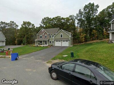
7 Liams Ln Methuen, MA 01844
The North End NeighborhoodEstimated Value: $905,000 - $934,000
4
Beds
3
Baths
2,916
Sq Ft
$316/Sq Ft
Est. Value
About This Home
This home is located at 7 Liams Ln, Methuen, MA 01844 and is currently estimated at $922,546, approximately $316 per square foot. 7 Liams Ln is a home with nearby schools including Methuen High School and Hilltop School.
Ownership History
Date
Name
Owned For
Owner Type
Purchase Details
Closed on
May 7, 2024
Sold by
Murphy Gerald J and Murphy Barbara J
Bought by
Murphy Ft and Murphy
Current Estimated Value
Purchase Details
Closed on
Mar 30, 2018
Sold by
Pinnacle Builders Llc
Bought by
Green Robert and Green Susan
Home Financials for this Owner
Home Financials are based on the most recent Mortgage that was taken out on this home.
Original Mortgage
$531,043
Interest Rate
4.38%
Mortgage Type
FHA
Create a Home Valuation Report for This Property
The Home Valuation Report is an in-depth analysis detailing your home's value as well as a comparison with similar homes in the area
Home Values in the Area
Average Home Value in this Area
Purchase History
| Date | Buyer | Sale Price | Title Company |
|---|---|---|---|
| Murphy Ft | -- | None Available | |
| Murphy Ft | -- | None Available | |
| Green Robert | $579,900 | -- |
Source: Public Records
Mortgage History
| Date | Status | Borrower | Loan Amount |
|---|---|---|---|
| Previous Owner | Sierpina Michelle L | $640,000 | |
| Previous Owner | Green Susan | $530,201 | |
| Previous Owner | Green Robert | $531,043 |
Source: Public Records
Tax History Compared to Growth
Tax History
| Year | Tax Paid | Tax Assessment Tax Assessment Total Assessment is a certain percentage of the fair market value that is determined by local assessors to be the total taxable value of land and additions on the property. | Land | Improvement |
|---|---|---|---|---|
| 2025 | $8,877 | $839,000 | $244,600 | $594,400 |
| 2024 | $8,809 | $811,100 | $214,900 | $596,200 |
| 2023 | $8,353 | $713,900 | $190,100 | $523,800 |
| 2022 | $8,426 | $645,700 | $165,300 | $480,400 |
| 2021 | $7,921 | $600,500 | $157,000 | $443,500 |
| 2020 | $7,823 | $582,100 | $157,000 | $425,100 |
| 2019 | $7,843 | $552,700 | $132,200 | $420,500 |
| 2018 | $1,769 | $124,000 | $124,000 | $0 |
Source: Public Records
Map
Nearby Homes
- 580 Howe St
- 7 Sadie Ln
- 22 Cardinal Rd Unit 22
- 57 Phoebe St Unit 33
- 10 Sierra Ct Unit 10
- 14 Stephan Ave
- 16 Sierra Ct Unit 16
- 11 Sierra Ct Unit 10
- 4 Hawkes Brook Ln
- 80 Hampstead St
- 63 Currier St
- 7 Michael Anthony Rd
- 27 Littlefield Ct Unit 37B
- 19 Moccasin Path
- 11 Hammond Farm Rd
- 139 North St
- 46 Crystal St
- 1513 Broadway
- 74 Ayers Village Rd
- 4 Clement Ct Unit 4