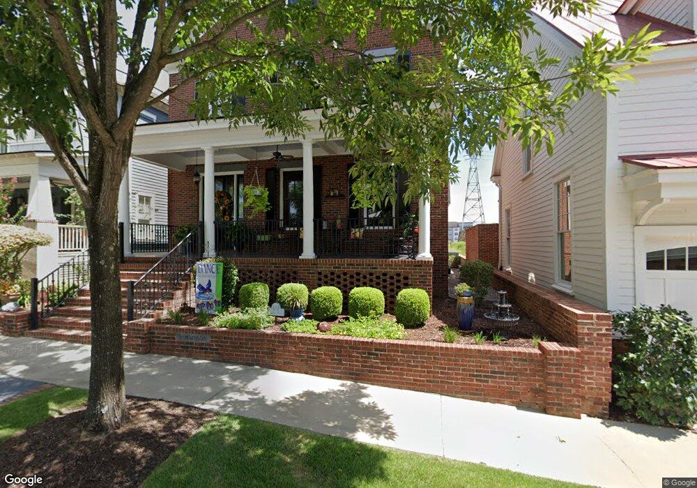
7 Madison St North Augusta, SC 29841
Hammond's Ferry NeighborhoodEstimated Value: $945,000 - $995,770
3
Beds
4
Baths
3,366
Sq Ft
$286/Sq Ft
Est. Value
About This Home
This home is located at 7 Madison St, North Augusta, SC 29841 and is currently estimated at $963,590, approximately $286 per square foot. 7 Madison St is a home located in Aiken County with nearby schools including Hammond Hill Elementary School, Paul Knox Middle School, and North Augusta High School.
Ownership History
Date
Name
Owned For
Owner Type
Purchase Details
Closed on
Oct 31, 2008
Sold by
Grkovic George M and Grkovic Vivian L
Bought by
Grkovic George M and Grkovic Vivian L
Current Estimated Value
Home Financials for this Owner
Home Financials are based on the most recent Mortgage that was taken out on this home.
Original Mortgage
$250,000
Outstanding Balance
$164,349
Interest Rate
6.11%
Mortgage Type
New Conventional
Estimated Equity
$799,241
Purchase Details
Closed on
Nov 13, 2007
Sold by
North Augusta Riverfront Co Llc
Bought by
Grkovic George M and Grkovic Vivian L
Create a Home Valuation Report for This Property
The Home Valuation Report is an in-depth analysis detailing your home's value as well as a comparison with similar homes in the area
Home Values in the Area
Average Home Value in this Area
Purchase History
| Date | Buyer | Sale Price | Title Company |
|---|---|---|---|
| Grkovic George M | -- | -- | |
| Grkovic George M | -- | -- | |
| Grkovic George M | $68,000 | Attorney |
Source: Public Records
Mortgage History
| Date | Status | Borrower | Loan Amount |
|---|---|---|---|
| Open | Grkovic George M | $250,000 |
Source: Public Records
Tax History Compared to Growth
Tax History
| Year | Tax Paid | Tax Assessment Tax Assessment Total Assessment is a certain percentage of the fair market value that is determined by local assessors to be the total taxable value of land and additions on the property. | Land | Improvement |
|---|---|---|---|---|
| 2023 | $3,049 | $30,390 | $4,582 | $676,070 |
| 2022 | $2,966 | $31,840 | $0 | $0 |
| 2021 | $2,972 | $31,840 | $0 | $0 |
| 2020 | $2,622 | $26,430 | $0 | $0 |
| 2019 | $2,622 | $26,430 | $0 | $0 |
| 2018 | $2,627 | $26,430 | $3,200 | $23,230 |
| 2017 | $2,495 | $0 | $0 | $0 |
| 2016 | $2,498 | $0 | $0 | $0 |
| 2015 | $2,566 | $0 | $0 | $0 |
| 2014 | $2,571 | $0 | $0 | $0 |
| 2013 | -- | $0 | $0 | $0 |
Source: Public Records
Map
Nearby Homes
- Lot 12 Railroad Ave
- 383 Blue Clay Dr
- 520 Arrington Ave
- 380 Front St
- 388 Front St
- 392 Front St
- 384 Front St
- 376 Front St
- 617 Railroad Ave
- 686 Railroad Ave
- 308 Bluff Ave
- 1642 Broad St Unit 1642,1644,1646,1648
- 156 Landing Dr
- 305 W Ave
- 305 W Clifton Ave Unit 7
- 111 Landing Dr
- 210 Alta Vista Ave
- 406 Hamilton St
- 509 Carolyn Cir
- 503 Sikes Ave
- 13 Madison St
- 434 Front St
- 17 Madison St
- 438 Front St
- 19 Madison St
- 23 Madison St
- 443 Arrington Ave
- 456 Front St
- 9 Madison St
- 416 Arrington Ave
- 434 Arrington Dr
- 447 Arrington Ave
- 434 Arrington Ave
- 31 Madison St
- 460 Front St
- 451 Arrington Ave
- 444 Arrington Ave
- 35 Madison St
- 464 Front St
- 455 Arrington Ave